Welcome to Noble County GIS
 Noble County GIS geospatial data is considered a strategic asset for directly benefiting county office decision-making abilities, helping county government operate more efficiently, promoting economic development, and delivering public services with greater transparency. The county recognizes that geospatial data is a benefit to others. This GIS homepage strives to provide access to the county’s GIS geospatial data in various ways.
GIS Quick Links
Noble County Beacon GIS Website - search parcel assessment, drainage, and tax information.
Beacon Pamphlet - (1 MB download) Updated May 19, 2026. View this double-sided 8 1/2 x 14 sheet of paper to gain a brief understanding of Beacon's capabilities and where to find additional GIS data for the State of Indiana, and learn about Noble County's GIS history.
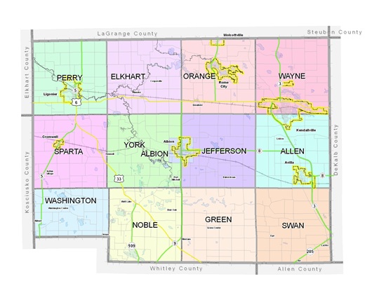
Printable County Highway Map - (3.2 MB download) Updated March 1, 2018. An 11 x 17-inch color county highway map.
Land Ownership Roster - (8.5 MB download) Updated July 15, 2026. Report listing land ownership per township from the Surveyor's database. This report is updated on or around the 15th of each month. Land ownership is divided into townships and listed alphabetically by last name.
What is GIS
GIS, an acronym for Geographic Information System, is an integrated collection of computer software and data used to view and manage information about geographic places, analyze spatial relationships, and model spatial processes.
A GIS provides a framework for gathering and organizing spatial data and related information so that it can be displayed and analyzed.
GIS Department Responsibilities
The GIS Department is responsible for the daily operations of the County Geographic Information System (GIS) and providing technical assistance to the County, Cities, and Towns utilizing the system.
Noble County's GIS History
Noble County’s GIS system has been a dynamic evolving entity over the last three decades. The Surveyor’s Office envisioned the need for a GIS and later became the driving force behind an Enterprise GIS. Starting in the mid 1980’s, the Surveyor’s Office began work towards a GIS for internal use. The vision for a GIS culminated in the creation of a county-wide digital tax map by the late 1990’s. The digital tax map was maintained with additional layers added. In 2003, the County Commissioners appropriated funds for the creation of an Enterprise GIS to promote Economic Develop. In 2003, the GIS project was launched with purchase of digital orthophotography and various planimetric layers (e.g., 2 ft. contours, building outlines, road centerlines, and railroads) . During 2004 and into the early part of 2005, the majority of the GIS layers were created. By March 2005, the GIS was supporting Phase II enhanced 9-1-1. Additional orthophotography datasets were obtained in 2005 (having 1 ft pixel resolution) and in 2008 (having 6.75 inch pixel resolution). Work continues today with ArcGIS Server for creating customized web mapping applications in Microsoft Silverlight.
Below is a summary of the major milestones in Noble County GIS development:
- 2025: The GIS Analyst position is added to the GIS Dept.
- 2025: County takes delivery of Spring orthoimagery and oblique imagery from Pictometry.
- 2023: County takes delivery of Spring orthoimagery and oblique imagery from Pictometry.
- 2021: County takes delivery of Spring orthoimagery and oblique imagery from Pictometry. A reflight was necessary because of heavy leaf conditions in the Spring of 2020. This flight was provided free of charge.
- 2020: County takes delivery of Spring orthoimagery and oblique imagery from Pictometry.
- 2017: County takes delivery of Fall orthoimagery and oblique imagery from Pictometry. A reflight was necessary because of heavy leaf conditions in the Spring. This flight was provided free of charge.
- 2017: County takes delivery of new Spring orthoimagery and oblique imagery from Pictometry.
- 2013: In July, the Noble County Commissioners approve a spring 2014 Pictometry flight and updated building footprints. Pictometry imagery will include 3-inch obliques and 4-inch orthoimagery county-wide.
- 2012: County was flown by Woolpert on March 6th and 9th as part of the State Photography Program. The County took delivery of the 6-inch color orthophotography on December 7,2012.
- 2009-2011: County works on custom web application development using ArcGIS Server and Silverlight
- 2008: County contracts with Pictometry to produce 6.75-inch color orthophotography and oblique photography
- 2005: County receives 1 foot resolution color orthophotography from state
- 2003: GIS Coordinator position created in August. County contracts with the Schneider Corporation (GIS/E-911 project); County contracts with Sanborn to produce 6-inch color orthophotography and planimetric features
- 1990's: Surveyor's Office continues mapping county into a digital environment using AutoCAD
- 1980's: Surveyor's Office compiles deeds, calculates section corner coordinates; begins tax mapping duties
GIS Recognition
Below is a list of GIS awards granted to Noble County:
- 2015 Award for Achievement in GIS, Counties Category: Award granted for the Noble County Parks Website by Indiana Geographic Information Council (IGIC) during 2015 IGIC State GIS Conference; see write-up "Noble County GIS receives statewide honor" on the KPC News website (http://kpcnews.com/news/latest/new_era/article_950d40ae-573e-5f69-8f0b-42367f047708.html)
- 2008 Award for Achievement in GIS, Counties Category: Award granted by Indiana Geographic Information Council (IGIC) during 2008 IGIC State GIS Conference; see write-up "What the Numbers Mean" on the IGIC website (http://www.igic.org/).
- 2006 Award for Achievement in GIS, Counties Category: Award granted by Indiana Geographic Information Council (IGIC) during 2006 IGIC State GIS Conference; see write-up "How All-Purpose Is Defined" on the IGIC website (http://www.igic.org/).
- 2005 GIS Award of Excellence-Schneider Corporation: Award determined by Schneider clients as they reviewed submitted pier projects during the 2005 Schneider User GIS Conference.