May 2023
INDOT’s involvement with a historic gristmill is further proof of how a-MAIZE-ing the agency is.
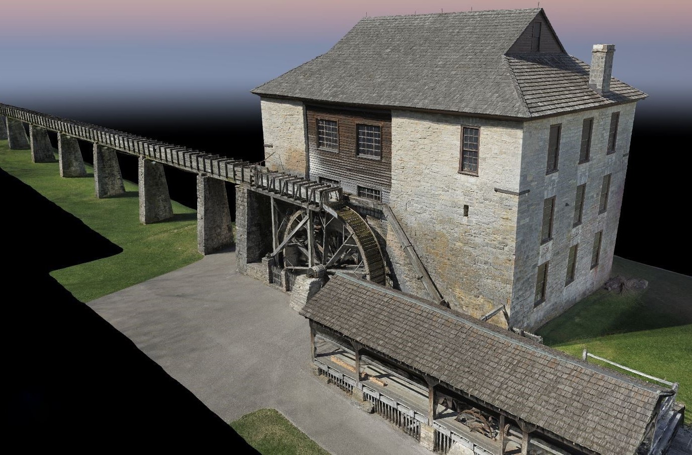
This spring, our Land & Aerial Survey Office collected imagery and LiDAR scan data of the gristmill at Spring Mill State Park in Mitchell, Ind., before the historic water-powered mill is renovated this fall.
“The Indiana Department of Natural Resources’ Division of Historic Preservation & Archaeology approached us,” said INDOT Aerial Geomatics Coordinator Adam French. “They wanted the data for historical documentation and possible public outreach. This was a fun and educational project, giving us the opportunity to utilize several of our sophisticated tools to complete the mission.”
INDOT’s Land & Aerial Survey Office used an unmanned aircraft system for both aerial photos and LiDAR scans, a high-quality camera for ground photos, and a high-speed 3D laser scanning system for ground-based LiDAR scans. Their efforts produced:
A 3D rendering of the building and water flume, including a fly-through video
A scaled and georeferenced point cloud of the building and water flume
A publicly sharable link to an online geographic information system that features the 3D rendering and panoramic images
This fall, the DNR plans to replace the gristmill’s water wheel, shaft, one of the gears, and part of the flume. Wood is being harvested from the state park, located in Lawrence County, and will be allowed to cure before being used for the renovation.
The gristmill is located in the park’s Pioneer Village. Founded in 1814, the village contains 20 historic buildings to explore. The centerpiece is the spring-fed, three-story limestone gristmill, built in 1817, that still grinds corn today — for demonstration purposes — to produce cornmeal.
The gristmill was last restored in 1930.
“This project served as a testbed to combine and analyze many of the innovative technologies our office has available, including unmanned aerial systems, high-resolution imagery, both aerial and terrestrial LiDAR scanning, and GPS,” said INDOT Land & Aerial Survey Office Manager Eric Banschbach.