This map provides a resource for people who are looking to navigate Northwest Indiana through the available transit systems as well as acts as a resource for persons with disabilities to better understand the transit stop conditions they may encounter while planning a route to their destination.
See below the map for more information.
Provided Transit Stop Information
By clicking on each of the stop locations on the map, one will be able to see:
Location Information
- The location of the transit stop
- The transit line route
- The Bus Stop ID used for NIRPC internal reference
- The Cross Street at the transit stop location
- The Direction of the transit stop relative to the intersection. (Northwest, Southeast, mid block, etc)
Physical Characteristics
- The Sidewalk Measurement width by inches.
- Material of landing at the transit stop location. (Concrete, grass, asphalt, etc.)
- Bus stop signage present at transit stop. (Signage present in ADA friendly format, no signage, signage present but can be more accessible)
Amenity Information
- Shelter attributes present at transit stop.
- Park and ride located at the transit stop.
- Transit facility building located at transit stop.
- Public restrooms available near transit stops.
- Information such as hot line number, route maps, brochures, or time tables available at transit stops.
Using the Map
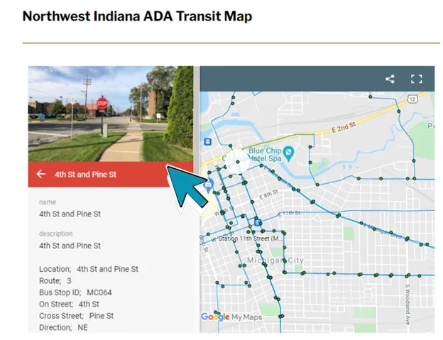
Click a point on the map to find out information about that specific transit stop
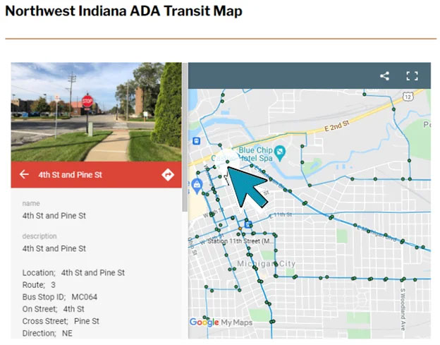
Click the arrow located on the red banner underneath the photo; this will open another tab where one can search directions to that particular transit stop