Location
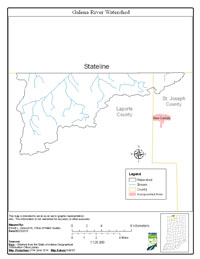
The Galena River Watershed is located in northwest Indiana, draining approximately 77 stream miles in LaPorte and St. Joseph counties. Major streams included in the Total Maximum Daily Load (TMDL) report are Galena River, Warrick Ditch, Spring Creek and Dowling Creek
History
A comprehensive survey of the Galena River Watershed was conducted by Indiana Department of Environmental Management (IDEM) from September 16, 2008 through October 14, 2008, with previous sampling in 2000. The primary cause of impairment is Escherichia coli bacteria (E. coli). Pollution sources in the watershed include nonpoint sources from agriculture and pastures, land application of manure and urban and rural run-off, as well as point sources from straight pipe discharges, home sewage treatment system disposal and combined sewer overflow outlets.
Pollutants Addressed
TMDLs for the Galena River Watershed are established for E. coli and will address eight impairments. Some of the recommended solutions to address the impairments include storm water controls, point source controls, manure management and habitat improvements.
Timeline
A kickoff TMDL public meeting was held January 21, 2009 at the Spicer Lake Nature Preserve, 50840 County Line Road, New Carlisle, Indiana starting at 6:00 p.m. (CST).
A draft TMDL public meeting was held July 14, 2009 at the LaLumiere School Fine Arts Building, (Gate 1), located at 6801 North Wilhelm Road, LaPorte, Indiana starting at 6:00 p.m. (CST).
A comment period began on July 13, 2009 and ended on August 14, 2009.
U.S. EPA under Section 303(d) of the Clean Water Act approved the Galena River Watershed TMDL report on September 20, 2010 for 8 impairments. TMDL reports identify and evaluate water quality problems in impaired water bodies and propose solutions to bring those waters into attainment with water quality standards.