Vision: “To restore waters impaired by nonpoint source pollution and maintain water quality in healthy watersheds through locally led partnerships.”
Prepared by: Indiana Department of Environmental Management Office of Water Quality Watershed Assessment Planning Branch Watershed Planning and Restoration Section
Table of Contents
- Acronyms List
- Mission Statements
- Executive Summary
- Purpose of the Indiana Nonpoint Source Management Plan
- History of the Nonpoint Source Program in Indiana
- Indicators of Success
- Physical Inventory
- Inventory of Stakeholders
- Problems, Causes, Sources
- Indiana’s Nonpoint Source Program
- Program Successes to Date
- Program Challenges to Date
- Prioritizing Waters
- Approach #1. Use the 303(d)/consolidated list (e.g., “stay the course”)
- Approach #2. Prioritize by source (e.g., conventionally tilled fields, livestock with stream access, denuded stream banks, eroding stream banks, drinking water resources)
- Approach #3. Prioritize implementation of current plans only
- Approach #4. Only provide funding for local project staff, not cost share (i.e., fund outreach, monitoring, planning, and coordination-related tasks)
- Approach #5. Prioritize areas with no planning for planning
- Approach #6. Use state/federal prioritizations already in place for MRBI, GLRI, endangered species, OSRWs, and others
- Approach #7. Prioritize using the U.S. EPA’s Recovery Potential Tool and Environmental Justice Screening Tool
- Approach #8. Prioritize based on Total Maximum Daily Load (TMDL) development
- Goals and Management Measures
- Goal 1: Improve the resources available for nonpoint source pollution management through partnerships
- Goal 2: Characterize Indiana waters for nonpoint source pollution impairments and improvements
- Goal 3: Cultivate a citizenry that embraces the value of water quality
- Goal 4: Improve Indiana’s water quality by reducing nonpoint source pollution and restoring aquatic habitats
- Goal 5. Protect priority water resources so that they may continue to meet their intended uses
- Goal 6. Provide networking, guidance, and support to the people doing the work
- Funding Mechanisms
- Clean Water Act grants
- Coastal Zone Management Act
- USDA Programs
- Conservation Reserve (Enhancement) Program
- National Water Quality Initiative
- Wetland Reserve (Enhancement) Program
- Mississippi River Basin Initiative
- Great Lakes Restoration Initiative (EQIP, EWPP – Floodplain Easements)
- Western Lake Erie Basin Initiative (EQIP)
- Cooperative Conservation Partnership Initiative (EQIP, CSP)
- Private and other Grants
- 2025 – 2029 Action Register
- Adaptive Management
- References
Table of Figures
- Figure 1. Total Indiana Section 319 funding allocation in FFY 2014 through 2023.
- Figure 2. Adaptive management (From EPA 2008)
- Figure 3. White River through Indianapolis.
- Figure 4. Ecoregions of Indiana.
- Figure 5. Bedrock Units of Indiana.
- Figure 6. Indiana State Land Use.
- Figure 7. Corn field in Indiana.
- Figure 8. Coal production in Indiana.
- Figure 9. Historical Oil Production in Indiana.
- Figure 10. Indiana’s 2-digit watersheds.
- Figure 11. Indiana’s 8-digit Watersheds.
- Figure 12. Major Indiana Rivers.
- Figure 13. White River through Indianapolis.
- Figure 14. Goose drinking water in the White River.
- Figure 15. Hoosier Riverwatch staff member giving a Hoosier Riverwatch Presentation.
- Figure 16. Hoosier Riverwatch supplies.
- Figure 17. Watershed Leadership Academy.
- Figure 18. Watershed Specialist coverage areas.
- Figure 19. Frozen Williams Creek.
- Figure 20. Cows grazing in pasture in Indiana.
- Figure 21. Pathway to Water Quality Education at Indiana State Fair.
- Figure 22. Total Indiana Section 319 funding allocation in FFY 2014 through 2023.
- Figure 23. Low-head dam and bridge over the Patoka River in Dubois County.
- Figure 24. Waterfalls in Mill Creek.
- Figure 25. Bird at Eagle Creek Reservoir in Indiana.
Table of Tables
- Table 1. Selected Field Indicators of Hydric Soils (NRCS 2018).
- Table 2. Indiana Land Use.
- Table 3. Assessment of monitored stream and lake miles in Indiana.
- Table 4. Water quality standards for common nonpoint source pollutants.
- Table 4 cont. Water quality targets for common nonpoint source pollutants.
- Table 5. Waterbodies Reported to U.S. EPA under its Success Stories (WQ-10) programs. Performance Measures Reported 2008-2024.
- Table 6. Hydroelectric Dams in Indiana.
- Table 7. Prioritization Approach #1 Decision Table.
- Table 8. Prioritization Approach #2 Decision Table.
- Table 9. Prioritization Approach #3 Decision Table.
- Table 10. Prioritization Approach #4 Decision Table.
- Table 11. Prioritization Approach #6 Decision Table.
- Table 12. Prioritization Approach #7 Decision Table.
- Table 13. Prioritization Approach #8 Decision Table.
- Table 14. Cisco Lakes Priorities.
- Table 15. Indiana Eligible CREP Practices.
Acronyms List
| AIMS | Assessment Information Management System |
| AOC | Area of Concern |
| AWEP | Agricultural Water Enhancement Program |
| BMP | Best Management Practice |
| BONWR | Big Oaks National Wildlife Refuge |
| CAFO | Concentrated Animal Feeding Operation |
| CALM | Consolidated Assessment and Listing Methodology |
| CCPI | Cooperative Conservation Partnership Initiative |
| CEES | Center for Earth and Environmental Science |
| CFU | Colony Forming Unit |
| CIG | Conservation Innovation Grant |
| CLP | Clean Lakes Program |
| CNPCP | Coastal Nonpoint Control Program |
| CREP | Conservation Reserve Enhancement Program |
| CRP | Conservation Reserve Program |
| CSO | Combined Sewer Overflow |
| CSP | Conservation Securities Program |
| CWA | Clean Water Act |
| CWI | Clean Water Indiana |
| CWSRF | Clean Water State Revolving Fund |
| CZARA | Coastal Zone Act Reauthorization Amendments |
| CZMA | Coastal Zone Management Act |
| DO | Dissolved Oxygen |
| DOR | Division of Reclamation |
| EDF | External Data Framework |
| EPA | Environmental Protection Agency (U.S. EPA) |
| EQIP | Environmental Quality Incentives Program |
| ERB | Environmental Review Board |
| EWPP | Emergency Watershed Protection Program |
| FFY | Federal Fiscal Year |
| FOTG | Field Office Technical Guide |
| FRPP | Farmland and Ranchland Protection Program |
| FSA | Farm Service Agency |
| FWA | Fish and Wildlife Area |
| GAO | Government Accountability Office |
| GIS | Geographical Information System |
| GLRI | Great Lakes Restoration Initiative |
| GRTS | Grants Reporting and Tracking System |
| GW | Groundwater |
| GWMN | Groundwater Monitoring Network |
| HAB | Harmful Algal Bloom |
| HRW | Hoosier Riverwatch |
| HRI | Healthy Rivers Initiative |
| HUC | Hydrologic Unit Code |
| IAC | Indiana Administrative Code |
| IASWCD | Indiana Association of Soil and Water Conservation Districts |
| IBC | Impaired Biotic Communities |
| IBI | Index of Biotic Integrity |
| IC | Indiana Code |
| ICP | Indiana Conservation Partnership |
| IDEM | Indiana Department of Environmental Management |
| IDNR | Indiana Department of Natural Resources |
| IFA | Indiana Finance Authority |
| IGS | Indiana Geological Survey |
| IR | Integrated Report |
| ISDA | Indiana State Department of Agriculture |
| IDOH | Indiana Department of Health |
| IU | Indiana University – Bloomington |
| IU-SPEA | Indiana University School of Public and Environmental Affairs |
| IU | Indiana University – Indianapolis |
| IWLA | Indiana Watershed Leadership Academy |
| LaMP | Lakewide Management Plan |
| LARE | Lake and River Enhancement program |
| LMCP | Lake Michigan Coastal Program |
| L-THIA | Long-Term Hydrologic Impact Analysis tool |
| mIBI | Macroinvertebrate Index of Biotic Integrity |
| MOU | Memorandum of Understanding |
| MRBI | Mississippi River Basin Initiative |
| MS4 | Municipal Separate Storm Sewer System |
| NASS | National Agricultural Statistics Service |
| NH3 | Chemical formula for ammonia |
| NIPSCO | Northern Indiana Power Service Company |
| NIRPC | Northwest Indiana Regional Planning Commission |
| NOAA | National Oceanic and Atmospheric Administration |
| NPDES | National Pollutant Discharge Elimination System |
| NPS | Nonpoint source pollution |
| NRCS | Natural Resources Conservation Service |
| NWI | National Wetland Inventory |
| NWQI | National Water Quality Initiative |
| OISC | Office of the Indiana State Chemist and Seed Commissioner |
| ORSANCO | Ohio River Valley Water Sanitation Commission |
| OSDS | On-site Disposal System (a.k.a. septic systems) |
| OSMRE | Office of Surface Mining Reclamation and Enforcement |
| OSRW | Outstanding State Resource Water |
| OWQ | Office of Water Quality (IDEM) |
| P.L. | Public Law |
| ppb | Parts per billion |
| ppm | Parts per million |
| PWQ | Pathway to Water Quality |
| QAPP | Quality Assurance Project Plan |
| QHEI | Qualitative Habitat Evaluation Index |
| QMP | Quality Management Plan |
| RAP | Remedial Action Plan |
| RC&D | Resource Conservation and Development District |
| RCAP | Rural Community Assistance Program |
| RPT | Recovery Potential Tool |
| RWWTF | Rural Wastewater Task Force |
| SIDMA | Social Indicators Data Management and Analysis tool |
| SMCRA | Surface Mining Control and Reclamation Act |
| SRF | State Revolving Fund |
| SSC | Suspended sediment concentration |
| SSCB | State Soil Conservation Board |
| SWAP | Source Water Assessment Plan |
| SWCD | Soil and Water Conservation District |
| SWOT | Strengths, Weaknesses, Opportunities and Threats analysis |
| SWQMP | Storm Water Quality Management Plan |
| TBD | To Be Determined |
| TKN | Total Kjeldahl Nitrogen |
| TMDL | Total Maximum Daily Load |
| TNC | The Nature Conservancy |
| TSS | Total suspended solids |
| U.S.C. | United States Code |
| USACE | United States Army Corps of Engineers |
| USDA | United States Department of Agriculture |
| USFS | United States Forest Service |
| USFWS | United States Fish and Wildlife Service |
| USGS | United States Geological Survey |
| WASCoB | Water and Sediment Control Basin |
| WHIP | Wildlife Habitat Incentive Program |
| WLEB | Western Lake Erie Basin |
| WMP | Watershed Management Plan |
| WQC | Water Quality Certification |
| WQMS | Water Quality Monitoring Strategy |
| WQS | Water Quality Standards |
| WREP | Wetland Reserve Enhancement Program |
| WRP | Wetland Reserve Program |
| WSS | Watershed Specialist |
| WWH | Warm-water habitat |
Mission Statements
INDIANA DEPARTMENT OF ENVIRONMENTAL MANAGEMENT
The Indiana Department of Environmental Management’s core mission is to implement federal and state regulations to protect human health and the environment, while allowing the environmentally sound operation of industrial, agricultural, commercial, and governmental activities vital to a prosperous economy.
OFFICE OF WATER QUALITY
The Office of Water Quality’s mission is to monitor, protect, and improve Indiana’s water quality to ensure its continued use as a drinking water source, habitat for wildlife, recreational resource, and economic asset.
The office achieves this by developing rules, guidance, policies, and procedures; assessing surface and groundwater quality; regulating and monitoring drinking water supplies and wastewater treatment facilities; and protecting watersheds and wetlands. The office also provides outreach and assistance to the regulated community and the public, while supporting environmentally responsible economic development.
Executive Summary
The Indiana State Nonpoint Source Program management plan (“Management plan”) guides the usage of Clean Water Act (CWA) Section 319 funds received by the Indiana Department of Environmental Management (IDEM) from the United States Environmental Protection Agency (U.S. EPA). The Plan outlines and drives the IDEM’s Nonpoint Source Program efforts, while seeking to credit and provide synergy with other state, local, and federal nonpoint source efforts in Indiana.
Current U.S. EPA guidelines require states to update their Plans every five years. This 2025 revision of the Plan is a comprehensive update to all sections of the previous Plan (2019-2023, IDEM 2019). IDEM requested and received a one-year extension of the previous plan to provide additional time needed due to programmatic limitations at the time. Therefore, this plan will cover years from 2025 through 2029 and will continue its five-year revision cycle on this schedule. For this revision to the Indiana State Nonpoint Source Management Plan, IDEM is updating all sections to reflect current data to create a comprehensive standalone plan. This Plan will be reviewed annually by program staff to assess its continued validity. The next full revision of this program plan will be completed in Federal Fiscal Year (FFY) 2029.
Approach
Sections of the Plan are representative of the conditions in Indiana, continue to inform how the Indiana Nonpoint Source Program guides the use of Clean Water Act (CWA) Section 319 funds, and provide explanation of how the Indiana Nonpoint Source Program will operate in 2025-2029.
The goals and actions presented in this document were informed through a survey of stakeholders and a pair of workshops with an advisory team made up of IDEM staff and partner organizations. IDEM has established six goals for 2025-2029 plan:
- Improve the resources available for nonpoint source pollution management through partnerships.
- Characterize Indiana waters for nonpoint source pollution impairments and improvements.
- Cultivate a citizenry that embraces the value of water quality.
- Improve Indiana’s water quality by reducing nonpoint source pollution and restoring aquatic habitats.
- Prioritize water resources so that they may continue to meet their intended uses.
- Provide networking, guidance, and support to the people doing the work.
Nonpoint source water pollution reflects land uses. Nonpoint source pollution in Indiana originates from a variety of sources including agriculture, forestry, mining, and urban or residential land uses that impact 13,616 miles of streams, while unknown sources impair 11,649 miles of streams (IDEM 2024 Integrated Report).
Indiana has formulated a multi-layered approach to address nonpoint source pollution that includes monitoring, targeted implementation, and education and outreach. Monitoring forms the basis of the approach. Monitoring identifies which waterbodies are high quality, which meet designated uses, and which are designated as impaired. In recent years, Indiana has solicited grant applications for both restoring impaired waters and protecting higher-quality waters. Indiana has targeted its restoration dollars to watersheds with impaired waters that have demonstrated stakeholder interest in tackling nonpoint source pollution issues and show the most potential for success. Section 319 watershed planning and implementation grant recipients undertake an outreach campaign for the local watershed and encourage the use of best management practices (BMPs) on targeted lands. Cost-share for those BMPs is often provided through a Section 319 grant or through the United States Department of Agriculture’s (USDA) Farm Bill programs. As a result of these efforts, Indiana has been able to show successful restoration of several streams and watersheds at www.idem.IN.gov/nps/what-is-nonpoint-source-pollution/make-a-real-difference/.
Over the next five years, Indiana’s Section 319 program proposes to continue working with state, federal, and local partners to produce and implement Watershed Management Plans (WMP). To optimize resources and water quality benefits, Indiana proposes to work with partners to prioritize its watersheds for targeted funding. Indiana will work to achieve a balance between restoration and protection activities funded through its programs.
Purpose of the Indiana Nonpoint Source Management Plan
The need to protect America’s waterways from man-made pollution has been an issue of national significance for well over a century. In 1899 Congress passed the Rivers and Harbors Act, legislation which prohibited the dumping of refuse into navigable waterways or their tributaries. The Federal Water Pollution Control Act was first enacted in 1948 and addressed public health issues relating to polluted ground and surface water. The Act was amended many times between 1948 and 1987, but perhaps the most significant of these revisions occurred in 1977.
The 1977 Amendments to the Federal Water Pollution Control Act, commonly referred to as the Clean Water Act (CWA), outlined actions to be taken by the nation to mitigate pollutants in, and prevent further pollution to, surface waters in the United States. The goal of the CWA is to restore and maintain the chemical, physical, and biological integrity of the Nation’s waters, with an interim goal of “water quality which provides for the protection and propagation of fish, shellfish, and wildlife and provides for recreation in and on the water be achieved by July 1, 1983” (P.L. 95-217). Early success in reducing point-source water pollution throughout the nation occurred by regulating industry and municipal waste through the National Pollutant Discharge Elimination System (NPDES program). However, it became clear that additional federal assistance was needed to address nonpoint source (or “run-off”) pollution. To address this need, the U.S. Congress amended the CWA in 1987 to establish the Section 319 Nonpoint Source Program (Appendix A).
The Section 319 Nonpoint Source Program exists today primarily as a grant program with funding provided each year by Congressional appropriations under CWA Section 319. These funds are distributed to the U.S. EPA, and then to the states, tribes, and territories of the United States to control nonpoint source pollution. States are required to identify, through CWA Sections 303 and 305, those waterbodies that do not meet water quality standards, including those impaired by nonpoint source pollution. The states then outline a management program plan to mitigate nonpoint source pollution. State management plans are subject to approval by U.S. EPA, upon which they may request federal Section 319(h) funding to implement their program.
The Nonpoint Source Program management plan guides states’ efforts to identify strategic priorities, develop goals and milestones, and work effectively to address the ever-changing condition of their waters and engage partners to address statewide nonpoint source priorities. A portion of the financial assistance provided is used for pass-through grants to fund projects statewide and local initiatives to address nonpoint source pollution in which states competitively award funding to and for Nonpoint Source Program administration to manage the funds and establish statewide nonpoint source pollution initiatives.
Section 319 funds can be used for activities such as technical assistance, financial assistance, planning, education, training, technology transfer, demonstration projects, and monitoring to assess the success of nonpoint source pollution implementation projects. Federal funding levels for the 319(h) program have fluctuated over the years since its enactment (Figure 1). Indiana received its maximum funding allocation of $5,220,600 in FFY 2003. In light of this shrinking federal funding for the Section 319 program, as well as major nonpoint source pollution-fueled water quality problems such as hypoxia in the Gulf of Mexico and sedimentation and algal blooms in Lake Erie, the efficient use of nonpoint source pollution funds is now more urgent than ever.

Figure 1. Total Indiana Section 319 funding allocation in FFY 2014 through 2023
A study done by the Government Accountability Office (GAO) in 2012 found that both U.S. EPA and states can do more to ensure that nonpoint source funding is spent according to the most efficient use of funds (GAO 2012). U.S. EPA performed a similar study in 2011 to evaluate the 319 program (EPA 2011). U.S. EPA has formulated new guidelines for the 319 program, including revised guidance to U.S. EPA Regions on how to make consistent satisfactory progress determinations for the states, updated guidance for state Nonpoint Source Program management plans, and updated Nonpoint Source Program and grants guidance. States are required to review and update their plans every five years or risk unsatisfactory performance leading to potential ineligibility to receive Section 319(h) grants. New 319 guidelines were published in 2024.
Indiana’s State Nonpoint Source management plan was last updated in 2019. This Plan revision will describe Indiana’s strategies for reducing and preventing nonpoint source pollution through program implementation and document the methods Indiana will use to meet the criteria included in the U.S. EPA guidance “Key Components of an Effective State Nonpoint Source Program” (Appendix B).
History of the Nonpoint Source Program in Indiana
The 1987 Clean Water Act (CWA) amendments created a federal source of dedicated nonpoint source funding available to the states, provided that the states assessed the status of their nonpoint source pollution and reported that status to U.S. EPA. Indiana prepared its first assessment of nonpoint source pollution in the state in 1989. At that time, it was estimated that 3,579 total stream/river miles and 20,539 lake acres in Indiana were affected by nonpoint source pollution. Key sources of impairment listed in the report included agriculture (crop production, pasture and range land, as well as feedlots and aquaculture), silviculture, construction and urban run-off, resource extraction/exploration/development, land disposal, hydrologic/habitat modification and “other” (including atmospheric deposition, waste storage/storage tank leaks, spills, and natural sources) (IDEM 1989).
Indiana received its first appropriation of $1,012,520 of Section 319 dollars in FFY 1990. The money was administered by IDEM, Indiana’s CWA designee. IDEM created a new Nonpoint Source Program in its Water Quality Surveillance and Standards Branch in the Office of Water Management. With this funding, IDEM set up an internal structure to administer funds, continued its nonpoint source pollution assessment activities, and passed through $355,000 to statewide and local projects. Over the next 22 years, IDEM received nearly $77 million in Section 319 funding to assist with implementation of the State Nonpoint Source management plan.
Since the Nonpoint Source Program was established in Indiana, it has undergone a myriad of internal shifts and evolutions in response to changing priorities and needs at the federal, state, and local levels. Just a few of them are highlighted here.
From the program’s inception, the state recognized that nonpoint source pollution management was larger than the program housed at IDEM. To complete the first nonpoint source pollution assessment, leaders of the IDEM and Indiana Department of Natural Resources (IDNR) pulled together an inter-agency task force to analyze the most up-to-date information on potential sources of nonpoint source pollution and devise strategies to ameliorate it. Members of the task force included the Lieutenant Governor’s Office; IDNR’s Divisions of Water, Reclamation, Forestry, Fish and Wildlife, Soil Conservation, and Oil and Gas; the Office of the State Chemist (OISC); Purdue’s Cooperative Extension Service; the Agricultural Stabilization and Conservation Service (now the Farm Service Agency, or FSA); the Soil Conservation Service (now the Natural Resources Conservation Service, or NRCS); State Department of Highways; the State Board of Health; and IDEM’s Offices of Water and Solid and Hazardous Waste Management.
Many potential sources of nonpoint source pollution were (and continue to be) present in Indiana. However, due to the large presence of agricultural land use in the state (nearly 62%), and its potential to be a large source of nonpoint source pollution in Indiana, IDEM partnered with NRCS early in its nonpoint source pollution work to coordinate with the local Soil and Water Conservation Districts (SWCDs) and their local field offices to reach out to the agricultural community. In FFY 1992, IDEM funded a nonpoint source pollution liaison between NRCS and itself.
This arrangement lasted for eleven years. From FFY 1999 through 2003 IDEM also used Section 319 dollars to fund NRCS personnel to work with local watershed interests and provide technical assistance around the state. This “Watershed Team” was very effective at getting watershed initiatives off the ground at the local level. Due to the success of the Watershed Team, when NRCS could no longer spare personnel for the Nonpoint Source Program (in 2003), IDEM was able to create four in-house Watershed Specialist (WSS) positions (in 2004) that continue to provide local support and technical assistance to the present.
By 2003, the Indiana Nonpoint Source Program was hitting its stride, and several key accomplishments were completed in this year. By this time the Nonpoint Source Program had released a Watershed Management Plan (WMP) checklist (in 2001); which was revised in 2003 to include the nine Key Elements of a Watershed Management Plan (U.S. EPA 2002). Also in 2003, the program published a comprehensive manual for organizing a watershed group and writing a management plan. The State Revolving Fund Loan Program had also developed a Nonpoint Source Program to dovetail with the nonpoint source grants program and completed its first project with the City of Evansville in 2003.
Another internal reorganization moved the Nonpoint Source Program into closer integration with the total maximum daily load (TMDL) and 305(b)/303(d) Assessments programs in 2007 when the Watershed Management Section (WMS) combined with those two programs to become the Nonpoint Source/TMDL Section in the Watershed Planning Branch. The staff had grown to 14 in number and included six project managers, a Quality Assurance Project Plan (QAPP) Coordinator, the Section Chief, a Geographic Information Systems (GIS) Coordinator, a clerical assistant, and four WSS. The WSS were equivalent to the Watershed Conservationists: they frequently traveled to local watershed group steering committee meetings, public meetings, one-on-one meetings with watershed coordinators throughout the state, groups that were interested in writing a WMP, and groups looking for funding for their remediation activities.
The Nonpoint Source Program endured another internal shift when it became part of the Watershed Assessment and Planning Branch in 2010. There it remained co-located with the 305(b)/303(d) and TMDL programs and was paired with the Assessment Branch (Biological Studies Section, Surveys Section, and Toxicology and Chemistry Section). This alignment enabled the Nonpoint Source Program to capitalize on the monitoring expertise of the Assessment Branch to begin baseline studies for watershed plans and follow-up monitoring for success. This structure has also allowed better coordination with the TMDL program by incorporating local interest into the priority framework for selection of TMDL projects across the state. The two programs working together have established an effective relationship of producing meaningful TMDLs by leveraging local partnerships early in the process who can implement the TMDLs using funding and support from Nonpoint Source Program. At present, the Nonpoint Source Program remains in the Watershed Assessment and Planning Branch as part of the Watershed Planning and Restoration Section.
Indicators of Success
From an economics point of view, nonpoint source pollution has been characterized as a “wicked problem” – a problem that is not solved, as much as it is either improved, made worse, or remains constant (Doering 2013). Wicked problems are not easily described, due to differing perspectives of the observers and the complex nature of the problems themselves; and involve a great deal of uncertainty, complexity, and conflict. Under these conditions, wicked problems are not a typical “scientific problem,” in which the problem is observed, defined, analyzed, and solved in a series of steps. Rather, the problems are somewhat defined by the solutions. Suggested methods for tackling wicked problems include authoritative strategies where a small number of people are made responsible for the larger problem; competitive strategies where the most opposing viewpoints are made responsible for choosing their most preferred solution, thereby generating many possible “best solutions” from which to choose; and collaborative strategies that include as many perspectives as possible to share knowledge and generate a consensus on an approach to tackle the problem (Roberts 2000).
Indiana’s Nonpoint Source Program has chosen to work on the wicked problem of nonpoint source pollution under a collaborative process. The approach includes an iterative process of planning, implementing, evaluating, and adaptive management (Figure 2).

Figure 2. Adaptive management (From EPA 2008)
The indicators the IDEM uses to evaluate its program will have an impact on the definition of “success” and in turn, will influence decisions that are made. Acknowledging this truth, IDEM has identified means of measuring program success based on both environmental and administrative measures.
Environmental Indicators
U.S. EPA’s Strategic Measures: Objective 5.2 Protect and Restore Waterbodies and Watersheds, in its Strategic Plan 2022-2026, has set a national goal of attaining an increase in surface water quality standards for all pollutants and impairments that did not previously meet standards by 41,000 square miles by 2026. On a regional scale, Indiana is committing to show improvement in or delisting of five waterbodies that appear on the 2024 or subsequent Indiana 303(d) List of Impaired Waters to satisfy the WQ-10 commitment.
Water quality improvements generally take a long time to manifest. IDEM’s approach thus far has been to monitor those waters 1) that are listed on Indiana’s 303(d) List of Impaired Waters for E. coli and/or IBC; and 2) that have utilized 319 funding or a “watershed approach” to delist or show a trend of improvement. In accordance with the 2022-2026 Water Quality Monitoring Strategy, IDEM will continue to use additional resources (e.g., staff, funds, and technical support) to monitor water quality in select watersheds where nonpoint source pollution restoration activities have occurred. The monitoring data will be compared to baseline information, if available, to gauge the efficacy of the work. IDEM will also, to the extent practicable, continue to participate in the discussion of the appropriate indicators to report to Congress and U.S. taxpayers the improvements being made through the use of Section 319 and related funds.
Estimated Load Reductions
Many of the nonpoint source pollution-related listings on the Indiana 303(d) List of Impaired Waters are due to elevated sediment, nutrients, and bacteria. IDEM will track, in the federal Grant Reporting and Tracking System (GRTS) database, estimated load reductions of these sediment and nutrients that are reported to the Nonpoint Source Program. While the Nonpoint Source Program can only track those reductions that have been reported (most of which are BMP-funded and reported by 319 grantees), IDEM believes that reductions in these parameters indicate future improvements in water quality, as sources/causes of pollution are removed from the system.
Program Progress - Administrative Indicators
Additional indicators of success will be administrative in nature and demonstrate the success of the Nonpoint Source Program in meeting the goals of this plan. Some of these indicators include:
- Percentage of state covered by WMPs
- Money passed through to local entities for planning and implementation
- Number of watershed groups serviced by the program through grants or through contact with watershed specialists
- Number of improved water bodies or water quality improvements due to nonpoint source pollution projects
- Continued implementation of the External Data Framework and the submission of water quality data for potential use in making water quality assessments and determining nonpoint sources of pollution
Physical Inventory
Demographics, Population & Location
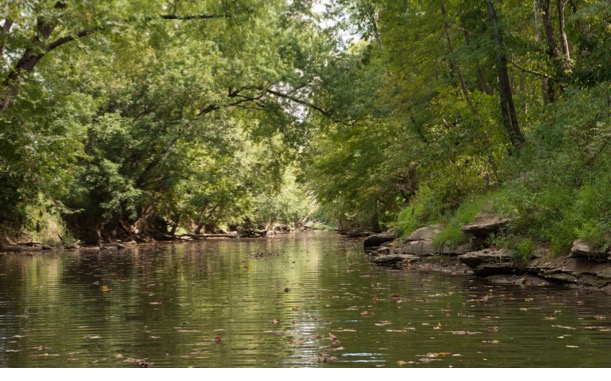
The state of Indiana covers more than 36,000 square miles in the Midwestern/Great Lakes Region of the United States and has a population approaching 6.8 million (Census 2020). Prior to European settlement, the state was predominately forested (primarily oak-hickory and beech-maple climax communities) and included large tracts of wetland in the north and small patches of prairies scattered throughout. Major rivers ran clear enough to see the substrate, as attested by the Native American names “Wabashiki” (“water over white stones”) and “Wapahani” (“white sands”) for the Wabash and White Rivers (Figure 3), respectively.
The state can be divided into several ecoregions: the Eastern Corn Belt Plains, Interior Plateau, Interior River Valleys and Hills, Central Corn Belt Plains, and Southern Michigan/Northern Indiana Drift Plains (Figure 4).

Figure 3. White River through Indianapolis.
Figure 4. Ecoregions of Indiana
Geology
Bedrock and Glacial History
Indiana is underlain by six different types of bedrock (limestone, shale, dolomite, sandstone, siltstone, and coal) from five distinct geological periods (Figure 5). The topography of the state’s bedrock drives drainage patterns to some extent. The highest points on the bedrock surface are found in Randolph and Wayne Counties, on a plateau from which four major river systems originate (White, Wabash, Whitewater, and Great Miami Rivers). The lowest bedrock elevations are found in Posey and Vanderburgh Counties, near the confluence of the Wabash and Ohio Rivers. The composition of bedrock has important implications for hydrologic networks in the state. In particular, limestone and dolomite are unstable over time, creating challenges for Indiana’s construction and agricultural industries and recreational opportunities for Hoosier spelunkers. Limestone and dolomite were formed from the lithified remains of aquatic sea creatures that resided in the shallow sea covering Indiana during the early Paleozoic era (from the Cambrian through the Devonian period - approximately 542-359 million years ago) (Appendix C). These materials are rich in calcium carbonate and subject to dissolution from slightly acidic rain waters.
As a result of this dissolution, cave systems, sinkholes, and sinking streams are formed, to create a landscape known as “karst.” Karst geology is present in south-central and south-eastern Indiana. It is generally extremely vulnerable to pollution as surface water can bypass the filtering soil and infiltrate straight into groundwater. The surficial topography of Indiana has been shaped in large part by at least three major glaciations events of the Pleistocene epoch: the pre- Illinoian, Illinoian, and Wisconsin glaciations.

Figure 5. Bedrock Units of Indiana
As the shallow seas that covered Indiana receded, deposits of limestone, shale, siltstone, dolomite, sandstone, and coal were left exposed to the erosive forces of wind and water. Over time, erosion and deposition caused soil to form atop the exposed bedrock. Around 2.5 million years ago, the most recent Ice Age began. Ice sheets from the Arctic reached down into the area that is now the United States, eroding, churning, and depositing the sediments born from bedrock. Several such events likely took place between 700,000 and 300,000 years ago, but since it is very difficult to characterize their chronology and extent, geologists simply refer to them as “pre-Illinoian.” During the Illionoian glaciation (300,000-140,000 years ago), the ice sheet penetrated the majority of the state, excepting an upside-down “U”-shape that ranged from the Wabash-Ohio River confluence in the southwest, up to the Morgan-Monroe County line, and back down to present- day Jeffersonville in the southeast. When this ice sheet retreated, it left several tens of feet of sediment throughout its range in Indiana. The last glaciation occurred ca. 50,000 years ago when the Wisconsin glacier advanced into Indiana. It reached as far south as central Indiana, flattening the landscape and creating glacial lakes in northern Indiana, but leaving the rolling hills of southern Indiana virtually untouched.
Soils
Soil types in Indiana vary widely from well-drained prime farmland soils in the central and north- central region to the sandy soils of northwestern Indiana to very-poorly drained, mucky soils in certain parts of the central and east-central regions and southern bottomlands. Soil-related nonpoint source pollution concerns include erosion from highly erodible and potentially highly erodible lands, depth to bedrock or groundwater, potential nutrient runoff, hydric soils, and septic system suitability.
Table 1. Selected Field Indicators of Hydric Soils
| Field Indicators of Hydric Soils for All Soils | |
|---|---|
| A1. | Classified as a Histosol or Histel |
| A2. | Histic epipedon underlain by mineral soil material with chroma 2 or less. |
| A3. | Black Histic. |
| A4. | Hydrogen sulfide odor within 30 cm of soil surface. |
| A5. | Stratified Layers starting within the upper 15 inches. |
| A6. | 2% or more organic bodies of muck or mucky modified mineral texture starting within 15 cm of soil surface. |
| A7. | Mucky mineral layer 5 cm or more thick, starting with 15 m of soil surface. |
| A8. | Layer of muck starting within 15 cm or more of the soil surface. |
| A9. | 1 cm muck or more thick within 15 cm of surface. |
| A10. | 2cm or more muck layer starting in first 15 cm. |
| A11. | Depleted below dark surface. |
| A12. | Thick dark surface. |
| A13. | Alaska gleyed |
| A14. | Alaska redox. |
| A15. | Alaska gleyed pores. |
| A16. | Coast prairie redox |
| A17. | Mesic spodic |
Statewide, nearly 2.4 million acres of cropland have been classified as “at risk” for sheet and rill erosion. Of those at-risk acres, 90% still need treatment. In addition, about 1 million acres of pasture and 2.4 million acres of forestland are also at risk due to sheet and rill erosion, with nearly 98% of pasture and 99.7% forest at-risk acreage still needing protection. While sheet and rill erosion are problematic in most of the state, soil damage via wind erosion is a concern in the northwestern portion of the state (NRCS 2011).
To a degree, soil can act as a filter of suspended and dissolved particles, chemicals, and compounds. As surface water infiltrates, then percolates through soil, a variety of substances can become absorbed, altered, or taken up by roots and microorganisms. The degree to which the soil can clean polluted water is highly variable, depending upon soil type, pollutants involved, and depth to groundwater or impermeable materials. Where these conditions allow shortened contact time between the soil and pollutants, the risk of pollutants reaching the water table or surface water (through surface water recharge via groundwater) is increased. Nutrients, pathogens, pesticides, and household hazardous waste (e.g. paint, oil poured out on the ground) are some of the nonpoint source pollutants of concern in these scenarios.
Depth to bedrock and to groundwater is highly variable throughout the state. In the glaciated northern 2/3 of Indiana, bedrock is covered by a relatively thick layer of unconsolidated materials (i.e. “soil”); while in the southern portion of the state, depth to bedrock is relatively shallow and exposed outcroppings of bedrock sometimes can be found.
Hydric soils are soils that have formed under conditions of saturation, flooding or ponding long enough during the growing season to develop anaerobic conditions in the upper part (Federal Register 1994). Though these soils may be drained through the employment of open ditches or drainage tiles, which effectively lower the water table, indicators of prior wetness remain present (Table 1). Hydric soils are one criteria of a wetland determination and may provide an indication of where historic wetlands may have existed, and could be prioritized, for restoration purposes. Hydric soils are generally very limited to somewhat limited in their suitability for dwellings, out- buildings, roads, shallow excavations, lawns, septic systems, and landfills. Approximately 24% of the major soil components in Indiana are hydric.
Septic System Suitability
Where wastewater treatment plants and sanitary sewer connection lines are not available, residents and commercial establishments treat their wastewater using “septic systems.” Though there are many different kinds of septic systems employed to treat wastewater under a variety of soil conditions, these types of treatment systems always consist of a tank to hold solids and a mechanism to filter effluent. The tank is typically made of concrete and is buried near the home or building. A waste line brings effluent into the tank, where solids separate into two layers: scum (soap, grease, toilet paper) that floats to the top and solids (sludge) that settle to the bottom. Settled solids are broken down into organic matter by the anaerobic bacteria that naturally colonize the tank. The liquid effluent is passed through the tank chamber into the drainage field through the tank’s outlet line. The effluent infiltrates the soil through the “fingers” of the drainage field, and then moves through the soil’s pore spaces where microorganisms found in the pores of the soil break down additional bacteria and viruses that are present in the liquid. Other impurities also decompose in the drainage field. Eventually this purified water is taken up by nearby plants or deposited into groundwater.
Septic systems depend, in large part, on soil porosity to treat wastewater. In order to operate properly, the tank must be pumped on a regular basis so that solids do not reach the level of the effluent line and escape to clog the drainage field. In addition, the effluent must have proper contact time with the soil so that the soil microorganisms can treat pathogens and adsorb or decompose impurities. Soils that are very well-drained (such as sandy soils) or are very wet (e.g. due to flooding), do not provide enough time for treatment before the effluent reaches the groundwater. In addition, soils with a high clay content (“tight” soils), that have been compacted, or contain an impermeable layer, may not allow sufficient infiltration and create ponded conditions on top of a typical drainage field. In these types of soils, mounded or dosed systems may be more appropriate than a conventional drain field.
The NRCS has rated all soils in Indiana for their suitability to be used as a conventional septic system drainage field. This rating system ranges from “very limited” for septic systems to “not limited.” In Indiana, approximately 5% of soils are suitable for use as a conventional septic system drainage field. Modifications to septic systems can typically overcome soil limitations. Even so, it is estimated that 20% of the state’s residential septic systems are inadequate and have failed or are failing to protect human health and the environment (Steinhardt 2019).
Current Land Use
Table 2. Indiana Land Use
| Land Use | Acres | Square Miles | Percentage |
|---|---|---|---|
Agriculture | 11,531,682 | 18,018 | 49.8 |
Developed, High Intensity | 190,461 | 298 | 0.8 |
Developed, Medium Intensity | 845,037 | 1,320 | 3.7 |
Developed, Low Intensity | 501,230 | 783 | 2.2 |
Developed, Open Space | 1,168,842 | 1,826 | 5.1 |
Forest | 5,523,086 | 8,630 | 23.9 |
Hay/Pasture | 2,532,261 | 3,957 | 10.9 |
Open Water | 296,473 | 463 | 1.3 |
Shrub/Herbaceous | 12,594 | 20 | 0.1 |
Wetlands | 543,173 | 849 | 2.4 |
Land use information for Indiana is compiled annually as a part of the National Agricultural Statistics Service (NASS), hosted and made available by George Mason University: Center For Spatial Information Science and Systems (CSISS). As a part of that effort, land cover information available via satellite was converted into (among other things) corresponding land uses (Figure 6). The largest land use in Indiana is agriculture (60.76%, when hay and pasture are included), followed by forested use (23.86%). Various developed land uses account for 11.69% and wetlands and open water make up 3.63% of the state (Table 2). For the purposes of the Nonpoint Source Program, land uses will be characterized as “rural” (for agriculture, forestry, mining, wetlands and open water running through these landscapes) and “urban” (including cities and towns, residential areas in more rural locations, and open water surrounded by such uses). 
Figure 6. Indiana State Land Use
Rural Land Uses
Since European settlement, Indiana has been predominately an agricultural state, though large tracts of forest cover remain in the southern and central portions of the state (Figure 6). In 2022 (the last year for which statistics are available), the National Agricultural Statistics Service (NASS) indicated that Indiana ranked 6th in the nation for its inventory of hogs and pigs and 5th in the nation for the value of its grains (including corn, wheat, oilseeds, dry soybeans, and dry peas). Indiana ranked 9th in the U.S. for overall market value of agricultural products sold. This same year Hoosier farmers harvested 5.7 million acres of soybeans, 5.4 million acres of corn for grain, and 488,227 acres of hay. The state also maintained an inventory of 8.1 million broilers and other meat-type chickens, 770,048 cattle and calves, 4.4 million hogs, 35.9 million layers, 10.9 million pullets, and 8.5 million turkeys. In 2022, the Indiana agricultural industry netted some $18 billion (NASS 2022).

Figure 7. Corn field in Indiana
An annual survey is conducted by partners from the Indiana Conservation Partnership (ICP), led by the Indiana State Department of Agriculture (ISDA) to estimate the adoption of cover crops and post-harvest tillage. As of 2023, there were 1.6 million acres of living cover crop in all crops, 596 thousand acres of living cover crop in corn (Figure 7), and 931 thousand acres of living cover crop in soybeans. Living green cover implementation has increased from 8.5% (1,230,875 acres) in 2014 to 14% (1,611,147 acres) in 2022. This is an additional 380,272 acres of living cover crop implemented over 10 years. Brown County had the highest percentage of total living cover planted after all crops at 53%, followed by Bartholomew County at 43.2%, and both Knox County and St. Joseph County at 39% (ISDA, 2023). In addition to implementing more cover crop practices, Indiana has also had an increase in the implementation of conservation tillage practices. According to ISDA, conservation tillage implementation on corn and soybean fields increased from 1,412,359 acres (15% of all corn and soybean fields) in 1990 to 6,101,134 acres (53% of all corn and soybean fields) in 2019 (ISDA, 2019).
According to the United States Department of Agriculture (USDA) Economic Research Service, in 2022, Indiana exported $2.7 billion in soybeans, $1.4 billion in corn, and $836 thousand in feed and other feed grains. Pork exports were the highest among livestock exports at $394 thousand, followed by poultry products at $273 thousand. In 2022, Indiana ranked 7th in the country for the export value of total agricultural exports, 11th for the export value of total animal products, and 6th for the export of total plant production (USDA, 2023). The ISDA reports agriculture in Indiana contributed an estimated $35.1 billion to Indiana’s economy, exporting $7.4 billion in 2022 (ISDA, 2024).
Urban Areas
Significant urban areas in the state include Indianapolis and its suburbs in central Indiana, the major urban areas in northwest Indiana, Ft. Wayne in the northeast, Evansville in the southwest, and the South Bend/Elkhart area in the north. Smaller urban areas are spread out throughout the state; locations of note include Anderson, Bloomington, Lafayette, Muncie, and Terre Haute. Despite the fact that developed space is only about 12% of the land cover in the state, the majority (78%) of Indiana’s population lives in the urban areas.
Urban areas can be a large source of nonpoint source pollution, especially when best management practices are not used by a large population base. Common urban sources of nonpoint source pollution include construction activities, pet waste, fertilizing grassy areas, run-off from impervious surfaces, nuisance waterfowl waste, residential car washing done on the street or in the driveway, and stream bank erosion. Polluted waters from these activities can run over land or enter storm sewers to discharge directly into streams. To mitigate the pollutants generated by populated areas, the U.S. EPA, together with the state, has designated certain populated areas such as cities, towns, universities, colleges, hospitals, military bases, and certain correctional facilities to be permitted for their discharge of urban storm water run-off. These permittees are known as “municipal separate storm sewer systems” or MS4s. Indiana’s MS4s are regulated under 327 IAC 15-13 or “Rule 13” and are issued a National Pollutant Discharge Elimination System (NPDES) permit. In MS4 areas, much of the storm water discharge is generated by overland flow, but since the water is captured via storm sewers and conveyed to the waterbody through pipes, the nonpoint source pollution runoff becomes a “point” source discharge which can be regulated under the NPDES program.
There are over 200 MS4s that have been designated in Indiana (www.idem.in.gov/stormwater/municipal-separate-storm-sewer-systems-ms4/designated-ms4-entities-currently-permitted/), though in many cases, two or more entities were co-permitted. These NPDES permits are reviewed and re-issued (as applicable) on a 5-year cycle. MS4 entities must submit a Storm Water Quality Management Plan (SWQMP) to IDEM that includes a watershed characterization and program implementation elements. Program elements must include the following six minimum control measures:
- Public Education and Outreach
- Public Participation and Involvement
- Illicit Discharge Detection and Elimination
- Construction Site Storm Water Run-off Control
- Post-construction Storm Water Run-off Control
- Municipal Operations, Pollution Prevention, and Good Housekeeping
All MS4 municipalities have local storm water ordinances or other legal means in place, and many fund their SWQMP activities through a storm water utility. Even though the pollution being mitigated through MS4 regulation could be considered nonpoint source pollution, regulated activities specifically outlined in the SWQMP cannot be funded with Section 319 funds. However, any nonpoint source pollution activity that goes “above and beyond” the SWQMP may be funded through Section 319 funds.
Urban areas can serve as significant sources of chlorides when roads are treated with “salt” as de-icer for driving safety considerations. Populated areas that use sand instead of salt have an increase of sediment when sand enters stream system as runoff.
Mineral, oil and gas extraction
Coal and Minerals Southwestern Indiana includes land rich in minerals such as coal, clay, shale, and shale oil (Figure 8). The Indiana Geologic Survey (IGS) estimates that Indiana has approximately 57 billion tons of unmined coal resources, of which 17 billion tons are recoverable using current technologies (IGS 2011). As of the end of 2012, there were 30 active coal operations (DNR 2013a), two gypsum mines, and six shale and/or clay mines covering 590.95 acres in southwestern Indiana (IMCC 2012). Of these activities, the coal industry is the largest and has the potential to greatly impact water quality in the state.
Coal mining in Indiana dates back to the 1800s. Prior to 1941, there was no state or federal requirement that coal mining companies address environmental concerns resulting from the abandonment of spoil piles, coarse-grain refuse and tailings. Though some coal mining companies voluntarily began reclamation activities, not all companies took it upon themselves to do so. Major nonpoint source pollution concerns from barren gob piles and tailings include erosion and acid mine drainage. Acid mine drainage occurs when water flowing through slurry waste piles becomes acidic, due to the reaction of water with sulphur-bearing materials in the waste. The reaction creates sulfuric acid, which then leaches heavy metals out of the rocks it encounters. These waters are dangerous to humans, and aquatic life generally cannot tolerate the low pH present in these environments. There is some evidence of acid mine drainage to waters of the state in southwest Indiana.
In 1941, Indiana passed a law that required coal mining companies to plant trees on spoil banks. By 1967, Indiana’s mining regulations had incorporated additional protections for mined land, including provisions to allow farming activities, burial of certain acid-forming rocks, grading specifications, and a requirement for a performance bond so that reclamation activities would be guaranteed. Nationally, the environmental standards of the coal mining industry changed dramatically with the enactment of the federal Surface Mining Control and Reclamation Act (SMCRA) of 1977 (30 U.S.C. 25), which mandated that the coal industry take steps to control the environmental impacts of coal mining. SMCRA provides authority for the federal Office of Surface Mining Reclamation and Enforcement (OSMRE) to support and oversee state mining regulatory programs, as well as providing grants and oversight to state abandoned mine reclamation programs. Today, the state of Indiana, through the DNR Division of Reclamation, oversees the mining and reclamation activities of 30 coal mines and the production of 32-36 million tons of coal per year.
Coal mining sites that are no longer active (whether abandoned or properly closed according to a DNR-approved mine reclamation plan) can be rehabilitated for many land uses, including farmland, forest land, wildlife habitat, wetlands, and recreation areas.
Aside from coal, several other minerals are mined in Indiana. The soft mineral gypsum is mined from two underground mines in Martin County. The deposit is 350-600 feet beneath the surface and can be up to 16 feet thick. Gypsum is used to make drywall, cement, soil amendments, plaster of Paris, and finishing compound.
Southern Indiana also includes a belt of limestone situated between Bloomington and Bedford, where 2.7 million cubic feet of “Indiana limestone” (technically Salem limestone) is excavated from nine quarries annually for its uses in the building industry. In addition, sand and gravel seams, peat, and marl are distributed widely throughout the state. While 150 active sand and gravel mines across the state produce 25 million tons annually, some 2000 sand and gravel quarries have been abandoned, with potential nonpoint source impacts on groundwater. Water quality concerns from these mining activities include pesticide and fertilizer run-off leaching into groundwater through abandoned quarries and erosion concerns.

Figure 8. Coal production in Indiana
Oil and Gas
Exploration of subsurface oil and gas probably began in Indiana during the middle of the 1800s stemming from early drilling for salt recovery and precipitation. Although gas springs and oil seeps were discovered in counties in southern Indiana along the Ohio River in the 1860s, the first major exploitation of gas and oil began with the discovery of the Trenton Field in east-central Indiana in 1876. This explosion in oil and gas development precipitously declined in the early 20th century due to wasted resources and poor drilling practices. As the Trenton Field exploration and exploitation declined, reserves in the Illinois Basin in southern Indiana were discovered and developed throughout the mid-1900s. Overall, the amount of oil production in Indiana has declined since the 1960s, but has seen resurgence in the New Albany Shale Play in southeastern Indiana in the last 20 years (Figure 9).

Figure 9. Historical Oil Production in Indiana
Unlike the shallower pits and mines created for mineral and coal mining, oil and gas wells in the U.S. average nearly 8,000 feet deep. The majority of Indiana has been drilled and explored for oil and gas, but only in the shallow range of the first few thousand feet. This restricted exploitation of only the shallow surface has potentially left undiscovered reserves of oil and gas available at greater depths. These potential deep, and unexplored, reserves may be more accessible with the advent of new technologies in oil and gas extraction, including but not limited to the application of advanced seismic acquisition and processing techniques, new drilling technologies including horizontal drilling and shale fracturing, and complex completion techniques such as CO2 stimulation.
While early primitive drilling and oil extraction techniques had the potential to lead to surface “blow outs” and environmental contamination, modern techniques use blow out preventers that keep material within the bore-hole, preventing contamination to the environment. Although modern controls can prevent surface contamination, by-products from oil and gas wells (such as brine or chlorides) can reach shallow groundwater aquifers through poor maintenance and defunct equipment, including corroded well casings and leaking storage tanks and/or pipelines. The proper handling of by-products from finishing can also be of concern to water resources if not disposed of properly. As new techniques are developed, including high-volume hydraulic fracturing, it will be important to keep up on the transparency of chemical use and the elimination of potential groundwater contamination pathways. The IDNR, Division of Oil and Gas is charged with regulating petroleum exploration, production and site abandonment activities, underground injection control, and test hole drilling.
The total oil production in Indiana for 2022, the last year on record as of this writing, was approximately 1.7 million barrels. At an approximate price of $92.56 per barrel, the total production of oil in tax dollars from 2022 was roughly $1.5 million. The total gas production in Indiana for 2022 was approximately 3.8 million Mcf (an Mcf is 1000 cubic feet of gas). At an approximate price of $6.05 per Mcf, the total production of gas in tax dollars in 2022 was over $230,000 at www.dnr.in.gov/oil-and-gas/oil-and-gas-activity/oil-and-gas-statistics/.
Indiana’s Hydrology
Watersheds
Nonpoint source pollution is often called “run-off” pollution because pollution “runs off” the watershed and into the body of water. A watershed is an area of land that collects and drains water from high points (hills) to low points (valleys) (Figure 10). When rain falls in a watershed, the water travels over natural and manmade terrain features toward the lowest point. Any area that drains water to one location is a watershed. Watersheds are synonymously called “basins,” “catchments,” and “drainage areas.”
The United States Geological Survey (USGS) has categorized watersheds according to their size, using an address system known as hydrologic unit codes (HUCs). Watersheds are nested, with the drainage of a small creek belonging to the watershed of that creek, as well as the next larger watershed, and the next, continuing all the way to a major river that leads to an ocean. In order to capture this “basin within a basin” characteristic of watersheds, HUCs can describe very specific watersheds, but can be extrapolated to their larger watershed. The fewer the numbers in a HUC, the larger the area it covers.

Figure 10. Indiana’s 2-digit watersheds
For example, the Upper White River watershed (of which Marion County and Indianapolis are a part) is the HUC-8 watershed (or 8-digit watershed) 05120201. It is part of the Patoka-White River drainage (051202), which is part of the larger Wabash River drainage (0512), which is part of the Ohio River drainage (05). Indiana’s HUCs were first described at the HUC-8, HUC-11, and HUC-14 scales by the USGS Indiana-Kentucky Water Science Center. However, in order to maintain consistency across the nation, Indiana’s HUCs have been re-indexed to the HUC-8, HUC-10, and HUC-12 scales. Older maps and documents that depict or discuss watersheds will often describe 11- and 14-digit HUCs, while the newer figures and texts refer to the 10- and 12-digit HUCs. The 12-digit level is the smallest level that is described by HUCs (of which, Indiana has 1589), though watersheds smaller than 12-digits can be defined using software tools and land survey equipment. The state of Indiana can be divided into three regional watersheds (HUC-2 scale): the Great Lakes (04), Ohio River (05), and the Mississippi River (07) regional watersheds (Figure 10). Over 81.8% of Indiana drains to the Ohio River, while 9.7% goes to the Great Lakes, and 8.5% goes to the Upper Mississippi River. Indiana wholly or partially contains 38 sub-basins (8-digit HUCs) (Figure 11).

Figure 11. Indiana’s 8-digit Watersheds
Streams
Indiana contains 62,746 miles of streams and rivers, from headwater agricultural streams to the mighty Wabash (Figure 12). Warm water stream habitats dominate these stream miles, with cold water streams present in the Lake Michigan drainage only. Of these miles at least 81.42% are first and second order (“headwater”) streams, with drainage areas of less than 5 mi2 (Ward 2008).
Hydromodification of streams, and of headwater streams in particular, is a major issue in Indiana. Many portions of the state have wet soils that must be drained through ditches and subsurface drainage tiles in order to be farmed. In many instances, natural headwater streams were straightened and channelized in order to send water away from farm fields as fast as possible. In addition, many miles of forested riparian corridor have been removed to reduce the occurrence of in-stream log jams and root intrusion into the tile drainage system. While such hydromodifications have rendered the majority of the state arable, from an ecosystem standpoint, the result has been reduced canopy cover resulting in higher water temperatures; mucky and embedded substrates unsuitable as habitat for many aquatic macroinvertebrates or fish spawning; loss of riffle-pool-run systems; flashy hydrographs; and disconnection with floodplain, resulting in downstream flooding.
While drainage projects have had a profound effect on Indiana’s aquatic systems, they are not the only hydromodifications seen in Indiana. Pumping of groundwater - both for irrigation and as drinking water for single-family dwellings as well as whole communities- has affected changes in spring-fed streams. In addition, low head, hydroelectric and flood-control dams, drinking water impoundments, and road crossing culverts have disconnected stream segments and limit the migration of fish and mussel species.
Large Rivers
In Indiana, the Wabash and White Rivers, portions of the St. Joseph (Lake Michigan), Maumee River, and portions of the Kankakee River are “large rivers” (Indiana Biological Survey 2005).
Characteristics of the Wabash and White Rivers (whose watersheds comprise the majority of Indiana’s drainage) are detailed below.
Figure 12. Major Indiana Rivers
Wabash River
The Wabash River is Indiana’s state river and has played a major role in the state’s history. Beginning near Ft. Recovery, OH, the river drains 32,910 mi2 of Indiana, Ohio and Illinois. After flowing for approximately 30 miles in Ohio, the river enters Indiana and flows 61 miles before it is dammed for flood control at the J. Edward Roush Lake, upstream of Huntington, IN. From there, the Wabash River flows unimpeded for 411 miles and is the longest free-flowing river east of the Mississippi River (Karns et al. 2006).
The Wabash River watershed is connected to the Great Lakes watershed in Ohio through Beaver Creek, an outlet of Grand Lake Saint Mary’s and tributary of the Wabash. However, historically, the main trade route between the Great Lakes and Mississippi River during early European settlement was via the Wabash River through a portage at Ft. Wayne. Though commonly reported as a 7–8-mile portage, the actual passage could vary greatly, according to water levels; during times of intense flooding, travelers could navigate their canoes between the watersheds without portaging. Flood waters still come between the basins via Junk Ditch at the site of Eagle Marsh on the south side of Ft. Wayne. Control of the portage was a key reason that the Miami Indians situated their village “Kekionga” near the Three Rivers and why Fort Wayne was established here.
Once Indiana was granted statehood, its leadership embarked on the building of a canal that would connect the Lake Erie tributaries in Ft. Wayne to the Wabash (and ultimately, the Mississippi) River. The result of the project was the historic Wabash and Erie Canal. Between 1832 and 1853 Indiana constructed over 450 miles of canals with the assistance of federal land grants. At 468 miles, the canal connected the Maumee River at Fort Wayne with the Wabash River, then exited the Wabash at Terre Haute and continued south to Evansville by way of the Eel River. This canal system allowed steamboats and flatboats to navigate the traditional trade route much more efficiently. However, the canal soon fell into disuse when the railroad became the preferred method of transporting goods. In 1876 the Wabash and Erie Canal was auctioned off by its trustees; however, remnants of the system remain today, particularly near the Town of Delphi in Carroll County and City of Logansport.
Towns established along the Wabash River in the late 19th and early 20th centuries have always been subject to flooding. A major flood of Peru, Logansport and Lafayette occurred in March 1913; and the Lower Wabash flood of January 1937 was the worst flood to occur in recorded history.
These flooding events prompted the United States government to develop a plan for flood control to protect these Wabash riverfront towns. Over the course of several decades, the U.S. Army Corps of Engineers (USACE) devised a plan to construct eight flood-control reservoirs including three in the Upper Wabash River basin (Roush, Salamonie, and Mississinewa), one in the Middle Wabash (Cecil M. Harden Lake), two in the White River watershed (Cagles Mill Lake and Lake Monroe), and one in the Patoka watershed (the aptly named Patoka Lake) (USACE 2011).
Despite the anthropogenic alterations to the river, its tributaries, and watershed, the Wabash still has the potential to regain the ecological diversity once present in its waters. The system has the last population of the lake sturgeon in the entire Mississippi River basin. A viable fishery of shovelnose sturgeon is also present in the mainstem. Though unionid mussel diversity has decreased significantly, at least 30 species maintain reproducing populations.
White River
Draining 11,400 mi2, the White River is the major tributary of the Wabash River. The White River consists of two forks that flow in a generally southwesterly direction: the East Fork White River and the West Fork White River. The two forks converge northeast of Petersburg, IN and flow for an additional 45 miles as the White River. Altogether, the river flows for a combined 554 miles to its confluence with the Wabash near Mt. Carmel, IL.
The West Fork of the White River begins in a farm field in eastern Randolph County. The river quickly grows in size as it crosses the agricultural landscape as a result of numerous small tributaries in Randolph and eastern Delaware Counties. Muncie is the first of several major urban areas that influence the White River. In the City of Muncie, major efforts have been undertaken by the city to clean up the pollution caused by the releases of numerous factories from the early 20th century. The Muncie Sanitary District’s Bureau of Water Quality monitors fish and macroinvertebrate populations in the White River and its Delaware County tributaries to ensure that anthropogenic impacts are not causing additional degradation of the river.
Figure 13. White River through Indianapolis
As the West Fork White River progresses on its course through Madison, Hamilton and Marion Counties, it grows larger from the contribution of major tributaries such as Killbuck Creek, Duck Creek, Pipe Creek, Fall Creek, Cicero Creek, Cool Creek, Stony Creek, Eagle Creek, and White Lick Creek, and flows through the Cities of Anderson, Noblesville, Fishers and Carmel into Indianapolis (Figure 13). Though urban issues create various pollution issues, such as phosphorus from lawn fertilization and pathogens from combined sewer overflows (CSOs), recreational use in this section of the river is relatively high, with angling being the most popular form of recreation employed (Hoffman 2005).
The East Fork White River begins at the confluence of the Flatrock and Driftwood Rivers in central Indiana near the City of Columbus. As it flows through primarily rural and wild lands, the East Fork is joined by major tributaries such as the Muscatatuck River, Salt Creek, Sand Creek, and Lost River, before meeting with the West Fork to form the White River (Figure 14). Unlike the West Fork, the East Fork has little in the way of urban influences.
Great Rivers
The Ohio River, forming the southern border of the state, is Indiana’s only “great river.” The Ohio begins at the confluence of the Allegheny and Monongahela Rivers in Pittsburgh, Pennsylvania and flows 981 miles through six states before emptying into the Mississippi River at Cairo, IL. It is a warm-water, navigable river, with 20 high-lift dams to facilitate commercial shipping.
Despite the fact that it contains over 1,000 CSO outfalls and over 600 NPDES permitted discharges - including from industry, power-generating facilities, and municipalities – the river serves as a water supply for over 5 million people and as habitat for the federally-endangered pink mucket pearly mussel. Drainage from parts of 15 states (IL, IN, OH, PA, NY, MD, WV, KY, TN, VA, NC, GA, AL, MS & SC) and 203,940 mi2 flows to the Ohio River. Because it shares drainage with so many states, water quality in the Ohio River is governed through the Ohio River Valley Water Sanitation Commission (ORSANCO), of which Indiana is a part (ORSANCO 2023).
Beyond Indiana: Hypoxia in the Gulf of Mexico
As a contributor to the Mississippi River watershed, Indiana (represented by the Indiana State Department of Agriculture, or ISDA) is involved in the Gulf Hypoxia Task Force. This collaborative state/federal partnership oversees work on the Gulf of Mexico Hypoxia Action Plan, the strategy for reducing and eliminating the annual dead zone in the Gulf of Mexico (Mississippi 2008). The dead zone appears to be the result of a massive yearly algal bloom, brought about by the over- enrichment of waters coming into the Gulf from the Mississippi/Atchafalaya River Basin. One prominent nutrient model (the SPAtially Referenced Regressions On Watershed attributes, or SPARROW model) indicates that Indiana is among several states which are responsible for significant exports of nitrogen and phosphorus to the Gulf. As such, ISDA (in collaboration with several other Indiana agencies and organizations) has prepared and submitted Indiana’s nutrient reduction strategy to U.S. EPA. This strategy follows guidelines set forth by the Gulf Hypoxia Action Plan which include prioritization of HUC-8 and HUC-12 watersheds; a description of how the state will utilize and coordinate existing resources and programs within those watersheds, seek future funding, and grow and maintain conservation partnerships; a summary of current and future monitoring across the state; and the methods for which accountability will be provided to state and federal agencies, to conservation partners and to the public.
In addition, the Indiana State Nutrient Reduction Strategy (www.isda.in.gov/divisions/soil-conservation/indiana-state-nutrient-reduction-strategy) has been developed through efforts with the ICP, IDEM, and ISDA to outline present and future impactful conservation efforts with an overall commitment towards reducing nutrient runoff into water bodies. The Indiana State Department of Agriculture (ISDA) is Indiana’s representative on the Gulf of Mexico Hypoxia Task Force. As the state water quality agency designated by U.S. EPA to administer CWA programs, IDEM has co- authored the SNRS and is participating on the work group to track progress and provide revisions to it every five years.
Lakes
Indiana boasts over 1,000 public lakes covering 106,000 acres. The distribution of those lakes includes 452 natural lakes and 580 impoundments (DNR 2012b). Generally, the lakes in the northeastern and north central regions are natural kettle lakes or chains of lakes left over from the glacial period. Also, in general, lakes in the central and southern portions of the state tend to be impoundments, though the flood control reservoirs can also be found in northeastern Indiana. Additional impoundments have been established for drinking water storage and recreation.
The majority of Indiana’s public lakeshore has been developed. Potential pollutants from developed lakeshores include nutrients from fertilizer, pet waste, and car-washing detergents; sediment from erosion; and E. coli from nuisance geese and failing septic systems.
In recent years, many of Indiana’s lakes (both natural and man-made) have been experiencing harmful algal blooms (HABs). It is believed that high levels of phosphorus in addition to other factors are contributing to these freshwater algal blooms.
Great Lakes
Lake Michigan
Indiana’s portion of the Lake Michigan shoreline is 67 miles located entirely within the Little Calumet-Galien watershed (HUC 04040001). This 8-digit watershed also roughly corresponds to the area managed under the Coastal Zone Management Act (16 U.S.C. §1451 et seq.) through the IDNR Division of Nature Preserves Lake Michigan Coastal Program (LMCP). At present, all 67 miles of the shoreline in Indiana are listed as impaired for recreational and fishable uses. Several watershed management plans for subwatersheds of the Little Calumet-Galien have been approved (Appendix F). Additional water quality-related plans in the area include the Remedial Action Plan (RAP) for the Grand Calumet Area of Concern (AOC) and the Lake Michigan Lakewide Management Plan (LaMP; agreed to in the U.S – Canada Great Lakes Water Quality Agreement of 1987), MS4 entities and associated SWQMPs, and several plans developed for the Indiana Dunes National Lakeshore through the National Park Service.
Indiana’s share of Lake Michigan waters includes 154,176 acres of open water. The Indiana waters of Lake Michigan have been assessed for mercury and polychlorinated biphenyls (PCBs) in fish tissue in accordance with IDEM’s Consolidated Assessment and Listing Methodology (CALM). 154,176 acres have been impaired for human health and wildlife designated uses for both Mercury and PCBs in fish tissue. Because Lake Michigan is assessed as a single unit, any impairment identified in any part of the lake is applied to all 154,176 acres of Lake Michigan.
In addition to the coastal zone and open waters of Lake Michigan, Indiana shares the St. Joseph River watershed (HUC 04050001), a major tributary to southeastern Lake Michigan, with the state of Michigan. A cooperative watershed management plan was developed for the 8-digit HUC using Michigan 319 funds and is being implemented by partners in both states (www.idem.in.gov/nps/resources/watershed-management-plans/st-joseph-river-lake-michigan-wmp). Several smaller WMPs have been developed in both states, implemented by local groups.
Lake Erie
Though Indiana cannot claim to have Lake Erie lakefront real estate, the state does contribute drainage area to the Maumee River, the largest tributary to the Western Lake Erie Basin. Formed from the confluence of the St. Joseph (Lake Erie) and St. Mary’s Rivers, the Maumee flows eastward out of the City of Ft. Wayne, through Ohio, to Lake Erie. The watershed is predominantly agricultural, though the river itself runs through several urban areas (Ft. Wayne and New Haven in Indiana, as well as Defiance and Toledo in Ohio). Since 2003, a large plume of sediment and algae coming into the lake through Maumee Bay has been observable via satellite images. Several partnerships, including the Western Lake Erie Basin (WLEB) Partnership, the St. Joseph River Watershed Initiative, the Upper Maumee Watershed Partnership, and the Maumee River Basin Partnership of Local Governments are working to improve water quality in the tributaries that lead to Maumee Bay. At the state level, ISDA actively participates in the WLEB Partnership and offers technical assistance to landowners to reduce nutrient loss in the watershed. IDEM leads a dedicated Advisory Committee comprised of representatives from different stakeholder sectors. Their collaborative effort resulted in publishing Indiana’s Great Lakes Water Quality Agreement (GLWQA) Domestic Action Plan (DAP) to reduce phosphorous to the Western Lake Erie Basin. Founded on the principle of adaptive management, the DAP is a dynamic document acknowledging that phosphorous loading in particular, and nutrient pollution in general, is a very complex problem caused by point and nonpoint sources across all sectors, which requires a multi-dimensional solution. IDEM has and continues to provide funding for watershed groups working in this area to reduce nonpoint source pollution to Lake Erie. All watersheds within the Indiana portions of the Western Lake Erie contain approved watershed management plans.

Figure 14. Goose drinking water in the White River
Wetlands
Wetlands are present in every county in Indiana. The best estimate of the wetlands in Indiana prior to European settlement is based on the presence of hydric soils (soils that form under saturated, flooded, or ponded conditions). Mapping of soils is conducted by the USDA Natural Resource Conservation Service, or NRCS (formerly the Soil Conservation Service or SCS). Based on an analysis of this data by the IDNR, it is believed there were approximately 5.6 million acres of wetlands in Indiana 200 years ago.
The value of wetlands, including wetland functions with economic impacts such as flood control, pollutant attenuation, and wildlife habitat, has not always been appreciated in Indiana. One historical bulletin issued from by the Indiana Bureau of Legislative Information in 1914 indicated that 625,000 acres stood to be “reclaimed” (i.e. drained) in Indiana at that time. Significant pre- settlement wetlands that existed as part of the Kankakee Grand Marsh in northwestern Indiana and the Great Black Swamp in northeastern Indiana were drained in order to exploit the prime farmland beneath the waters. Additional wetland acreage has been filled to allow for development and agriculture. Bogs are mined for peat, a horticultural amendment. Today, an estimated 863,000 acres of wetland remain in Indiana.
The nation’s wetlands were mapped beginning in the 1970s by the U.S. Fish and Wildlife Service (USFWS) as part of the National Wetlands Inventory (NWI). Advances in remote sensing and Geographic Information System (GIS) technologies have been made since the state’s wetlands were originally tallied as part of the NWI in 1985. IDEM contracted with Ducks Unlimited to update the NWI maps for Indiana in 2007. The project was completed in 2009. A total of 174,204 acres of emergent, 658,205 acres of forested/scrub-shrub, and 30,551 acres of lacustrine wetland were identified. Of the identified wetlands, 59% are under an acre in size.
Change in wetland acreage since the last NWI was completed suggests that some wetlands were converted to other uses over the intervening years. The analysis indicated that 45,415.96 acres were converted for other uses between the date of the original NWI (ca. 1980-1988) and the update year (ca. 2005). Approximately 72% were converted for agriculture purposes and nearly 24% for development (the remaining 4% of wetland conversions were categorized as recreational and “other”). Additionally, the report found that emergent wetlands occupied the greatest converted acreage (48%), with forested wetlands a close second (32%). Ditched and/or excavated wetlands accounted for 117,099 acres; while farmed wetlands totaled only 2,215 acres.
Combining the information from the National Wetlands Inventory (NWI) and the IDNR yields the following summary:
- Estimated wetlands circa 1780s: 5,600,000 acres
- Percent of surface area in wetlands circa 1780s: 24.1%
- Existing wetlands: 813,000 acres
- Percent of surface area in wetlands today: 3.5 %
- Percent of wetlands lost: 85%
The country’s attitude toward wetlands shifted in the 1970s, evidenced by President Jimmy Carter’s Executive Order 11990, which required federal programs to avoid wetland loss when possible. Later, the 1985 Farm Bill would include a “Swampbuster” provision (16 U.S.C. §§3801- 3823) to discourage more wetland loss due to agriculture. President George H. W. Bush set a national policy of “No Net Loss” (of wetlands) in 1989, paving the way for compensatory wetland mitigations for drained or filled wetlands. Today, in Indiana, IDEM and the USACE permit wetland and riparian impacts requiring mitigation. Many groups throughout the state are preserving and restoring wetlands through Farm Bill programs, state monies, and private funding. Wetland restorations with notable state involvement include the Limberlost-Loblolly Swamp in Jay County, Goose Pond Fish and Wildlife Area in Greene County, the Healthy Rivers Initiative (including wetlands in the floodplains and bottomlands of Sugar Creek, Wabash River, and Muscatatuck River), Grand Kankakee Marsh (500,000 acres in eight northwestern Indiana counties), Jasper-Pulaski Fish and Wildlife Area (in Jasper and Pulaski Counties), Wabashiki Fish and Wildlife Area (Vigo County), and numerous smaller tracts dedicated as state nature preserves. In addition, several land trusts and conservancies are protecting wetland acres across the state.
Groundwater
Groundwater is water that resides in aquifers, underground geologic formations that are capable of producing water through a well. Groundwater doesn’t “flow” (like a river or stream) so much as it slowly migrates through sediments and fissures in bedrock until an equilibrium is reached. Groundwater in the northern 2/3 of Indiana is typically found in sand and gravel of glacial deposits and is generally plentiful. More than 300,000 public and private wells provide water for drinking and industrial uses in Indiana.
Given the absence of glaciers, and therefore the unconsolidated materials they generated, in southern Indiana, groundwater is much scarcer. In addition, some portions of southern Indiana have karst landscapes that bypass the natural filtering capacity of soil and send water from the surface to deep underground through caverns and tunnels. Groundwater in karst landscapes is very susceptible to pollution because there is no chance to filter the water through a soil layer before it permeates into bedrock. The solution to this groundwater scarcity has been to build drinking water reservoirs.
Despite the widespread use of groundwater as drinking water in Indiana, this source water receives less attention from the Nonpoint Source Program than surface water. Significant nonpoint source pollution threats to groundwater include:
- Nitrates
- Bacteria and other pathogens
- Arsenic (naturally occurring)
- Pesticides
- Improper abandonment of wells
- Dumping to quarries, mines, and karst features
Considerable opportunities exist to coordinate the Nonpoint Source Program with IDEM’s Groundwater (GW) Section to identify communities with source water intakes that do not have a watershed management plan and encourage the creation of a source water implementation plan. In addition, the GW Section has initiated a project to rank wellhead protection areas on the risk of contamination and target those high-ranking communities for additional technical assistance. Long-term, the Section is interested in using a tool that can predict groundwater recharge and discharge areas of the state to better predict the magnitude of the risk of particular aquifers to contamination. Other states have programs that the GW Section is interested in emulating, including the groundwater management zones in Oregon and the groundwater-enhanced super gages in Montana.
Water Quality
Ambient surface water quality standards for the state of Indiana are found in Title 327 of the Indiana Administrative Code. 327 IAC 2-1-1.5 defines the water quality goal of the state: “to restore and maintain the chemical, physical, and biological integrity of the waters of the state.” All waters in Indiana are designated for one or more beneficial uses in the state’s water quality standards, which also contain numeric and narrative criteria to protect their water quality. These criteria are used to determine whether a waterbody is “fully supporting” the designated use or if the use is impaired. Beneficial uses take into consideration the use and value of the water as a public water supply, as habitat for the protection of aquatic wildlife, and as a source for recreation, industry and agriculture uses (Table 3).
Unless otherwise noted in the IAC, all of Indiana’s waters are designated for full-body contact recreation and warm water aquatic life use (327 IAC 2-1-3 and 327 IAC 2-1.5-5). In the Great Lakes, waters that meet the ecological conditions for salmonid reproduction and put-and-take trout fishing should also, by rule, maintain those conditions (327 IAC 2-1.5-5). The state also designates waters for public and industrial water supply, agriculture, and fish and wildlife uses, but generally, if a waterbody meets the water quality criteria for both the full-body contact and aquatic life use designation, it will meet the criteria for the remaining uses.
Every two years (in even-numbered years), Indiana submits to U.S. EPA the Integrated Water Quality Monitoring and Assessment Report (also known as the Integrated Report or IR). The IR describes the state of water quality in Indiana. Each waterbody for which data is available is assessed according to whether or not it meets the minimum water quality criteria for aquatic life use and human health, which includes full-body contact recreation and fish consumption. The 2024 IR included the following summary of surface water quality conditions in Indiana:
Table 3. Assessment of monitored stream and lake miles in Indiana
Designated Beneficial Use | Total Size | Size Assessed | Size Fully Supporting | Size Not Supporting | Size Not Attainable |
River (Miles) | |||||
Full Body Contact (Recreational Use) | 62,746 | 33,643 | 8,956 | 24,687 | 0 |
Human Health and Wildlife (Fishable Use) | 62,746 | 8,916 | 3,361 | 5,555 | 0 |
96 | 27 | 27 | 0 | 0 | |
Warm Water Aquatic Life (Aquatic Life Use) | 62,746 | 36,264 | 24,486 | 11,778 | 31 |
Lake Michigan Shoreline (Miles) | |||||
Full Body Contact (Recreational Use) | 67 | 67 | 0 | 67 | 0 |
Human Health and Wildlife (Fishable Use) | 67 | 67 | 0 | 67 | 0 |
Public Water Supply (Drinking Water Use) | 41 | 41 | 41 | 0 | 0 |
Warm Water Aquatic Life (Aquatic Life Use) | 67 | 67 | 67 | 0 | 0 |
Lake Michigan (Acres) | |||||
Human Health and Wildlife (Fishable Use) | 154,176 | 154,176 | 0 | 154,176 | 0 |
Lakes and Reservoirs (Acres) | |||||
Full Body Contact (Recreational Use) | 129,547 | 39,790 | 30.7% | 30,503 | 9,287 |
Human Health and Wildlife (Fishable Use) | 129,662 | 81,336 | 62.7% | 42,215 | 39,120 |
Public Water Supply (Drinking Water Use) | 22,851 | 12,471 | 54.6% | 0 | 12,471 |
Warm Water Aquatic Life (Aquatic Life Use) | 129,547 | 16,540 | 12.8% | 5.434 | 11,106 |
From Indiana’s 2024 Integrated Water Monitoring and Assessment Report https://www.in.gov/idem/nps/watershed-assessment/water-quality-assessments-and-reporting/integrated-water-monitoring-and-assessment-report/).
The Integrated Report also contains a Consolidated List of all the waters of the state. Each waterbody is placed into a category for each of its designated uses depending on the degree to which it supports that use:
- Category 1: The waterbody is fully supporting all of its designated uses and none of its uses are threatened.
- Category 2: The waterbody is fully supporting the designated use assessed and no other use is threatened; insufficient data and information are available to determine if the remaining uses are supported or threatened.
- Category 3: Insufficient data and information are available to determine if the waterbody is supporting its designated use.
- Category 4: The designated use is impaired or threatened but a total maximum daily load (TMDL) is not required because:
- A TMDL has already been completed for the impairment(s) and approved by U.S. EPA and is expected to result in attainment of all applicable water quality standards; or
- Other pollution control requirements are reasonably expected to result in the attainment of the water quality standard in a reasonable period of time; or,
- The impairment is not caused by a pollutant.
- Category 5: The designated use is impaired, and a TMDL is required because:
- The aquatic life use, recreational use, or drinking water use is impaired or threatened by one or more pollutant; or
- The concentration of mercury or PCBs in the edible tissue of fish collected from the waterbody exceeds Indiana’s human health criteria for these contaminants.
The 303(d) list is comprised of the Category 5 waters on Indiana’s Consolidated List and is included as an appendix to the IR. Category 5 waters may be impaired by point sources or nonpoint sources. If the cause and source of the impairment is determined to be driven by point sources, permits are revisited to remedy the impairment. If the impairment is driven by nonpoint source pollution, the waterbody is eligible for watershed planning and implementation through IDEM’s Nonpoint Source Program. In either case, the state may need to prepare a TMDL for the impaired waterbody.
TMDLs
TMDL reports are assessments of water quality in rivers, lakes, and streams where impairments exist. The report is mandated through CWA Section 303(d), and contains an overview of the waterbodies, the sources of pollutants, the methods used to analyze data, reductions in levels of pollutants needed to restore water quality, actions that need to be taken to reduce pollutant levels, and actions that are being taken to improve water quality. Currently, Indiana’s TMDLs are written on a watershed basis. In 2011, IDEM completed a project to create a TMDL template that would address several of the U.S. EPA’s 9 Elements of a Watershed based Plan. FFY 2013 was the first year in which this template was applied to TMDLs in Indiana. Since then, multiple TMDL projects have been followed with the development and implementation of watershed management plans using 319 funds through local partnerships. IDEM recently updated their TMDL development priority framework through 2032 building on this concept of local partnerships in determining future watersheds for TMDL development.
Prior to FFY 2014, IDEM did not use Section 319 funding to develop TMDLs (including monitoring or staff time). However, with completion of the TMDL/WMP Template, TMDLs are being written to increase TMDL/ Nonpoint Source Program integration and efficiency, and include an implementation focus to align with current program needs. The opportunity exists to utilize 319 funding for TMDL development and implementation, with the acknowledgement that local adaptation may be necessary. IDEM will continue to pursue greater integration of the TMDL and Nonpoint Source Programs. The state has continued to use a model and prioritization strategy leading to strong reasonable assurance in TMDLs through Nonpoint source program coordination. Working with local stakeholders from the beginning, watershed planning and implementation projects have directly followed TMDL development. IDEM will continue using this model and expanding on efficiencies between TMDL and WMP development. Indiana will continue program assessment to determine the best use of leveraging nonpoint source pollution funds when developing TMDLs.
Regulatory Actions to Control Nonpoint Source
NPDES Storm Water Permits
Facilities and industries that discharge effluent to surface water bodies of the state must apply for and receive a permit under the NPDES Permit Compliance Program (CWA 308, 327 IAC 5, et seq.), housed in the IDEM Office of Water Quality (OWQ). This also applies to storm water discharges as defined under 327 IAC 15-6 (Rule 6 – Storm Water Discharges Exposed to Industrial Activity and discharges associated with concentrated animal feeding operations (CAFO) in accordance with 327 IAC 15-16. As of December 18, 2021, Indiana no longer administers the construction stormwater program under Indiana Administrative Code (327 IAC 15-5 or Rule 5). Permitting coverage is now issued under the Construction Stormwater General Permit (CSGP). IDEM also issued a Municipal Separate Storm Sewer General Permit (MS4GP) in 2021. The MS4 General Permit replaces 327 IAC 15-13 (Rule 13) that had previously been the Administrative Code that established the permitting requirements for all designated MS4s in Indiana. The NPDES permitting area coordinates regulatory compliance activities with the Office of Enforcement and the Office of Voluntary Compliance (Office of Pollution Prevention and Technical Assistance), as well as informs the public, private sector, and regulated community about strategies to achieve regulatory compliance. Section 319 funds cannot be used to meet permit requirements. Permitted sources are only eligible to receive Section 319 funding from the state if the project is “above and beyond” the conditions of the entity’s state or federal permit.
Section 401 Water Quality Certifications
IDEM regulates activities in lakes, rivers, streams and wetlands to ensure that those activities maintain the chemical, physical, and biological integrity of these waters. Our nation’s wetlands and waterways provide beautiful scenery, drinking water/groundwater recharge, and recreation value, along with many other benefits. They also provide raw materials for industry and medicine, hydroelectric power, a receptacle for wastewater, and a highway for commerce. While these uses provide great benefits to citizens, they can also alter and pollute our nation’s waters and waterways. Federal permits or licenses are required to conduct many of these types of operations, including building and operating hydroelectric dams, discharging wastewater, altering flow paths, and placing fill materials into wetlands and waterways.
When a project is planned in Indiana that will impact a wetland, stream, river, lake, or other Water of the U.S., that project must apply for a Section 401 Water Quality Certification (401 WQC) from IDEM before the planned water quality impacts commence. A Section 401 WQC is a required component of a federal permit and must be obtained before a federal permit or license can be granted.
Water Quality and Water Shortage
Indiana experienced the worst drought since the dust bowl era in 2012. During the drought, water use restrictions were put into place in several Indiana localities as streams dried up and lake levels lowered. As a result of the drought, the Indiana legislature reconvened the Water Resources Study Committee in the summer of 2013 to discuss issues of water scarcity and the development of a comprehensive water plan for the state.
Water quality is linked to water quantity. During a drought, pollutants may become concentrated as flow is reduced and lake levels drop. Aquatic communities must seek pools as refugia in flowing systems or, in lake systems, move lower in the water column. As Indiana continues to discuss issues of water scarcity, it must also consider related water quality. No comprehensive water plan would be complete without a discussion of both.
Non-Regulatory Actions to Control Nonpoint Source
Watershed Management Plans
Most actions to reduce and prevent nonpoint source pollution in Indiana are voluntary actions. Local “watershed groups” can be anything from an ad-hoc group of stakeholders meeting together to strategize about their water quality issues to incorporated 501(c)(3) non-profit groups. When watershed groups come together to create a program to address nonpoint source pollution in a local watershed, they often start with writing a watershed management plan (WMP). A WMP is a strategy and a work plan for achieving water resource goals that provides assessment and management information for a geographically defined watershed. It includes the analyses, actions, participants, and resources related to development and implementation of the plan. The watershed planning process uses a series of cooperative, iterative steps to characterize existing conditions, identify and prioritize problems, define management objectives, and develop and implement protection or remediation strategies as necessary.
The main components (or chapters) in a watershed management plan include:
- Public Concerns
- Watershed Inventory - includes water quality, physical, and social data
- Problem Identification
- Identification of Sources of Problems
- Selection of Critical Areas
- Goals and Objectives
- Methods to Measure Success
These components include U.S. EPA’s 9 Elements for Watershed Management Plans (U.S. EPA 2008), incorporated within a larger checklist of items needed within the plan before it is accepted. CWA Section 319 or 205j funds can be used to hire additional staff that may be required to produce a WMP. WMPs in Indiana are approved using the 2024 Indiana Watershed Management Plan Checklist (Appendix E). Approved WMPs are then eligible to receive 319 implementation funding. Indiana currently has 127 approved WMPs (Appendix F).
Section 319 funding may be used to implement best management practices identified in a WMP, but many different sources of funding exist for water quality improvement projects. The “Funding Mechanisms” section (page 129) provides further details on implementation funding available for watershed implementation projects in Indiana.
Monitoring
Monitoring for water quality is a primary responsibility of the IDEM Office of Water Quality. The Office monitors for ambient water quality information (including groundwater and surface water); potential permit violations; watershed characterization; to support the development of public health advisories (such as fish consumption advisories and beach closures); identify trends in water quality improvement/degradation; to develop water quality criteria, to set permit limits and environmental indicators; identify impacts to beneficial uses; and to respond to citizen concerns. The state’s full water quality monitoring strategy is described in the Indiana Water Quality Monitoring Strategy 2022-2026. However, only those monitoring activities related to nonpoint source pollution programming will be included in this document.
Nonpoint Source Monitoring Strategy
Indiana’s nonpoint source pollution monitoring strategy has been evolving since it was first completed and submitted to U.S. EPA in late 2009. At that time, IDEM’s monitoring staff and Nonpoint Source Program staff were organizationally and spatially separated into IDEM’s Assessment Branch (monitoring staff) and the Watershed Planning Branch (Nonpoint Source Program staff), and resided in different physical locations, making coordination between the programs somewhat difficult. In early 2010, IDEM combined these branches to more effectively utilize resources. Also in 2010, the newly created “Watershed Assessment and Planning Branch” embarked upon revising the water quality monitoring strategy (WQMS) for the state. Nonpoint source pollution monitoring issues were incorporated into the updated WQMS, and new programs commenced in the 2011 sampling season.
Essential nonpoint source pollution monitoring strategy components retained in the new WQMS can be grouped into four broad topics which are summarized below. Additional information on each of these programs is available in the Indiana WQMS 2022-2026, the 2023 IDEM Quality Management Plan (QMP), and internal project work plans.
1. Monitoring for Watershed Characterization Leading to the Formulation of a Watershed Management Plan
Watershed management plans funded through Section 319 grants to local watershed groups and other organizations must:
- Identify the causes of impairment within their watershed(s), the sources and/or stressors driving them, and the load reductions or other activities needed to control them.
- Identify and prioritize the critical areas in need of implementation measures to reduce nonpoint source pollution.
- Include a monitoring component to evaluate the effectiveness of the implementation efforts over time, measured against a set of defined criteria that can be used to determine whether loading reductions are being achieved and whether progress is being made toward attaining water quality standards.
These monitoring objectives are met with targeted monitoring data. However, for the purposes of identifying impairments within their watersheds, nonpoint source projects may also draw upon other types of data such as those available through OWQ’s fixed station and probabilistic monitoring activities.
Watershed groups and other organizations participating in watershed planning and restoration activities may use data from any source, including but not limited to data collected by IDEM.
Watershed groups commonly conduct their own monitoring to characterize water quality for such purposes as creating a watershed management plan (WMP) or detecting an improvement in water quality. Any monitoring activities funded through IDEM’s Nonpoint Source Program must be conducted under a Quality Assurance Project Plan (QAPP) approved by OWQ’s Nonpoint Source Program prior to initiation of monitoring activities. Watershed groups typically use the most scientifically rigorous sampling and analytical methods their expertise and budget will allow, which can vary significantly from watershed group to watershed group. To identify the reliability and potential use of external data in OWQ programs, IDEM created the External Data Framework (EDF), which allows the state to evaluate data submitted to the state from external parties in terms of quality, methodology, and rigor.
The EDF is a voluntary approach to systematically and transparently categorize external data sets submitted to IDEM for use in OWQ programs. IDEM uses a tiered approach to evaluate data submissions based upon scientific rigor, with Level 1 consisting of data with low rigor (but based on solid science) that is appropriate as supplemental or educational information; Level 2, which includes a medium level of rigor and documented data quality that can be used for activities such as demonstrating the effectiveness of TMDL implementation efforts; and, Level 3 data which has high scientific rigor and can be used for 303(d) listing and delisting and regulatory decisions.
Because U.S. EPA requires all states to show progress on improving waters impacted by nonpoint source pollution, and because IDEM has chosen delistings as the mechanism by which it will show progress, data quality level plays an important role in the characterization of nonpoint source pollution and measuring the success of best management practices (BMPs) in each watershed. IDEM anticipates that not all watershed groups can meet data quality level 3, which is necessary to make listing and delisting decisions.
IDEM provides additional support to a limited number of watershed groups in characterizing water quality for a WMP in its watershed characterization monitoring program and follow-up monitoring for success (delistings) each year. This monitoring will provide a reliable scientific baseline for later determining if improvements in water quality have been achieved because of any best management practices implemented in the watershed, which may help IDEM to meet some of the performance measures described in the following section.
Watershed characterization for combined TMDL and WMP planning
IDEM’s selection criteria for determining where to provide watershed characterization monitoring support is driven by where a TMDL is also planned for development. Because IDEM develops one TMDL per year at the HUC-10 watershed scale, IDEM will also choose one HUC-10 watershed per year on which to perform watershed characterization monitoring.
Watershed characterization monitoring provides valuable data for the dual purpose of TMDL development and CWA § 319 watershed management planning. Additionally, this intensive monitoring design allows for future comparisons to evaluate changes in the water quality within the watershed(s) studied. Selecting a spatial monitoring design with sufficient sampling density to accurately characterize water quality conditions is a critical step in the process of developing an adequate local scale watershed study. For its watershed characterization studies, IDEM uses a modified geometric site selection process in order to get the necessary spatial representation of the entire study area. Sites within a watershed are selected based on a geometric progression of drainage areas starting with the area at the mouth of the mainstem stream and working upstream through the tributaries to the headwaters (sites ≥ 5 square miles). Monitoring sites are then “snapped” to the nearest bridge with additional sites located at pour points and, to the extent possible, sites of concern to the stakeholders. Study areas are selected based upon TMDL development needs and where there is local interest in developing and implementing a watershed management plan. Due to staffing and laboratory constraints, one watershed characterization study will be conducted per year commencing in the fall (usually November). The watershed characterization monitoring project provides Tier 3 physical, chemical, and bacteriological data collected monthly for twelve months at the pour points and for the rest of the sites, April through October, which constitutes the recreational season. Biological data are collected once per year at each of the sites.
The results of the watershed characterization monitoring provide the data needed to identify the sources and extent of impairment for TMDL development and for local watershed groups to designate critical areas and management decisions for their watershed management plans. Additionally, the rigor of this monitoring design supports future performance measures monitoring to determine if improvements in water quality have occurred due to management and BMP implementation.
2. Identify Water Quality Improvements Accomplished by Watershed Restoration Efforts Funded Through Clean Water Act Programs
This monitoring objective comes from the National Water Program Guidance issued by U.S. EPA (U.S. EPA 2022), which defines the measures to be used to assess progress in meeting the goals outlined in its Strategic Plan. This guidance contains both administrative and environmental performance measures for many of IDEM’s CWA programs. IDEM’s WQMS addresses those measures which require water quality monitoring data.
“Number of primarily nonpoint source pollution-impaired waterbodies partially or fully restored by Nonpoint Source Program actions”: Measured through WQ-10 (or “Nonpoint Source Success Stories”) – This performance measures state developed “nonpoint source success stories” and submits them to U.S. EPA for the purposes of tracking how nonpoint source pollution restoration efforts are improving water quality. To meet this measure, IDEM must identify nonpoint source-impaired waters that have been improved as a result of watershed restoration efforts funded in whole or in part by IDEM’s Nonpoint Source Program.
This performance measure involves identifying where water quality improvements are occurring, either as a result of OWQ grant-funded watershed planning and restoration efforts or for other reasons. To meet this monitoring objective, OWQ must conduct targeted monitoring of waters previously identified as impaired on Indiana’s 303(d) list, with an emphasis on those watersheds where restoration efforts are known to have occurred. Because of the need to delist streams, Level 3 data quality is necessary. The completion of the EDF now allows IDEM to accept third party data that meets Level 3 criteria and use those data to make delisting decisions when appropriate.
3. Lakes Monitoring
The Indiana Clean Lakes Program (CLP) is administered for IDEM by Indiana University O’Neill School of Public and Environmental Affairs (IU/O’Neill) through a Section 319 grant from OWQ’s Nonpoint Source Program. The project has two primary monitoring components. One uses trained IU/O’Neill graduate and undergraduate students and staff to sample lakes. The second monitoring component uses a group of volunteer citizen scientists (volunteers) trained by O’Neill School staff.
Lakes monitored by O’Neill School are selected from the approximately 1500 potential lakes and reservoirs in the state by narrowing the list to those deemed “publicly accessible” to create a candidate lake list. Candidate lakes are lakes greater than 5 acres in surface area, 1.5 meters deep, and having a publicly accessible boat launch. The candidate lakes (approximately 500) are narrowed to 80 randomly selected lakes each year for sampling. This random selection of lakes allows for statistical assessment of lake water quality across the state.
Lakes monitored by volunteers are those lakes that volunteers regularly recreate on. Any lake can be monitored by volunteers. This monitoring is conducted throughout the summer to obtain repeated and long-term measurements on lakes. This is beneficial as our other monitoring only allows for snapshot water monitoring.
Additional Monitoring Programs
In addition, several monitoring programs that are currently funded through sources other than 319 may be funded by Section 319 in the future. These include, but are not limited to, the following:
- Monitoring to Support Total Maximum Daily Load Development
- Monitoring to Support Development of Public Health Advisories
- Special Studies
- Groundwater Monitoring
- Monitoring to Support the National Water Quality Initiative
- Monitoring to support the State Nutrient Reduction Strategy and/or GLWQA Annex 4 Initiatives
Generally, OWQ’s targeted monitoring approaches are designed to meet specific needs but are leveraged where possible to meet multiple water monitoring objectives. Sites and study areas are specifically selected based on known impairments, historical information, permitted dischargers, land use, watershed group focus areas, and other factors relevant to the monitoring objective for which the monitoring is to be conducted. Sampling projects and sites change annually and may occur anywhere in the state, depending on specific monitoring objectives. The targeted monitoring design allows for gathering a variety of biotic and abiotic information including bacteriological, fish and macroinvertebrate community measures, fish and sediment contaminant levels, in-stream and riparian habitat measures, and physical and chemical water chemistry parameters.
Environmental Indicators Collected by 319 Projects
In addition to data collected by IDEM, some watershed interest groups have the budget and expertise to conduct their own water quality monitoring programs. These groups have requested guidance from the Nonpoint Source Program as to the types of information that is important to collect, as well as the appropriate methods to be used. In response to this need, IDEM partnered with Purdue University on a project to produce a manual for watershed groups collecting water quality data. The result of that project was the Monitoring Water in Indiana: Choices for Nonpoint Source and Other Watershed Projects handbook which lays out basic information on important nonpoint source pollution parameters and biological indices, identifies core and supplemental indicators, suggests targets and protective levels, and provides information on photo monitoring. In addition, it identifies methodologies used by the main water quality agencies in the state, including IDEM, IDNR- Lake and River Enhancement (LARE), USFWS, and USGS so that groups can choose to use methods comparable to larger datasets in the state. The program is exploring the possibility of updating this guidance over the coming years.
Hoosier Riverwatch Program
Hoosier Riverwatch is a program of the IDEM, Watershed Assessment and Planning Branch. The program began in Indiana to increase public awareness of water quality issues and concerns by training volunteers to monitor stream water quality (Figure 15). The mission of Hoosier Riverwatch is to involve the citizens of Indiana in becoming active stewards of Indiana’s water resources through watershed education, water monitoring, and clean-up activities. Hoosier Riverwatch accomplishes this mission through the following goals:
- Educate citizens on watersheds and the relationship between land use and water quality.
- Train citizens in the basic principles of water quality monitoring.
- Promote opportunities for involvement in water quality issues.
- Provide water quality information to individuals or groups working to protect water resources.
- Support volunteer efforts through technical assistance, monitoring equipment, networking opportunities, and educational materials.

Figure 15. Hoosier Riverwatch staff member giving a Hoosier Riverwatch Presentation
Prior to November 2012, Hoosier Riverwatch was a program within the IDNR where it was supported by a federal Sport Fish Restoration grant and state funding. The move to IDEM better integrates the volunteer water monitoring program into watershed monitoring and planning activities, and it is now 319-funded. Many watershed groups without large budgets or technical resources utilize Hoosier Riverwatch to monitor their watersheds. Currently, over 30 volunteer instructors help support the program to meet annual workshop goals. These instructors are spread across the state and provide basic training as well as advanced training sessions as requested. Future advanced workshops will include additional training on macroinvertebrates. The program has also been working in recent years to produce training videos that can be used to help streamline the training workshops as well as be used as reference materials for previously trained volunteers.
QAPPs
Any monitoring data collection (including the collation of data collected by third parties) funded through IDEM’s Nonpoint Source Program must be conducted under a QAPP approved by the Nonpoint Source Program prior to initiation of monitoring activities. QAPPs ensure that the data collected are the data needed to meet water quality objectives. QAPPs also lay out the sampling sites, protocols, and QA/QC measures that will be employed throughout the sampling program. More information related to QAPP requirements is available at www.idem.in.gov/nps/resources/indiana-nonpoint-source-management-plan/quality-assurance-project-plan-qapp-guidance/. In recent years, IDEM worked with a contractor to develop a novel tool that can be used to electronically submit and review QAPPs, with the intention of making the process easier for external data submitters in general and through nonpoint source grant funded projects. Currently, the tool has been built and is being beta tested. The tool is planned to be implemented fully in 2025.
4. Management of Nonpoint Source Grant Project Data and Data Submitted through the Office of Water Quality’s External Data Framework
The IDEM Assessment Information Management System (AIMS) database includes the ability to integrate nonpoint source monitoring data collected by external organizations for projects funded through IDEM’s Nonpoint Source Program and others interested in submitting their data through the External Data Framework (EDF). In recent years, data submission and review guidance has been finalized allowing a defensible process for review of submissions of external data. The EDF, which is, guides IDEM’s use of data submitted by external partners for the purposes of 305(b) water quality assessments.
While many of the external sources of information may be from volunteer or other monitoring professionals, the ability to integrate data from multiple sources allows OWQ to better support internal and external data requests by providing a more comprehensive set of data, which is accurately characterized in terms of its data quality and appropriateness for various uses.
In addition to storing water quality data collected by nonpoint source project and other external partners, AIMSII also supports watershed planning and implementation efforts with its ability to store modeled results for load reduction estimates based on specific types of best management practices.
The nonpoint source pollution function of AIMS supports the internal data management needs associated with the EDF and serves as an important component of the guidance that external organizations can receive. The templates developed for the submission of data from grant funded Nonpoint Source Program projects can also be used by external organizations who wish to provide their water quality data to IDEM. The templates will help participating organizations to standardize their project metadata, which describes the data they collect, and their water quality data for submission through the EDF. Providing such documentation will help external organizations ensure that the data they collect is of known quality, enhancing the usability of the data and creating new opportunities for collaboration. Based on feedback from data submitters, the template has been modified over the years to make submissions more streamlined such as defining the protocols for the submitters when they receive a template. IDEM is also hoping to provide instructional videos to make the submission process easier and reduce the staff time needed by providing assistance.
Modeling
While monitoring water quality conditions is an approach taken by IDEM and many local watershed groups to characterize problems, causes, and source of nonpoint source pollution, modeling is another way to approximate conditions in a given watershed. Models require data of some type – be it water quality data or land use data. Many models have been, and continue to be, produced for use by water quality practitioners. Common models utilized by groups in Indiana include the Region V model, the Long-term Hydrologic Impact Analysis tool (L-THIA), the Spreadsheet Tool for the Estimation of Pollutant Load (STEP-L), the Soil and Water Assessment Tool (SWAT), Pollutant Load Estimate Tool (PLET), and the Agriculture Conservation Planning Framework (ACPF). Many additional models are available for cases in which the aforementioned tools are not well-suited.
Inventory of Stakeholders
Legal Framework Renders all Citizens Stakeholders Relative to nonpoint source pollution
The Indiana Code (IC) legally defines water in a natural stream or lake as a public trust resource – property of the citizenry held in trust by the state (IC 14-25-1-2). To further paraphrase, the state is designated as the primary caretaker of water resources, acting on behalf of citizens and making determinations to protect the natural resource for future generations. Although the state protects Indiana’s water resources, each Indiana resident is made a stakeholder in the quality of their water resources, whether it is for economic, recreational, or consumptive uses.
IDEM is the agency designated by the state to administer the federal programs stemming from the Clean Water Act (CWA) and the Safe Drinking Water Act (SDWA), which gives it broad authority to act on behalf of citizens to reduce water pollution, including nonpoint source pollution. While the CWA and SDWA provide federal and state authority for protecting water quality, the state of Indiana has also put into place a legal framework whereby state agencies - IDEM as well as other agencies, such as the Office of the Indiana State Chemist (OISC) – can control nonpoint sources and protect water quality. Additional water-related functions fall under the jurisdiction of IDEM’s sister and partner agencies, such as Soil and Water Conservation Districts (SWCDs), the Indiana State Department of Health (IDOH), the Indiana Department of Natural Resources (DNR), and Purdue University Extension.
The IC itself empowers IDEM to protect Indiana from sources of pollution through a variety of avenues. More specifically, the Environmental Rules Board (ERB) has been established to adopt rules and promulgate those adopted rules to abate pollution. The state retains the authority to broadly interpret the code in its protection of water resources. For example, IC 13-18-4-5 states that “a person may not throw, run, drain, or otherwise dispose; or cause, permit, or suffer to be thrown, run, drained, allowed to seep, or otherwise disposed; into any of the streams or waters of Indiana any organic or inorganic matter that causes or contributes to a polluted condition of any of the streams or waters of Indiana…” The Indiana Attorney General has suggested that this Act protects state water resources from pollution regardless of the activity from which it was created, including nonpoint source pollution sources (Appendix G).
The ERB is also tasked in the IC to establish the requirements for issuing permits, with IDEM establishing the guidelines for compliance and reporting (IC 13-15-1- 2). While the majority of these permits regulate point source discharges, the Nonpoint Source Program works in partnership with most of these programs in their effort to eliminate nonpoint source pollution, including the programs for storm water, drinking water, wetlands, and confined animal feeding, among others. The individual state programs established by federal and state Acts are integral to protecting Indiana’s water resources and perform as important internal partners to the state Nonpoint Source Program.
Indiana contains land as part of a federally recognized tribe, the Pokagon Band of Potawatomi, which covers approximately 165 acres near South Bend, IN. Jurisdiction of activities on this land lies within the tribe itself. However, the Nonpoint Source Program will help collaborate as requested for NPS related activities surrounding monitoring, planning, and/or implementation projects in these areas.
Internal IDEM Program Partners
The Nonpoint Source Program is integral to the mission of improving water quality in Indiana, but it acts only as a part of several integral IDEM programs that work in parallel to enhance the resource. The nonpoint source pollution program staff work to engage these other agency programs when working with external partners and look to create efficiencies in their efforts to reduce nonpoint source pollution sources. Each internal partner brings a different piece to the puzzle that is holistic nonpoint source pollution reduction. In no particular order, the internal IDEM partners that assist the Nonpoint Source Program are:
- Storm Water Program
- Wetlands Program
- Enforcement Program
- TMDL Program
- Monitoring & Assessment Programs
- Hoosier Riverwatch Volunteer Monitoring Program
- Brownfield Program
- Confined Feeding Program
- GW/Drinking Water Program
The Nonpoint Source Program works with these partners through attendance at their annual conferences, information-sharing and coordination meetings, technical assistance, invitations to speak with local watershed groups on a variety of projects, and the resolution of water quality problems at the local level.
External Program Partners
While the IC gives IDEM broad authority to regulate many facets of water pollution, a large majority of nonpoint source pollution planning and implementation requires the voluntary participation of partners external to the agency to improve water quality in Indiana. These stakeholders represent a wide array of interests, including federal, state, and local governments and agencies, as well as universities, other nonprofit organizations, and ad hoc interest groups. External stakeholders are engaged in a variety of ways, including, but not limited to:
- Participation on watershed steering committees,
- Providing technical assistance in their areas of expertise,
- Partnering in nonpoint source pollution and watershed education resource development,
- Facilitation of outreach messaging,
- Integration of resources to achieve nonpoint source pollution goals and objectives, and
- Implementation of BMPs to reduce nonpoint source pollution.
The current list of external partners is varied in its scope but continues to grow as the Nonpoint Source Program investigates new partnerships and unique opportunities. Current external Nonpoint Source Program partners include:
External Agency Partners
- Indiana Department of Natural Resources (DNR) Programs
- DNR – LMCP
- DNR – LARE Program
- DNR – Forestry
- DNR – Fish and Wildlife – Fisheries Section
- DNR – Fish and Wildlife – Wildlife Diversity Program, Nongame Section
- DNR – Parks and Reservoirs
- DNR – Healthy Rivers Initiative
- DNR – Heritage Trust
- DNR – Reclamation
- DNR – Oil and Gas
- DNR – Water
- Indiana Department of Health (IDOH)
- Indiana State Department of Agriculture (ISDA)
- OISC)
- State Revolving Fund (SRF) Program
- USACE)
- U.S. Department of Agriculture (USDA) Programs
- Natural Resources Conservation Service (NRCS)
- Farm Service Agency (FSA)
- USGS)
- U.S. Environmental Protection Agency (EPA)
- Adjacent state environmental agencies
- Local governments
- Indiana Conservation Partnership (ICP)
- Tribal Lands
Nonprofit Partners
- Indiana Association of Soil and Water Conservation District (IASWCD)
- Resource Conservation and Development (RC&D) Councils
- The Nature Conservancy (TNC)
- Wabash River Basin Initiative
- Western Lake Erie Basin Initiative
- Alliance for Indiana Rural Water
- Local watershed and conservancy groups, lake associations
- Ad hoc interest groups
- Water utilities
Academia
- Purdue University
- Indiana University-O’Neill School of Public and Environmental Affairs
- Indiana University – Center for Earth and Environmental Science (CEES)
- Manchester University
- Grace College – Kosciusko Lakes and Streams program
- Taylor University
- Purdue University – Fort Wayne (PFW)
IDEM also actively looks to recruit new stakeholders in its mission to reduce nonpoint source pollution in Indiana. This is primarily achieved through the duties carried out by the regional watershed specialists and other Nonpoint Source Program staff. The watershed specialists assist local and regional groups with watershed planning, but also actively assist groups in stakeholder recruitment, and actively look to develop new partnerships through their participation in agency, academic, and professional organization meetings and conferences. The watershed specialists and other staff also represent IDEM on external working committees, including the Indiana Conservation Partnership (ICP) and the Indiana Association of Soil and Water Conservation Districts (IASWCD), among others.
The revised 2025-2029 state Nonpoint Source management plan was informed by public and practitioner input through a stakeholder survey and taskforce meetings. Overall, public input in decision-making processes ensures that decisions are made in the public’s best interest, promotes accountability, and enriches outcomes with a wider range of perspectives and experiences.
IDEM targeted external partner feedback in this revision of the Management Plan in the form of an online survey. The survey also solicited stakeholder opinion concerning the major state nonpoint source pollution goals and objectives, prioritization of nonpoint source pollution challenges, and the best strategies to reduce nonpoint source pollution for the next five years. The complete external stakeholder survey can be found in Appendix H, while the list of stakeholders originally targeted to receive the survey appears in survey results section below.
In addition to gaining feedback from the online survey, IDEM identified practitioners within the external agency partners to invite as taskforce members to provide insights into the goals and objectives of the Nonpoint Source management plan. Two taskforce meetings were completed in April and June 2024.
Stakeholder Participation
The revised 2025-2029 state Nonpoint Source management plan was informed by public and practitioner input through a stakeholder survey and taskforce meetings. Overall, public input in decision-making processes ensures that decisions are made in the public’s best interest, promotes accountability, and enriches outcomes with a wider range of perspectives and experiences.
IDEM targeted external partner feedback in this revision of the Management Plan in the form of an online survey. The survey also solicited stakeholder opinion concerning the major state nonpoint source pollution goals and objectives, prioritization of nonpoint source pollution challenges, and the best strategies to reduce nonpoint source pollution for the next five years. The complete external stakeholder survey can be found in Appendix H, while the list of stakeholders originally targeted to receive the survey appears in survey results section below.
In addition to gaining feedback from the online survey, IDEM identified practitioners within the external agency partners to invite as taskforce members to provide insights into the goals and objectives of the Nonpoint Source management plan. Two taskforce meetings were completed in April and June 2024.
Methods
An online survey collected data on opinions about the next five years of nonpoint source pollution in Indiana (Appendix H). IDEM developed the 2023 nonpoint source pollution stakeholder survey in collaboration with DJ Case & Associates (DJ Case). This survey allowed practitioners in Indiana to present their organizations’ opinions in the planning process. Practitioners were asked via an online survey for their opinions about the management plan for the next five years, as well as goals, objectives, and challenges to the management plan. Many of the items on the questionnaire were used in previous Nonpoint Source management plans. In addition, the survey included open and closed questions from previous Nonpoint Source management plan surveys. Data collection occurred in March and April 2024. DJ Case conducted the survey with the help of IDEM staff to identify and invite people via email to a closed-access questionnaire programmed in Qualtrics. Over 1,000 email addresses were sent the survey through listservs and organizational contacts by IDEM staff. A total of 98 responses were received.
Results
Relationship to nonpoint source pollution
Respondents represented regions in Indiana with many in the Northwest (26%), Northeast (19%) and a combination of all four regions (20%). The majority (85%) expressed that they were aware of IDEM’s Nonpoint Source Program. Experience with nonpoint source work in Indiana ranged from not involved (17%) to involved in a watershed group (24%) to being an active partner with the Nonpoint Source Program (5%). The majority responded in a combination of all five response options (42%). Describing participants’ relationship to nonpoint source work in the state ranged from part of a watershed group (51%), conservation professional (58%), interested citizen (44%), and IDEM nonpoint source pollution grantee (21%).
Ways to improve
Survey respondents were asked how Indiana could change the way it administers its grant program to be more effective at abating nonpoint source pollution in the state. The top choices included adding an online grant application process (50%), provide additional information about the eligibility of projects (56%), and less paperwork (35%). Participants who chose other options included themes such as timing when considering grant announcements and application process, clarification on grant criteria, and providing resources to previous efforts. The Nonpoint Source Program will put additional focus on identifying and implementing ways to improve these processes for projects during this cycle as part of Goal 6 of this plan.
Goal effectiveness and improvement
The five goals in the 2019 Nonpoint Source management plan scored moderately to very effective in addressing the needs of nonpoint source pollution efforts in the state.
Themes for goal improvement:
- Continued partnerships and providing guidance for implementation
- Awareness:
- Frequency and use of monitoring system
- What services IDEM provides for the state and its residents
- Communication between IDEM, groups, and organizations
- Resources and training opportunities to staff
Nonpoint Challenges- Areas of Concern
- Protecting outstanding state resource waters with endangered, threatened, or rare species (78%)
- Drinking water contamination (78%)
- Bacteria contamination from runoff (70%)
- Nutrient runoff from farms (70%)
- Protecting outstanding state resource waters (70%)
- Bacteria contamination from septic systems (68%)
- Nutrient runoff from urban/ suburban sources (59%)
- Algae blooms (58%)
- Fish kills (55%)
- Sedimentation issues (55%)
- Nonpoint Source impact on marginalized communities (44%)
Largest negative impact on public health and environmental quality in Indiana
- Nutrient runoff from farms (22%)
- Sedimentation issues (21%)
- Nutrient runoff from urban/ suburban sources (12%)
Highest amount of awareness among the public in Indiana
- Algae blooms (28%)
- Drinking water contamination (23%)
- Nutrient runoff from farms (18%)
- Fish kills (17%)
Lowest amount of awareness among the public in Indiana
- Nonpoint Source impact on marginalized communities (26%)
- Nutrient runoff from urban/ suburban sources (14%)
- Sedimentation issues (14%)
Greatest potential for improvement with concerted effort over the next 5 years
- Nutrient runoff from farms (23%)
- Bacteria contamination from septic systems (16%)
- Sedimentation issues (16%)
Attention and dedication of resources
- Bacteria contamination from septic systems (28%)
Respondents had the opportunity to list program areas or stakeholders who they thought IDEM should work with, and the list included Ag retailers, county management districts, elected officials, Indiana Conservation Partnership, Indiana Finance Authority, and Farm Service Agency.
Missing or recognized weaknesses:
- Better ways to connect communities implementing WMPs
- Education/outreach and septic funding
- Increase frequency of testing by IDEM
- Statewide overview and status update on watershed plans and groups
- Updates on program accomplishments
Problems, Causes, Sources
Problem
Many of Indiana’s waters are not meeting one or more of their designated uses. All Indiana waters, except where otherwise noted, are designated for recreational use and warm water aquatic life use (327 IAC 2-1-3). Even so, over 20,000 miles of the approximately 63,000 miles of streams in Indiana are impaired for one or more of their designated uses (IDEM 2024), and 144 of the 1,582 lakes in Indiana (not including Lake Michigan) are impaired. Current information on Indiana’s 303(d) List of Impaired Waters can be found at www.in.gov/idem/nps/watershed-assessment/water-quality-assessments-and-reporting/section-303d-list-of-impaired-waters.
Causes
Important nonpoint source pollutants and the designated use(s) impacted in Indiana include:
- Sediment – aquatic life use
- Nutrients (phosphorus in lakes and stagnant pools, nitrogen as ammonia and nitrate) – aquatic life, recreational, and drinking water (groundwater) use
- Pathogens, (E. coli as indicator) – recreational use
- Heavy metals – aquatic life use
- Pesticides – aquatic life use, drinking water use
- Oil, grease, and toxic chemicals – aquatic life, recreational, and drinking water use
- Pharmaceuticals and personal care products – aquatic life use
- Anions, particularly chloride and sulfates – aquatic life and drinking water use
Any one or more of these pollutants, along with the physical conditions in a waterbody, can have an individual or combined effect on water quality resulting in an impairment of one/more designated uses. Indiana’s water quality standards contain numeric water quality criteria that can be used to assess the potential impacts of these pollutants (327 IAC 2-1 et seq.). Numeric targets for various indicators of pollution and degraded water quality have also been developed for this purpose (Table 4).
Parameter | Target | Reference/Other Information |
Total Ammonia (NH3) | Range between 0.0 and 0.21 mg/L depending upon temperature and pH | Indiana Administrative Code (327 IAC 2-1-6) |
Atrazine | Max: 3.0 ppb | U.S. EPA Drinking Water Standard |
Dissolved Oxygen (DO) | Min: 4.0 mg/L | Indiana Administrative Code (327 IAC 2-1-6) |
Min: 6.0 mg/L in cold water fishery streams | Indiana Administrative Code (327 IAC 2-1.5- 8) | |
Min: 7.0 mg/L in spawning areas of cold water fishery streams | Indiana Administrative Code (327 IAC 2-1.5- 8) | |
E. coli | Max: 235 CFU/ 100mL in a single sample | Indiana Administrative Code (327 IAC 2-1.5- 8) |
Max: Geometric Mean of 125 CFU/ 100mL from 5 equally spaced samples over a 30-day period | Indiana Administrative Code (327 IAC 2-1.5- 8) | |
Nitrate | Max: 10 mg/L in drinking water class of water | Indiana Administrative Code (327 IAC 2-11- 6) |
Nitrite | Max: 1 mg/L in drinking water class of groundwater | Indiana Administrative Code (327 IAC 2-11- 6) |
Nitrate-N + Nitrite-N | Max: 10 mg/L in surface waters designated as a drinking water source | Indiana Administrative Code (327 IAC 2-1-6) |
Temperature | Dependent on time of year and whether stream is designated as a cold water fishery | Indiana Administrative Code (327 IAC 2-1-6) |
Heavy Metals | Variable, depending upon hardness | Indiana Administrative Code (327 IAC 2-1-6) |
pH | Min: 6.0/Max: 9.0 | Indiana Administrative Code (327 IAC 2-1-6) |
Chlorides | Dependent upon sulfate and hardness in general; Max: 250 mg/L (public water supply) | Indiana Administrative Code (327 IAC 2-1-6) |
Sulfates | Dependent on chlorides and hardness in general; Max: 250 mg/L (public water supply) | Indiana Administrative Code (327 IAC 2-1-6) |
Table 4. Water quality standards for common nonpoint source pollutants(from www.idem.in.gov/nps/watershed-assessment/water-monitoring-and-you/interpreting-data/water-quality-targets/#mean)
Table 4 cont. Water quality targets for common nonpoint source pollutants
Parameter | Target | Reference/Other Information |
Nitrate-nitrogen (NO3) | Max: 0.633 mg/L | U.S. EPA recommendation* |
Max: 1.0 mg/L | Ohio EPA recommended criteria for Warm Water Habitat (WWH) headwater streams in Ohio EPA Technical Bulletin MAS//1999-1-1 [PDF] | |
1.5 mg/L | Dividing line between mesotrophic and eutrophic streams (Dodds, W.K. et al., 1998, Table 1, pg. 1459, and in EPA-822-B- 00-002, p 27.) | |
10.0 mg/L | IDEM draft TMDL target based on drinking water targets | |
Orthophosphate also known as Soluble reactive phosphorus (SRP) |
Max: 0.005 mg/L |
Wawasee Area Conservancy Foundation recommendation for lake systems, NESWP344 |
Suspended Sediment Concentration (SSC) | Max: 25.0 mg/L | U.S. EPA recommendation for excellent fisheries |
Range: 25.0-80.0 mg/L | U.S. EPA recommendation for good to moderate fisheries | |
Total Kjeldahl Nitrogen (TKN) | Max: 0.591 mg/L | U.S. EPA recommendation * |
Total Phosphorus | Max: 0.076 mg/L | U.S. EPA recommendation |
0.07 mg/L | Dividing line between mesotrophic and eutrophic streams (Dodds, W.K. et al., 1998, Table 1, pg. 1459, and in EPA-822-B- 00-002, p 27.) | |
Max: 0.08 mg/L | Ohio EPA recommended criteria for Warm Water Habitat (WWH) headwater streams in Ohio EPA Technical Bulletin MAS//1999-1-1 [PDF] | |
Max: 0.3 mg/L | IDEM draft TMDL target | |
Total Suspended Solids (TSS) | Max: 80.0 mg/L | Wawasee Area Conservancy Foundation recommendation to protect aquatic life in lake systems |
Max: 30.0 mg/L | IDEM draft TMDL target from NPDES rule for lake dischargers in 327 IAC 5-10-4 re: monthly average for winter limits for small sanitary treatment plants | |
Range: 25.0-80.0 mg/L | Concentrations within this range reduce fish concentrations (Waters, T.F., 1995). Sediment in streams: sources, biological effects and control. American Fisheries Society, Bethesda, MD. 251 p. | |
Max: 40.0 mg/L | New Jersey criteria for warm water streams | |
Max: 46.0 mg/L | Minnesota TMDL criteria for protection of fish/macroinvertebrate health | |
Turbidity | Max: 25.0 NTU | Minnesota TMDL criteria for protection of fish/macroinvertebrate health |
Max: 10.4 NTU | U.S. EPA recommendation |
* U.S. EPA recommended criteria are different for parts of southwest Indiana within Ecoregion IX. See Ecoregional Nutrient Criteria for more information. (from www.idem.in.gov/nps/watershed-assessment/water-monitoring-and-you/interpreting-data/water-quality-targets/)
Pollution Indicators
The parameters shown in Table 4 are considered indicators of pollution if they are found in concentrations that exceed their associated targets. In addition to these parameters, the following parameters and indices (several parameters with results for each combined into a single score), are commonly used to indicate nonpoint source pollution in Indiana:
- Indices of Biotic Integrity (IBI – fish - and macroinvertebrates - mIBI) – indicates the condition of the current biological community against a perceived representative/ideal community. When a community quality is lower than the threshold, the biology indicates that something in the environment (habitat, chemicals, invasive species, etc.) is negatively impacting the aquatic life use in the waterbody. Biological indicators are valuable for water quality monitoring because, unlike chemical parameters, the organisms living in the water can indicate conditions in the water over time. When a waterbody does not meet the threshold for acceptable IBI, the stream reach is listed for “Impaired Biotic Communities” or IBC. IBI and mIBI values greater than or equal to 36 indicate those communities are fully supporting while values less than 36 indicate communities are not supporting (i.e., impaired). Possible scores range from 0-60.
- Qualitative Habitat Evaluation Index (QHEI) – indicates the quality of the aquatic habitat.
- Escherichia coli bacteria – indicates fecal contamination from warm-blooded animals.
- Chlorophyll a – indicates the presence of algae, which in itself indicates potential nutrient enrichment.
- Indiana Trophic Status Index – a measurement of water quality in Indiana lakes.
- % impervious surfaces – indicates increased potential for stream “flashiness” which leads to scouring, increased sediment and decreased habitat quality for aquatic life. These indicators, together or separately, help water quality professionals to determine if impairment exists and to identify potential sources of the degraded water quality. For example, a low IBI score could be the result of a habitat condition (little/no shade, lack of woody debris), sanitary/illicit discharge of wastewater (ammonia), nutrient enrichment (especially when combined with low DO, little shade and/or abundant algal growth), heavy metals/high pH, or excess siltation. Site conditions can help to tease out particular land uses that may be impacting water quality.
Sources of nonpoint source pollution:
Because nonpoint source pollution is generally transported through overland flow, widespread land use practices have the greatest potential for contributing to nonpoint source pollution. Major sources of nonpoint source pollution in Indiana include:
- Agricultural Management – These activities can cause nutrient, sediment, pesticide, and pathogen loading to waterways through field crop and livestock production, including land application of livestock manure as crop fertilizer.
- Atmospheric Deposition – Pollutants in the atmosphere, such as mercury and lead, can be deposited in waterways through rainfall or through the intermixing of air and water.
- Closed Landfills and Solid Waste Disposal Sites – Rainwater infiltrating improperly closed landfills can cause diffuse pollution to enter the groundwater or surface water.
- Groundwater – Rainwater infiltrating into the ground can carry nutrients, metals, and hydrocarbons that can contaminate groundwater resources. In groundwater-fed streams, these pollutants can enter the surface water through the groundwater interface.
- Hydromodification – Hydromodification, or the alteration of natural waterways through straightening, hard-armoring, and damming. Hydromodification includes channelized streams, denuded streams, low-head and hydropower dams and impoundments, drainage of wetlands/tile drainage, dredged channels. Increased sedimentation and habitat loss are concerns in modified waterbodies.
- Land Application of Non-Agricultural Wastes – Land application of non-agricultural wastes, or biosolids, can pollute ground and surface water through run-off and infiltration of nutrients, pathogens, salts, and heavy metals.
- Urban Issues – Urban run-off and drainage systems provide direct access for sediment, hydrocarbons, pesticides, nutrients, pathogens, salts, heavy metals, and thermal pollution to enter waterways.
- Natural Resource Extraction – Natural resource extraction, i.e. coal extraction, oil and gas production, and non-energy mineral extraction, can be a conduit for sediment, heavy metals, sulfates, hydrocarbon, brine, and acid pollution.
- On-Site Sewage Disposal – On-site sewage disposal, or septic systems, can be a source of nutrients, pathogens, salts, and pharmaceuticals and personal care product pollution in both surface water and groundwater.
- Streambank/Shoreline Erosion – Erosion of stream banks and shorelines mainly supplies sediment, but also some small amounts of nutrients, to surface waters.
- Timber Management – Erosion of land from timber harvesting techniques, access roads, and loss of vegetation cover can cause sediment pollution.
- Transportation – Run-off from transportation facilities and infrastructure can pick up pollutants similar to urban areas, including hydrocarbons, salts, and sediments.
This Nonpoint Source management plan will work to address the above sources as stakeholders express interest. However, during the next five years, the IDEM Nonpoint Source Program will not fund activities to control nonpoint source pollution from atmospheric deposition. Even so, any watershed group that is funded through a Section 319 grant can count the monies expended to address atmospheric deposition (excluding federal funds or other ineligible expenses) as matching funds.
Indiana’s Nonpoint Source Program
Current Approach
Indiana continues to use a multi-layered approach to manage nonpoint source pollution. This approach emphasizes careful monitoring, targeted grantmaking, strategic outreach and education, powerful partnerships, and responsible administration. Consequently, as of 2024, Indiana and Minnesota lead the Region V states in its reporting of Nonpoint Source Success Stories, a metric by which the Section 319 program is measured against EPA’s strategic plan at https://www.epa.gov/nps/success-stories-about-restoring-water-bodies-impaired-nonpoint-source-pollution.
Monitoring
IDEM continues to utilize probabilistic and targeted monitoring designs to identify impaired waters and report them biannually through the Integrated Report. Since 2014, IDEM has integrated targeted monitoring for at least one TMDL/WMP project per year in a “watershed characterization” design (www.idem.in.gov/cleanwater/surface-water-monitoring/). Through this design, IDEM monitors water quality at sites selected based on a geometric progression of drainage areas starting at the mouth of the mainstem stream and working upstream through the tributaries to the headwaters (sites ≥ 5 square miles). Monitoring sites are then “snapped” to the nearest bridge, with additional sites located at pour points of the 12-digit watersheds and at locations that are of concern to stakeholders. Water quality data collected in this manner allows IDEM to gather data necessary to complete the TMDL while simultaneously compiling the data required for local watershed management groups to designate critical areas and determine management measures to use in their WMPs. This level of sampling rigor also supports future monitoring for investigating the success of the management measures undertaken.

Figure 16. Hoosier Riverwatch supplies
Since the previous Plan was approved, Indiana has also built the infrastructure necessary to support third-party data submission and use by building on to the existing AIMS and Hoosier Riverwatch program databases (Figure 16). Nonpoint source data collected by 205(j) - and 319(h)-funded watershed groups are uploaded into the AIMSII database which regularly exports data to EPA’s Water Quality Portal (WQP) database through the Water Quality Exchange node.
Indiana’s Nonpoint Source Program encourages grantees to monitor their watersheds for the purpose of characterizing the watershed for watershed management plans and to document trends in water quality during and subsequent to implementation of a WMP. Grantees and other interested parties sometimes use the state volunteer monitoring program Hoosier Riverwatch in combination with other methods to gather water quality data for their particular project. However, until 2014, Hoosier Riverwatch and other grantee-generated data were generally not included in the state’s dataset for assessment purposes because they generally did not attain a high enough rigor (or, data quality level, set through quality assurance and quality control practices of the monitoring organization); nor was there generally official follow-up by IDEM to evaluate water quality improvements. The data were reported to IDEM, relayed to U.S. EPA as part of the project’s final report, and stored for future use.
Beginning in 2009, IDEM made strides to allocate resources for targeted success monitoring of watersheds that had received 319 funding. Also in 2009, the state adopted the Nonpoint Source Monitoring Strategy into the state Water Quality Monitoring Strategy (WQMS). The state thoroughly revised its WQMS for 2022-2026 that guides the way in which IDEM will deploy staff and other monitoring resources. Among other things, the 2022-2026 WQMS prescribes watershed characterizations for at least one watershed group receiving nonpoint source pollution funding per year and follow-up success monitoring where 319 implementation funding has been spent in order to document improvements in water quality. Best management practices (BMPs) are land management techniques that mitigate pollution of the watershed and are compatible with the productive use of the resource. BMPs are used in both urban and agricultural areas. Locations of BMPs installed through 319-funded projects are digitized by IDEM staff by polygons and maintained as a layer in the state’s Enterprise Portal. These data are used extensively to assist with selection of stream sites for follow up monitoring where improvements can be seen through nonpoint source pollution related efforts through the performance monitoring program.
Targeted Grantmaking for Water Quality Improvement
The majority of 319 funding provided to Indiana by U.S. EPA is passed through to state and local organizations to monitor water quality issues, prepare community-based 9 Element watershed management plans, implement those plans (including the installation of on-the-ground practices), and perform outreach and education activities. Each fall, IDEM solicits proposals from nonprofits, agencies, watershed groups, universities, and other eligible entities for water quality projects in furtherance of the applicant’s mission and the state Nonpoint Source management plan.
Over the past five years, IDEM has elected to target its pass-through nonpoint source pollution grant dollars to entities interested in nutrient reduction, source water protection, and positive impacts to Indiana’s aquatic life designated use. These grantmaking decisions have been informed by Indiana’s S source water protection provisions of the Safe Drinking Water Act, and Indiana’s Domestic Action Plan for the Western Lake Erie Basin. Load reductions and other results of these actions can be found in Indiana’s Nonpoint Source Program.
Strategic Outreach and Education
Goal 3 of Indiana’s state Nonpoint Source Management Plan outlines the Nonpoint Source Program’s strategy for nonpoint source outreach and education. Indiana has chosen to focus its educational program on challenging nonpoint pollution sources such as failing septic systems, hydromodification, and sediment and nutrients as outlined in the “Program Challenges to Date” section starting on page 93. Education in pass-through grants is generally limited to outreach that will result in a greater appreciation for water resources and the implementation of best management practices, though special projects have been undertaken for particular problems (e.g., septic outreach in the coastal zone).
IDEM nonpoint source pollution grants support statewide and local education efforts to both further public awareness of nonpoint source pollution and to train local watershed leaders to develop and implement watershed management plans at the local level. Local watershed grantees are encouraged to include an outreach aspect to each nonpoint source project funded through IDEM nonpoint source pollution. In addition, IDEM has supported various statewide outreach campaigns.
Local leaders and watershed coordinators have an annual opportunity to receive advanced training in watershed management through the Indiana Watershed Leadership Academy (IWLA) (Figure 17). Since 2006, Purdue University has trained over 532 watershed coordinators, teachers, leaders, volunteers, engineers, district staff, consultants, non-profit organizations, and local government leaders through its IWLA program, funded through IDEM’s 319 grant program. Participants learn skills related to watershed planning, working with local government and plan commissions, sharing the work with volunteers, monitoring water quality, and estimating load reductions. IDEM continues to support this program while encouraging the university to find alternative funding sources to sustain the program.
IDEM also employs four regional WSS to work with local watershed efforts to build community buy-in, set appropriate watershed goals, coordinate with similar efforts in the area, find sources of funding, and coordinate statewide messaging. The WSS are housed in Indianapolis and serve stakeholders in assigned basins across the state (Figure 18).

Figure 17. Watershed Leadership Academy

Figure 18. Watershed Specialist coverage areas
Powerful Partnerships
Partnerships remain the backbone of Indiana’s Nonpoint Source Program. IDEM continues to be a partner in the Indiana Conservation Partnership which has been particularly useful in developing priority watersheds for funding sources such as the National Water Quality Initiative and the Mississippi River Basin Initiative. The ICP also creates an annual report on load reductions accomplished through funding programs of the ICP partners at https://www.in.gov/isda/divisions/soil-conservation/. In 2019, the ICP agreed to update its watershed prioritization for several programs, including CREP and the Indiana State Nutrient Reduction Strategy that will be used to inform IDEM’s nonpoint source pollution priorities.
Additional partners outlined in the 2019-2023 SNPSMP such as academia, non-profit groups, and internal IDEM programs remain important partners with the program.
The IDEM Nonpoint Source Program utilizes multiple partnerships to reach diverse stakeholder groups and further its goals in Indiana. Some of those partnerships are highlighted below. IDEM is one of eight agencies and organizations comprising the Indiana Conservation Partnership (ICP). Along with the Indiana State Department of Agriculture (ISDA), NRCS, USDA Farm Service Agency (FSA), Purdue University Extension, the Indiana Association of Soil and Water Conservation Districts (IASWCD), the State Soil Conservation Board, and the Indiana Department of Natural Resources (IDNR), IDEM works toward the conservation and/or protection of Indiana’s soil and water resources. Several initiatives, such as the Conservation Cropping Systems Initiative (CCSI; education on the use of a system of practices, such as cover crops, nutrient management, continuous no-till/strip-till, and pest management to promote soil health); the ICP Training and Certification Program; Indiana’s Nutrient Reduction Strategy; and a multitude of local watershed efforts have a direct effect on nonpoint source pollution management in Indiana. Pooling our resources as a partnership avoids redundancy and inconsistent messaging to local stakeholders.
Aside from the ICP, the Nonpoint Source Program coordinates with several state and federal agencies at the state and local levels to share data, pool resources, and leverage expertise on key nonpoint source pollution issues and projects. Partners such as the USGS provide monitoring expertise and the Indiana State Department of Health (IDOH), and local health departments are valued partners for laboratory support and outreach on septic system issues. The Lake Michigan Coastal Program (LMCP), administered through the DNR Division of Nature Preserves, provides additional federal funding, local coordination, and technical assistance to accomplish nonpoint source pollution prevention. The DNR’s Division of Reclamation is a key partner to revitalizing former mining areas in the southwest part of the state, while their Division of Oil and Gas has coordinated with the Nonpoint Source Program on oil and mine extraction-related nonpoint source pollution issues.
Academia has long been a partner in dealing with Indiana nonpoint source pollution. The Indiana Clean Lakes Program (CLP) is conducted by Indiana University – O’Neill School of Public and Environmental Affairs (SPEA) under a grant agreement with IDEM. It is funded through the 319 program to sample a subset of Indiana’s lakes to provide water quality data to make assessments on whether or not those lakes are meeting designated uses. In addition, they run a volunteer lake monitoring program that educates stakeholders and trains them to collect data for trend analysis and encourages them to get involved in lake stewardship. Another partnership with Indiana University-Indianapolis (IU-Indy), formerly Indiana University-Purdue University Indianapolis, assisted with the initiation of Indiana’s, blue-green algae monitoring program. The Indiana Geological and Water Survey (IGWS), housed at IU, is a strong ally on groundwater issues research and characterization.
Purdue University is also a major academic partner for the Nonpoint Source Program. Aside from the IWLA referenced above, Purdue has participated in the nonpoint source pollution conversation through research on agricultural tile drainage, septic systems, and the human dimensions of natural resource management. Purdue has developed several online watershed tools to assist state and local watershed managers, including the Long-Term Hydrologic Impact Analysis tool (L-THIA), the Indiana Watershed and Watershed Group Finders, the Social Indicators Data Management and Analysis (SIDMA) tool, the Indiana Water Monitoring Inventory, and the Watershed Risk-Assessment Decision Support Tool (WaterDST).
Partnerships with non-profit groups such as The Nature Conservancy (TNC) and the Indiana Association of Counties have resulted in the placement of best management practices on the ground. Additional nonprofit partners include Indiana’s land trusts (particularly those with staff), incorporated watershed organizations, conservation-oriented nonprofits (such as the IASWCD and Resource Conservation and Development Councils), and lake associations, including the Indiana Lake Management Society.
Of course, partnerships between programs internal to IDEM are integral to accomplishing the Nonpoint Source Program’s mission. Some examples of these are working with the Clean Water State Revolving Fund (CWSRF) program to provide state match to the federal 319 grant; coordinating with the Total Maximum Daily Load (TMDL) program to provide data and load reductions for watershed management plans; IDEM’s monitoring team provides sampling services for baseline and targeted monitoring projects; and the integrated report coordinator assesses the data provided to validate impairments and successes. Groundwater (GW) staff work with Nonpoint Source Program staff to discuss how source water protection plans could be written to meet WMP approval requirements. Work with the Stormwater Program staff, including the MS4 coordinator, has led to the introduction of MS4 operators and watershed groups in a number of communities, with the potential of unified messaging to the public on stormwater issues. The Nonpoint Source Program has also held coordination meetings with IDEM’s Office of Land Quality Confined Feeding staff to understand the rules being applied to confined feeding of livestock, and to pass on contacts for local concerned citizens. Finally, the Nonpoint Source Program coordinates internally with compliance and enforcement sections as a mechanism for assisting permittees with options for addressing compliance concerns and providing outreach for identifying local partnerships or active watershed planning projects. IDEM staff have also developed online interactive tools and story maps which are shared directly as a source of identifying local partnerships and continue to put a focus on developing more meaningful tools as identified to promote outreach on related activities to a wide array of partners.
Responsible Administration
IDEM continues to look for efficiencies and improvements to its administration of the State Nonpoint Source Program. Since 2008, IDEM has reviewed and revised its state Nonpoint Source management plan on a 5-year cycle. In 2025-2029, IDEM will continue to pursue greater integration of the TMDL and Nonpoint Source Programs. The state has continued to use a model and prioritization strategy leading to strong reasonable assurance in TMDLs through Nonpoint source program coordination. Working with local stakeholders from the beginning, watershed planning and implementation projects have directly followed TMDL development. IDEM will continue using this model and expanding on efficiencies between TMDL and WMP development. The state has also reviewed and revised its 2009 watershed management plan checklist during the previous cycle and will implement the new 2024 checklist during this next cycle. The new checklist will make the writing and review process more streamlined while still meeting all required key elements.
In general, there have been improvements in the grant application process. In 2022, the form and instructions were updated to align with existing policies. The state also added the capability to accept electronic signatures for contracts and grant agreements, making the process more streamlined. The Nonpoint Source Program also decided to no longer route invoices through the Senior Project Manager for additional approval and began sending them directly for payment through the finance department. The additional review step was not found to be value added as watershed specialists were sufficiently trained to properly process invoices, making reimbursement payments to grantees quicker. Finally, the program added additional consideration in the application review process for groups that could provide a list of shovel-ready projects, which would lead to quicker and more successful implementation projects.
Addressing Nonpoint Source Pollution Impacting Underserved Communities
IDEM is currently taking actions to address equity and climate (Indiana 2023). Broadly, these include the creation of and activities performed by the IDEM Environmental Stakeholder Inclusion (ESI) program (environmental justice assessments, stakeholder outreach, bilingual staff), nonpoint source pollution control grant scoring to promote work in disadvantaged communities, the generation of public resources/documents in multiple languages, infrastructure replacement to address potential toxics exposure in impacted/overburdened areas, employee volunteering under the Community Service Leave Program, education and outreach initiatives, and the agency’s recognition, utilization, and involvement of and in external organizations’ efforts to combat extreme weather and respond to environmental justice issues.
Specifically, relevant projects are identified and given additional priority in the scoring process when selecting projects to fund under nonpoint source control grants. The methodology entails using GIS technology to create a layer that outlined the watershed locations specified on each application, blended with a layer that identified disadvantaged communities (DAC) as defined by the Climate and Economic Justice Screening Tool (CEJST). After blending those layers and using census data made available, “EJ” scores are developed taking into consideration the percentage of the watershed area that is in a designated disadvantaged community, but more importantly, the percentage of population within that watershed that lives in those disadvantaged communities. The applications are then ranked in order based on highest to lowest score under that methodology. The Nonpoint Source Program will continue to work internally with its ESI program moving forward to identify and score projects with environmental justice relevance.
To assess impacts of agency actions on or identify disadvantaged communities for other programs, IDEM OWQ has used EJ Screen and the Recovery Potential Screening Tool’s socioeconomic factors in addition to the Climate and Economic Justice Screening Tool. Indiana organizations focused on environmental justice and extreme weather include Purdue University Climate Change Research Center, Indiana Silver Jackets, Sustainable Rivers Program, Indiana Conservation Cropping Systems Initiative, Indiana Conservation Partnership, Hoosier Environmental Council, Just Transition Northwest Indiana, and Earth Charter Indiana.
Additional work for IDEM relative to the agency’s current initiatives could include increased monitoring in areas with disadvantaged communities, focusing citizen science programs such as the Hoosier Riverwatch in disadvantaged communities, improving public access to water resources in disadvantaged communities, restoring waterbodies in low-income areas, developing greater wetland storage for high-intensity precipitation events, or establishing vegetated buffers along waters likely to suffer from flooding or drought.
Additional IDEM considerations:
IDEM staff identified possible future work to be undertaken by the agency. This included continuing to expand accessibility to activities and information by producing multi-lingual resources and hiring bilingual employees; completing additional infrastructure replacements and repairs to improve the quality of life for disadvantaged communities; promoting work in disadvantaged or climate-challenged communities through nonpoint source pollution grants; targeting outreach, monitoring, education, restoration work, and citizen science programs in disadvantaged communities; partnering with more external organizations or academic institutions; and developing relevant baseline datasets to improve climate resiliency.
Addressing Extreme Weather
Increasingly extreme weather patterns should be considered in any efforts to address nonpoint source pollution, as increased frequency and intensity of rainfall can send more pollutants into waterways in shorter timeframes. Changes in weather patterns, temperatures, and growing seasons have lasting implications for nonpoint source pollution mitigation efforts, and climate resilience should continue to be part of any planning and implementation process (Figure 19).
Extreme weather impacts encountered in Indiana include drought, more intense storms, and flooding. Drought has created issues with monitoring and sampling. Waterbodies have become less representative of their natural state and smaller streams have become unnaturally ephemeral, which has led to accessibility issues when sampling, fewer biota captured during sampling, the inability to collect historically sampled variables, discrepancies between geographic information system (GIS) maps and present-day landscapes, and difficulty maintaining longstanding sampling schedules. Another extreme weather impact, flooding, is expected to potentially cause problems with Indiana’s Combined Sewer Overflow (CSO) infrastructure and program. Another consequence of extreme weather is inaccuracy when it comes to forecasting. With new and often unpredictable events caused by extreme weather now affecting the state, forecasted trends, an integral part of TMDL modeling and development, may be less representative of current conditions given the vintage of model inputs.
The ability to address these issues has been limited by a lack of funding, agency workload, the incremental and variable nature of extreme weather impacts, and the lack of a climate impacts directive or mission and dedicated staff. The Stream Regional Monitoring Network, the USGS, and the Hoosier Riverwatch (an IDEM volunteer water quality monitoring program) anticipate capturing extreme weather effects in their monitoring and long-term hydrologic trends reports that will likely include extreme weather impacts. IDEM OWQ has referenced/followed natural hazard mitigation and floodplain management work that considers extreme weather impacts, such as the fluvial erosion hazards program completed by the Indiana Silver Jackets. IDEM OWQ also noted the work of the Indiana Conservation Partnership, which educates Hoosiers about implementing conservation practices that promote climate resiliency. Additionally, the partnership’s program—the Conservation Cropping Systems initiative—aims to increase soil health, which would provide resiliency co-benefits. IDEM has reviewed Purdue University’s Climate Change Impact Assessment reports and could further their partnership with Indiana University-Purdue University Indianapolis, which has an Environmental Resilience Institute that conducts climate change research and community outreach and education. IDEM is also continually exploring new strategies to incorporate the information in these reports during the development of TMDLs.
One way that IDEM OWQ is expecting to work on climate resiliency is through education and outreach. The agency plans to discuss water and flood management strategies with farmers (via the CWA section 319 grant), continue the Clean Community Program, which is anticipated to increase resiliency, and potentially coordinate with the Indiana Conservation Partnership to discuss extreme weather with Hoosiers through the Pathway to Water Quality Program. IDEM OWQ also plans to respond to EPA’s new extreme weather priority with possible updates to the TMDL program to account for extreme weather impacts. Additionally, IDEM OWQ’s permitting branch will consider thermal impacts linked to extreme weather on the aquatic environment, for example CWA section 316(a) variances for power plants may change due to climate. Also, IDEM has been addressing greenhouse gas emissions and fossil fuel consumption via small changes over time—for example, switching from two-stroke boat motors to four- stroke motors, and using battery powered rather than gasoline backpack electrofishing equipment.
The completed Priority Climate Action Plan (https://www.in.gov/idem/airquality/files/cprg_20240301_final_pcap.pdf) was submitted to the U.S. EPA on March 1, 2024 as part of the Climate Pollution Reduction Grant (CPRG) Phase 1 Planning Grant. This is the first deliverable of the CPRG Phase 1 Planning Grant and the prerequisite to the CPRG Phase 2 Implementation Grant. Specifically, the plan addresses the expansion of green spaces and urban tree canopy (Measure 9) and implementation of agricultural best management practices (Measure 10). Multiple goals and targets outlined in this plan align with goals of the Nonpoint Source Program and should be considered along with programmatic efforts.

Figure 19. Frozen Williams Creek
Program Successes to Date
The Nonpoint Source Program has experienced a number of successes to date.
Indiana’s Nonpoint Source Management Plan includes a section on successes of the Nonpoint Source Program. Successes reported in 2019 have been maintained. Additional successes since 2019 and through 2024 include:
Since calendar year 2019, IDEM has:
- Allocated in excess of $14,103,950 toward local watershed planning and implementation
- Over 20% of funded projects contained a priority for drinking water totaling $2,316,991
- Approved 16 watershed management plans
- Allocated more than $12 million for implementation of best management practices
- Recorded over $8.5 million in local match
- Reduced nitrogen by 1,139,358 Ibs
- Reduced phosphorus by nearly 598,853 Ibs
- Reduced sediment by 372,942 tons
Over the life of the program, IDEM has:
- Reduced nitrogen by nearly 5,940,841 lbs
- Reduced phosphorus by nearly 3,033,659 lbs
- Reduced sediment by 2,216,369 tons
Coastal Nonpoint Source Pollution Control Program
Indiana has an approved Coastal Zone Management Program (authorized through the CZMA of 1972). The Indiana Department of Natural Resources (IDNR) Division of Nature Preserves administers the program on behalf of the state, which covers 604 square miles of land and 241 square miles of Lake Michigan (the Coastal Region). Indiana submitted its Lake Michigan Coastal Program (LMCP) Document/Final Environmental Impact Statement to NOAA for approval in 2002. It was approved the same year. The Coastal Zone Act Reauthorization Amendments (CZARA) of 1990 include a requirement for all states that have approved Coastal Zone Management Programs to develop a Coastal Nonpoint Pollution Control Program (CNPCP) as a part of their CZM program. This program was not intended to supersede the CZMA or Section 319 programs, but to act as a supplement to these programs. The CNPCP is federally administered by both NOAA and U.S. EPA, who provide approval of CNPCPs for CZARA and Section 319 funding, respectively.
Indiana received conditional approval of its 2005 draft CNPCP submission to NOAA and U.S. EPA in 2005. The draft program detailed how Indiana would meet the 55 management measures provided through NOAA/U.S. EPA guidance. Working with local, state, and federal partners, the LMCP submitted revised CNPCP measures based on NOAA and U.S. EPA’s feedback in December 2013, September 2014, February 2016, April 2016, and June 2016. During the 2014-2018 reporting period, LMCP received interim approval, indicating management measure conditions were satisfied for all but one of the remaining management measures. Only the Operating Onsite Disposal System: Maintenance and Inspection management measure remained to be completed.
U.S. EPA directed the IDEM Nonpoint Source Program to allocate, on average, at least $100,000 per year of Section 319 funding to the Coastal Zone until the remaining conditions were satisfied. Projects funded for this purpose were jointly developed by LMCP and Section 319 staff. To this end, the LMCP was awarded a Section 319 grant in May 2018 to support efforts to achieve the remaining management measure. This Section 319 grant included three critical tasks to achieve that goal: parcel-level septic system mapping/GIS across the Coastal Region, microbial source tracking (MST) of E. coli contamination at select sampling locations, and a robust neighborhood-based outreach and education program deployed in 20 neighborhoods within the Coastal Region.
The LMCP was awarded another Section 319 grant in June 2022 to further efforts to achieve the remaining management measure. This grant is currently active and is again focused on education and outreach efforts to increase awareness of septic health. The primary objectives for this grant are to: work with the Indiana Department of Health (IDOH) to develop a voluntary protocol for septic system inspections and tracking in the form of an online GIS dashboard, conduct an environmental scan and review of peer communities’ septic ordinances, and conduct an education and outreach program designed to bring about behavioral changes and encourage BMP implementation concerning septic systems in Indiana’s three coastal counties.
Implementation of the abovementioned Section 319 grant objectives is instrumental in meeting this final management measure. In March 2024, NOAA and EPA found that Indiana had satisfied all required conditions for meeting management measures and the state’s Coastal Nonpoint Pollution Control Program received full approval.
IDEM’s assistance and efforts during the prior reporting period were also instrumental in satisfying many of the 19 management measures submitted between 2014 and 2016. A letter dated January 9, 2013,from Indiana’s Office of the Attorney General regarding enforceable policies for management measures (included in the 2014-18 Nonpoint Source Pollution Management Plan) was important in satisfying many of the management measures completed during the prior reporting period.
Additionally, IDEM’s Section 319 Program requires WMPs funded with 319 funds in the Coastal Zone to meet Section 6217 requirements. Section 319 implementation funds awarded to the region must be used to address critical areas identified in the WMP (which are included under the definition of “critical coastal areas” for the purposes of 6217), which may include (but are not limited to) providing cost-share dollars and technical assistance to install BMPs, conducting an outreach and education program to raise awareness of nonpoint source issues in critical coastal areas, and administrative funding to hire staff and administer the grant.
In the last decade, IDEM has provided funding for planning and implementation of several WMPs in this region. IDEM awarded Save the Dunes, a nonprofit organization, a grant to complete a WMP for the East Branch Little Calumet River, which was released in June 2016.
LaPorte County Soil and Water Conservation District (SWCD) was awarded a grant to implement the Trail Creek WMP through a cost-share program (2013 – 2016). In addition, IDEM awarded FFY 2013 Section 319 funds to the Northwest Indiana Regional Plan Commission’s (NIRPC) effort to draft and implement a WMP for the Deep River-Portage Burns Harbor Waterway watershed (four-year project duration; FFY 2013- 2017). The Deep River-Portage Burns Harbor Waterway WMP was released in October 2016, with a cost-share program Implemented in 2017. Additional proposals for planning and implementation in the Coastal Region will be considered as they are received during the 319 grant solicitation period.
IDEM will track all 319 projects, including those in the Coastal Region, in GRTS and will report on load reductions in its nonpoint source annual report. Specific segments listed and delisted will appear on a biennial basis via the Integrated Report, and the 303(d) List. The DNR LMCP will provide additional documentation of progress made to NOAA and U.S. EPA, as required.
Successes in Water Quality Monitoring
Nonpoint source funding has had a profound effect on water quality monitoring in Indiana. The Clean Lakes Program, which began in 1989 and continues to this day, conducts both professional and volunteer monitoring on Indiana’s public freshwater lakes. Through a 319 contract with IU, samples are collected from a subset of Indiana lakes each year for the purposes of 305(b) and 314 assessments.
The toxics sampling program (fish and sediment) began as a 319-funded project in 1989. Though sediment sampling is no longer a part of IDEM’s water quality monitoring program, the fish tissue sampling, for the purposes of 305(b) assessments and preparation of fish consumption advisories, remains in place. The program is no longer funded through 319 but has transitioned to Section 106 and state funding sources.
Indiana’s first nonpoint source pollution monitoring strategy was submitted and conducted in 2010. At present, IDEM performs nonpoint source-related monitoring, including watershed characterization for watershed groups (since 2011), monitoring for success (since 2010) and beach monitoring for cyanobacteria and cytotoxins (since 2010).
Indiana’s Hoosier Riverwatch program has been the state’s leading volunteer organization for stream monitoring since 1994. Since that time, hundreds of volunteers have been trained to measure water quality parameters in waters of the state. Until late 2012, the program resided at the IDNR. However, given that many watershed groups utilize Riverwatch methods to monitor water quality in their watersheds, and that Riverwatch methods are designed to detect the most common nonpoint source pollutants, it just made sense to more closely connect the program to IDEM’s Nonpoint Source Programs. In 2013, the Riverwatch program was moved to IDEM’s Watershed Assessment and Planning Branch and is now funded using 319 funds.
Performance Measures
IDEM reported on 37 WQ-10(a) waterbodies and watersheds between 2008 and 2024 (Table 5). Indiana was pleased by EPA’s reduction in the number of measures to report for the 319 program and has appreciated the flexibility provided by WQ-10a. IDEM continues to report load reductions in GRTS.
Table 5. Waterbodies Reported to U.S. EPA under its Success Stories (WQ-10) programs. Performance Measures Reported 2008-2024
Successes in Water Quality Improvement
Over the life of the program, over 125 watershed management plans have been written (or revised) and approved by IDEM; more than $58 million dollars have gone toward implementing those plans; and an estimated 2,216,369 tons of sediment, 3,033,659 lbs of phosphorus, and 5,940,851 lbs of nitrogen have been kept out of Indiana and downstream waters as a direct result of this program. IDEM has also shown direct results of success through Success Story reports to U.S. EPA.
Successes in Water Quality Protection
Refuges, Preserves, and Easement Programs
The state has also seen success in water quality protection, in particular through the establishment of several refuges and easement programs to protect water quality and aquatic life use. In the original 1989 nonpoint source pollution assessment, Indiana reported that the USFWS was working to create the Patoka National Wildlife Refuge (to add to the Muscatatuck Refuge, which was established in 1966). The Refuge was established in 1994 along 30 miles of the Patoka River corridor. It includes wetlands, floodplain forest, and uplands – all beneficial for nonpoint source pollution control. Information from the USFWS indicates that, in addition to fish and wildlife habitat goals, one of the purposes of establishing the refuge was to improve water quality. In addition, Big Oaks NWR (BONWR) was established in 2000, on the closed Jefferson Proving grounds. Big Oaks is located on 50,000 acres in Jefferson, Jennings, and Ripley Counties. While the BONWR is known as a Globally Important Bird Area, it also encompasses several aquatic habitats including Big, Otter, and Graham Creeks; cave systems; fens, seeps and springs; and flatwoods within its boundaries.
In addition to the federal refuges, several significant state projects have been initiated to increase wildlife habitat and improve water quality. The Healthy Rivers INitiative, launched in 2010, aspires to protect some 69,000 acres along the Wabash and Muscatatuck Rivers and Sugar Creek. The project also involves restoration and enhancement of riparian and aquatic habitats and the species that use them. Project partners include Clean Water Indiana, NRCS, TNC, and other non-governmental organizations (NGOs). Similar projects include the Goose Pond Fish and Wildlife Area (FWA) in Greene County, Wabashiki FWA in Vigo County, and the Loblolly Marsh Nature Preserve in Jay County.
Indiana’s Conservation Reserve Enhancement Program (CREP) is a federal-state partnership offering water quality practices and land retirement to riparian and wetland landowners at an attractive rate. The goal of the program is the enrollment of 26,250 acres in land retirement. Indiana CREP is currently available in eleven 8-digit watersheds in 65 counties (Figure 11):
- Highland-Pigeon (HUC 05140202) Lower Wabash (HUC 05120113)
- Lower East Fork White (HUC 05120208) Lower White (HUC 05120202))
- Middle Wabash-Busseron (HUC 05120111)
- Middle Wabash-Deer (HUC 05120105)
- Middle Wabash – Little Vermillion (HUC 05120108)
- Tippecanoe (+Tippecanoe Priority Area additional incentive) (HUC 05120106) Upper East Fork White (HUC 05120206)
- Upper Wabash (HUC 05120101)
- Upper White (+Upper White Priority fish kill area additional incentive) (HUC 05120201)
CREP goals are to:
- Enroll 26,250 acres of eligible cropland and marginal pastureland, including frequently flooded lands, into CREP to establish buffer practices and wetlands
- Protect at least of 3,000 linear miles of watercourses by installing buffer practices.
- Reduce the amount of sediment, phosphorus, and nitrogen entering rivers and streams in the designated watersheds by 2,450 tons per year of sediment, 2,400 pounds per year of phosphorus, and 4,700 pounds per year of nitrogen.
- Increase the acres of wetlands in the watersheds for erosion control, sediment reduction, stormwater retention, and nutrient up-take.
- Enroll 15 percent of the eligible watersheds’ cropland, subject to normal CRP acreage limits by county.

Figure 20. Cows grazing in pasture in Indiana
As of December 2022, there are 23,516 acres that have been enrolled which is 89% of the enrollment goal. Within the CREP watersheds, 1,047 linear miles of waterbodies have been protected. Since 2005, 5,998 acres of wetland restorations have been restored in Indiana.
As of July 1, 2013, three eligibility restrictions on wetland restorations within CREP have been lifted. Wetland restorations, CREP’s largest cost-share BMP, now share the same guidelines as those in the USDA Conservation Reserve Program. These changes will allow a significant number of acres across all eleven watersheds to be eligible for enrollment into the program.
Since 2010, CREP practices have reduced nonpoint source pollutants from entering waterbodies:
- Sediment by 85,907 tons
- Phosphorus by 100,288 lbs
- Nitrogen by 197,091 lbs
In 2024, CREP issued a programmatic environmental assessment to propose expansion of the program to provide coverage in all 92 counties and add an additional practice. The proposal would increase enrollment acreage goals from 26,250 to 100,000 and increase protection goals for linear miles of watercourses from 3,000 to 4,000.
The President Benjamin Harrison Conservation Trust Fund (formerly called the Indiana Heritage Trust) was founded in 1992 to protect Indiana’s natural heritage for future generations. It provides funding for conservation easements and land acquisitions in sensitive areas of the state (e.g., rare habitats and species). It is funded through appropriations from the General Assembly, sales of the environmental license plate, and private donations. Although funding has been declining from the license plate because of the plethora of competing plates and significant reductions in appropriations, the Fund has protected more than 61,793 acres to date, including wetlands and riparian acres.
State-funded Erosion-Control Programs
In addition, Indiana has had several state-led erosion-control programs for agricultural lands. T by 2000, LARE, CREP, and CWI programs have all served at one time or another to control sedimentation by installing best management practices on vulnerable erosive soils. These programs are described thoroughly as part of the Funding Mechanisms section of this Plan.
Regulatory Protections
Rule 6 is Indiana’s industrial stormwater rules. As of December 18, 2021, Indiana no longer administers the construction stormwater program under Indiana Administrative Code (327 IAC 15-5 or Rule 5). Permitting coverage is now issued under the Construction Stormwater General Permit (CSGP). IDEM also issued a Municipal Separate Storm Sewer General Permit (MS4GP) in 2021. The MS4 General Permit replaces 327 IAC 15-13 (Rule 13) that had previously been the Administrative Code that established the permitting requirements for all designated MS4s in Indiana. The Construction Stormwater General Permit regulates sediment releases from construction sites where land disturbance is one acre or more in size. Rule 6 is the industrial stormwater rule, which regulates the discharge of pollutants that are associated with industrial activities for specific industries operating under specific standard industrial classification codes. The Municipal Separate Storm Sewer General Permit is the MS4 rule for populated areas.
In addition, Indiana has promulgated rules to protect water quality from confined feeding operations (both the federally-defined “concentrated animal feeding operations” and the state-defined “confined feeding operations” [327 IAC 19]) spills, inappropriate fertilizer applications (355 IAC 7) and pesticides (e.g., 355 IAC 4 et seq.; 357 IAC 1-12).
Successes in Integrating Programs/Partnerships
Since the last revision of the state Nonpoint Source management plan, the nonpoint source pollution section has been working hard to break down silos and integrate related programs to extend the resources of all Nonpoint Source Programs. Specific initiatives are referenced below.
Monitoring
The IDEM Office of Water Quality (OWQ) reorganized in 2010 to combine the Watershed Planning Branch with the Assessment Branch to create the Watershed Assessment and Planning Branch. This integration has permitted crucial conversations regarding targeted monitoring needs and how watershed groups should be monitored; and has allowed watershed characterizations for watershed groups to be completed by IDEM. These conversations culminated in an updated WQMS for 2011-2019 and carried over in the 2022-2026 WQMS which included efficiencies in staff time and use of limited resources. In addition, IDEM assumed the Hoosier Riverwatch (citizen-monitoring) program in 2012 from the IDNR.
The Groundwater Monitoring Network (GWMN) at IDEM has continued to provide important information on sources and pollutants in groundwater across the state. In the past five years, the GWMN has been conducting monitoring with an increased focus on arsenic concentrations. Arsenic is naturally occurring and found in rocks, soil, water, and plants in many areas of the U.S. Arsenic is released into the water through natural events like infiltration, dissolution of minerals from clay, and erosion of rocks. Arsenic can also be released into the environment through industrial activities like wood preservation, mining, and smelting. Samples collected in 2018 showed that the majority of arsenic present in Indiana groundwater occurs in the form of arsenic V, likely due to the strong reducing conditions in the groundwater. The sampling event confirmed that arsenic concentrations show high spatial variability across the state. As a follow up in 2019, a small residential neighborhood in Nappanee in Elkhart County was intensively sampled to measure the variability of arsenic. Arsenic concentrations ranged from 13 to 140 ug/L over the 23-acre neighborhood, despite a similar geology across the study area. Statistical analysis of the full GWMN dataset showed that well depth and construction could account for small variations in arsenic levels across Indiana, but well depths alone could not explain the full variability of the arsenic levels observed in the Nappanee study area.
To further investigate the issue of spatial variability of arsenic levels, a residential neighborhood in New Palestine in Hancock County was selected for intensive sampling in 2023. The 400-acre neighborhood was selected because of known arsenic levels in groundwater from previous GWMN and the availability of well logs in the Indiana Department of Natural Resources database. Samples were collected from 48 private drinking water wells within the study area. Arsenic was found above the MCL in 12 of the samples with concentrations as high as 77 ug/L. For 2024, the small-scale study was expanded to four additional study areas across Hancock County. Sampling is currently ongoing. When completed, the results from the study areas will be able to be compared to determine the aquifer characteristics responsible for the spatial variability of arsenic. Future geochemical modeling will help evaluate the geochemistry of the aquifers of Indiana and determine the conditions under which arsenic is mobilized.
Integration with other non-profit, local, state, and federal programs
As illustrated throughout this document, the Nonpoint Source Program has a multitude of non-profit, local, state, and federal partners with whom it works. Since the last revision of the Plan, IDEM nonpoint source pollution has:
- Completed work on a TMDL/WMP template that will bring TMDLs into alignment (to the extent practicable) with the WMP needs of the watershed group.
- Commenced watershed characterization monitoring for watershed groups/grantees.
- Coordinated with the IDEM monitoring sections and the 305(b)/303(d) coordinator on success reporting.
- Conferred with the IDNR-LARE program on watershed management plans and diagnostic studies.
- Contributed to the LMCP Coastal Nonpoint Pollution Control Program and received final approval.
- Called program coordination meetings with nonpoint source pollution -related programs, including Confined Feeding, Stormwater, Wetlands, and IDNR Forestry, Groundwater (Source Water and Wellhead Protection), USFWS, OISC, and U.S. Geological Survey.
- Collaborated with IDEM’s Environmental Stakeholder Inclusion (ESI) program and Environmental Justice Coordinator on integrating disadvantaged community considerations into program priorities and grant application reviews.
- Collaborated with the Indiana County Surveyors Association, TNC, Purdue and Indiana University Center for Earth and Environmental Sciences, as well as several consultants, on drainage and hydromodification issues.
- Collaborated with other members of the ICP on the ICP’s Leadership, Training and Certification Program, and Pathway to Water Quality (PWQ) committees.
- Cooperated with the ISDA on multiple training opportunities.
Successes in Outreach and Education
IDEM has made a large investment in outreach and education over the past five years. In addition to continuing the WSS outreach and program coordination efforts, IDEM also updated its website content and produced web-based tools to reach out to the citizens of Indiana. The online watershed toolkit includes information specific to Indiana watershed efforts trying to organize a group, write a watershed management plan, inventory their watershed, choose BMPs and provide cost-share, educate stakeholders, and procure sustainable funding for their watershed work. The Nonpoint Source Program also revised the Indiana Watershed Planning Guide and made it available online to watershed coordinators and volunteers.
IDEM completed additional outreach and education projects in collaboration with partners. IDEM sends representatives to participate in the PWQ exhibit and steering committee (an ICP outdoor learning center housed at the Indiana state fairgrounds), the IWLA (hosted by Purdue University), the IASWCD’s Conference Planning Committee (the IASWCD conference is the largest conservation-oriented conference in the state and where the ICP and other nonpoint source pollution partners annually congregate to share successful endeavors as well as lessons learned), and Networking Roundtables where programs educating on nonpoint source pollution topics can coordinate their training efforts, instead of duplicating them. In addition, IDEM contributed grant support to the Indiana-based Clear Choices Clean Water campaign, which has resulted in an estimated 18,532 lbs phosphorus saved across the country, the majority of which is in Indiana.
Successes in Adaptive Management
IDEM believes in the philosophy of continuous improvement. As such, it is continually analyzing and adapting programs to better meet the needs of the state and watershed stakeholders (Figure 21). In the past five years, IDEM has adapted its program policies to increase participation in practices that will keep nonpoint source pollution out of streams. One example of this is the decision to change the cover crops maintenance requirement from five years to one year, which increased adoption of the practice. Another example is the decision to publish a list of “Eligible BMPs” that are not subject to pre-approval by IDEM (Appendix J). Having this list available allows grantees to respond more quickly to potential cost-share participants.
Based on years of feedback using IDEM’s 2009 version of the nonpoint source pollution Watershed Planning Checklist, a 2024 version of the checklist was developed. Although there were no substantial changes to the overall required content, insightful feedback over the years from partners drafting WMPs as well as IDEM’s internal review committee prompted an update. The 2024 version is more streamlined, gives more flexibility to those drafting WMPs, and better allows reviewers to focus on quality of content. A transition plan for the updated version is still being finalized.

Figure 21. Pathway to Water Quality Education at Indiana State Fair
Program Challenges to Date
The Indiana Nonpoint Source Program has experienced a number of challenges to date. In some cases, IDEM Nonpoint Source Program has the authority to resolve those challenges. In other cases, outside forces impose challenges on the program, which will need to adapt in order to continue providing satisfactory progress on its commitments to U.S. EPA. In both cases, it is the intention of the Nonpoint Source Program to address the identified challenges through the goals and strategies of this Plan.
Since 2019, Indiana reported the following challenges to its Nonpoint Source Program:
- Decreased funding for projects
- Lack of assessment methodology for some nonpoint source pollutants
- Staff turnover at the federal, state, and local levels
- Challenging sources
- Uncompleted projects
- Measuring success
- Need for policy clarification
- Administrative best practices (e.g., finance and operations)
Progress and adaptive management have addressed some of these challenges, while others remain. Below is an update on each of these challenges as well as an accounting of additional challenges that have arisen in the past 5 years.
Decrease in Funding for Projects
In the past five years, Section 319 funding has remained relatively predictable, around $3.5 million. While IDEM continues to receive nonpoint source funding requests for much more than it can provide, the strategy at the state and local level is to integrate funding from other sources to improve water quality. Additional sources of funding can be found on page 129.
While the demand for nonpoint source funding still far exceeds the supply, as long as a relatively consistent funding amount can be expected, IDEM no longer considers decreased funding for projects to be a challenge.
One of the largest challenges of Indiana’s Nonpoint Source Program is a decrease in dedicated funding for planning and mitigating nonpoint source pollution. Non-federally-linked state funding for nonpoint source pollution is almost exclusively available through the CWI and LARE programs, which – when fully funded – have a combined annual appropriation of approximately $4 million. (Note that the state recycled funds of the CWSRF are not included in this total, as those dollars depend upon previous federal appropriations to make loans available.) Therefore, the state relies heavily on the federally funded 319 program to reduce and prevent nonpoint source pollution in Indiana. However, the U.S. EPA study of 2011 demonstrated a downward trend in federal funding of the 319 Program, from an all-time high of $238.5 million in 2003 to $175.5 million in 2011. Though it could be argued that these reductions are offset by increased targeted federal funding available to Indiana, such as funding for the Great Lakes through the Great Lakes Restoration Initiative (GLRI - through the U.S. EPA Great Lakes National Program Office) or drainage to the Gulf of Mexico through the Mississippi River Basin Initiative (MRBI, available through the NRCS), these types of regionally-competitive funding sources do not ensure that Indiana will receive any portion of those funding sources, nor that the most critically impaired watersheds in Indiana will be prioritized for regional funding.
Watershed management plans (WMPs) that meet U.S. EPA’s 9 Elements are the cornerstone of Indiana’s nonpoint source pollution reduction efforts. These WMPs identify the extent of pollution problems, identify causes and sources of that pollution, and outline a strategy to reduce nonpoint source pollution in the targeted watershed. Funding for implementation of a plan can be from diverse sources, including local, state, and federal mechanisms. However, funding for planning is still necessary. As of 2024, roughly 54% of 12-digit HUC watersheds have a WMP. This number nearly doubled over a decade of work since the previous management plan reported 32% of 12-digit HUC watersheds had a WMP in 2013. However, with the federal shift to an emphasis on implementation of WMPs and other allowable plans (U.S. EPA 2013), planning for watersheds that still do not have a WMP may be slowed.
In addition, funding for staffing of watershed groups/projects is diminishing. Though several federal programs (including Great Lakes Commission, GLRI, MRBI, and National Water Quality Initiative funding) have provided dollars for on-the-ground practices since the 1990s, the funding generally does not include monies for staff or technical assistance, choosing rather to emphasize implementation of on-the-ground mitigation measures. In Indiana, this presents a difficulty for watershed groups and others working on watershed-related projects (e.g., SWCDs), as state and local funding for such positions is typically very limited.

Figure 22. Total Indiana Section 319 funding allocation in FFY 2014 through 2023.
Assessment Criteria for some Nonpoint Source Pollutants
Indiana’s method for source identification is part of the 305(b) water quality assessment process and involves an evaluation of several types of information, including land use, field observations by monitoring staff, compliance issues with permitted facilities, etc., to identify the most likely sources driving an identified impairment. Distinguishing between point and nonpoint sources of impairment is part of this process.
Thus far, Indiana has not developed numeric water quality standards for sediment and nutrients, relying on existing narrative criteria. In FFY 2015, IDEM focused on developing an assessment methodology for drinking water, which includes some pesticides, and is currently exploring methodologies to assess sedimentation issues. Indiana already has an assessment methodology for nutrients, which is based on numeric benchmarks for a suite of nutrient-related parameters that is used to translate narrative standards in lieu of numeric water quality criteria.
In 2017, IDEM completed a pilot test (24-hour period) to study dissolved oxygen (DO) and nutrients in rivers and streams to better understand the relationships between nutrient loads, excessive nutrients, and the impact on biological communities. The study added continuous dissolved oxygen sensors as well as orthophosphate measurements. IDEM did not observe a significant correlation of macroinvertebrate index of biological integrity (mIBI) metrics or mIBI scores with any DO measure, but IDEM did observe correlations with increasing chlorophyll-a (chl a). Although no statistically significant relationships that would support numeric nutrient benchmarks for key variables were determined from this small study, the results suggested that the DO regime may play a key role in these complex nutrient relationships. The results suggested that additional data were needed to fully understand the nuances of nutrient utilization in the lotic environment and identify the factors influencing whether a given concentration of nutrient species is beneficial or harmful.
Currently, IDEM is working with a contractor to support developing conceptual models that link nutrients to endpoints of interest and reflect the protection of designated uses. A comprehensive, combined dataset of nutrient data (including total Kjeldahl nitrogen, dissolved inorganic nitrogen, total phosphorus, and orthophosphate), continuous dissolved oxygen (DO), fish, macroinvertebrate, diatom, and habitat measures will be leveraged to detect meaningful relationships between nutrients, related variables, and aquatic life in streams and support the identification of nutrient thresholds.
Water quality standards, and their interpretation in the form of CWA assessments, form the foundation of the state’s water quality program. Water quality standards and CWA assessments are determined at the state level, with approval by U.S. EPA, to reflect the conditions of both point and nonpoint source pollutants in the state as appropriate to meet the “fishable, swimmable” goals of the CWA. Utilizing these tools, the state is able to determine which waters are “impaired” or do not meet beneficial use requirements (i.e., the WQS are the basis of the 303(d) list). In Indiana, numeric surface water criteria related to nonpoint source pollution include E. coli, metals, salts (e.g. chloride and sulfates), ammonia, pH, temperature, pesticides, and other organic substances (327 IAC 2-1-6 et seq.). While narrative criteria are in place mandating that all surface waters of the state be free from discharges which will, in essence, render them unsafe for fishable and swimmable uses, some nonpoint source pollutants and issues (e.g., sediment, “flashiness” and biological oxygen demand) lack specific numeric surface water quality criteria and a defensible assessment methodology through which they could be assessed as “impaired” or “unimpaired” for particular nonpoint source pollutants. In these cases, these waters are assessed based on the narrative criteria using a combination of surrogate parameters and conditions present over a prescribed frequency (CALM 2024).
Water quality standards and assessment methodologies allow IDEM to determine whether or not a waterbody is impaired for its designated uses. Impairment places a waterbody on the 303(d) List of Impaired Waters (those waters which require a TMDL). Once a TMDL has been written for a waterbody, permit modification and watershed management planning are the next steps for TMDL implementation. IDEM’s Nonpoint Source Program uses 303(d) listings as one factor to determine priority for grant awards.
IDEM has collected data on nutrients, which can be used to develop numeric criteria for nutrients, but available resources limit the pace at which revisions to the water quality standards can be developed and implemented. IDEM will continue to work with U.S. EPA to provide U.S. EPA updated milestone information on the adoption of numeric nutrient criteria in subsequent nonpoint source pollution reports.
Staff Turnover at the Federal, State and Local Levels
Section 319 staff turnover, particularly among state-level primary project managers, has been a challenge since the program’s inception. With staff turnover at the state level, local project staff can become frustrated with their working relationship with the state as uncertainty enters into their project. This uncertainty results from a lack of experience in new staff and the lag time it takes to get them up to speed. Newly hired project managers experience a learning curve in regard to program policies, current/standard operating procedures, and expectations of project performance, all of which increase the time needed to respond appropriately to grantees. Turnover at the state level has occurred for a number of reasons, both personal and professional, at all levels of program management. Within the past five years, turnover among primary project managers has mostly been due to the pay grade and status level of the position. The governor’s Next Level State Work Initiative took place in 2022, which resulted in a review of the state’s job classification and compensation structures. This resulted in significant overall increases in compensation for those staff directly involved in administering Indiana’s Nonpoint Source Program at IDEM. A notable difference in staff recruitment and retention has resulted from this initiative. Agencywide specific efforts in recent years have been focusing on training and development for all staff. These efforts are playing key parts in developing and retaining quality staff; however, program areas across the board, including the nonpoint source program, have lost significant knowledge from experienced staff through turnover or retirements over the past five years.
Federal employee turnover can also cause delays in project completion and project success. On the regional level (e.g., U.S. EPA Region V staff), turnover can cause delays in receiving grant awards, approvals of workplans and management plans, and answers to questions relating to eligibility. When federal employees turn over on the local level (e.g., NRCS field employees), delays to conservation plans, practice designs, and contracting can occur – all of which could lead a group to ask for an extension of their grant agreement or risk project incompletion and landowner mistrust.
Local watershed groups also experience high staff turnover. This is often the case when watershed coordinators are funded solely with Section 319 funds. While some watershed coordinators are able to stick with the project until the end of their grant(s) period, others leave for more stable employment before the end of the grant term. At times, there is a lag between project grant awards such that a coordinator faces unemployment for several months before the next grant is awarded. Staff turnover at the local level is detrimental to projects because, as learned by one of the program’s grantees:
“The more partnerships and contacts the projects has the more successful it will be – the more people you know or know you the easier it is to schedule workshops, obtain good speakers, and assist with other projects” (IDEM 2011 Annual Nonpoint Source Program Report).
Local project success is built on rapport with local leaders. When project staff changes, that rapport is not transferred to the new leadership, who will need time to gain trust with stakeholders. This cyclical process delays watershed improvements and has been long recognized as a major obstacle to successful projects. Strategies to manage this challenge at a statewide level have been unsuccessful to date.
Staff turnover at multiple levels continues to be somewhat problematic. At the federal level, IDEM is pleased by the integration at Region V of the TMDL and nonpoint source pollution project management responsibilities and hopes that turnover is reduced. At the state level, turnover continues for a variety of reasons. Past consequences of this turnover have been reduced progress on the education goals of previous plans and challenges with completing ongoing projects on time due to lack of technical support from IDEM staff.
At the local level, grant-funded positions are subject to higher turnover. Some strategies to counter the job insecurity issue related to “soft” money include creating permanently funded watershed coordinator positions, one watershed coordinator working on several projects simultaneously, and utilizing existing staff to work on grant-funded projects, with the grant providing only partial funding for any given staff position.
Challenging Sources
While there are many sources of nonpoint source pollution in Indiana, two in particular have been difficult to address, both at the legislative and programmatic levels.
Challenging sources cited in the 2018 Plan included septic systems and modified hydrology. Little headway has been made on systematically addressing these sources in the past five years. Below are highlights of work completed in the past five years. Other accomplishments are in the program’s annual reports at www.idem.in.gov/nps/ or www.idem.in.gov/nps/resources/nonpoint-source-annual-report/.
Septic Systems
Residential septic systems are regulated by the IDOH, which delegates administration of most routine septic installations and inspections to the county health departments. While 410 IAC 6-8.3 regulates the standards of construction of septic systems, there is no uniform statewide control on failed or failing septic systems or legacy straight pipes (i.e., illicit discharges and “dumps to ditch” systems). County health departments typically do not have the staff or political backing to initiate maintenance inspections of septic systems and rely on complaints to investigate potential sanitary pollution. While water quality standards can, and have been, used to stop discharges from straight pipes, enforcement action at this level is relatively rare. Septic systems are expensive (and sometimes impossible, due to lot size limitations) to replace. Legacy straight-pipes are believed to be relatively common, but difficult to detect. Currently, Indiana funds sewer expansion through the CWSRF. Through the Nonpoint Source Program of the CWSRF, communities can request to take septic systems off-line as part of a sewer expansion project. And, while at least 23,200 homes that were on septic systems are now on sewer , the funding is limited to projects sponsored by utilities that also have a traditional infrastructure loan through CWSRF. The rural homeowner who is not in or near a community with a CWSRF infrastructure loan does not have access to those funds to repair or replace a septic system. The CWSRF Loan Program 2024 Annual Report for Indiana reported approximately 1,774 failing septic systems in nine communities were eliminated that were discharging to waters of the state.
Many opportunities are available to strategize about the septic problem. Lawmakers discuss the issue in nearly every General Assembly session. One group, the Rural Wastewater Task Force (RWWTF), attempts to inform public policy related to on-site sewage disposal (i.e., “septic”) systems. The group meets regularly during the Indiana General Assembly’s legislative sessions and also between sessions. The Rural Community Assistance Program (RCAP) provides assistance to rural water and wastewater treatment systems, including regional sewer districts that often result in the removal of septic systems from the landscape. Formal and ad-hoc meetings of representatives from multiple agencies and statewide organizations, such as IDEM and IDOH, RCAP, the Alliance for Indiana Rural Water, Indiana Office of Community and Rural Affairs, USDA’s Rural Development, among many others present various opportunities to brainstorm solutions to pollution from failed or failing septic systems.
IDEM believes that the Clean Water State Revolving Loan Fund (SRF) remains the best source of funding to take failed and failing septic systems offline. Between 2014 and 2024, 22,300 homes were taken off of septic systems and connected to centralized sewer service as SRF nonpoint source pollution projects, reducing nutrient and pathogen loads in varying parts of the state. Even as this work continues, IDEM’s nonpoint source program still works to increase coordination with SRF on an expanded integration solution to fit Indiana’s needs. In several of the past five years, interest rates were already so low that adding a nonpoint source project was not an incentive for borrowing communities, as it has been in the past.
IDEM’s position is that proper outreach and education from the Nonpoint Source Program, in connection with federal, state, and local partners; funding and sewer connection through the SRF; and regulation as appropriate will be needed to solve the problem created by failed and failing septic systems in Indiana.
In the Coastal Region, the LMCP was awarded a Section 319 grant in June 2022 to further efforts to achieve the remaining management measure of the state’s Coastal Nonpoint Pollution Control Program, which was approved in March 2024 This grant is currently active and is focused on education and outreach efforts to increase awareness of septic health. The primary objectives for this grant are to: work with the Indiana Department of Health (IDOH) to develop a voluntary protocol for septic system inspections and tracking in the form of an online GIS dashboard, conduct an environmental scan and review of peer communities’ septic ordinances, and conduct an education and outreach program designed to bring about behavioral changes and encourage BMP implementation concerning septic systems in Indiana’s three coastal counties.
Hydromodification
Hydromodification is both a legacy and continuing issue in Indiana with nonpoint source ramifications. Drainage projects often deplete habitat for aquatic life and interrupt the pollution attenuation function historically performed by wetlands. Stream channelization and dredging destroys habitat; increases flow, erosion and resuspension of sediment; and increases downstream flooding. Urban development increases impervious surfaces and hinders infiltration of surface water to groundwater. Low-head and hydroelectric dams obstruct some aquatic communities from inhabiting all portions of their potential range.
IDEM Nonpoint Source Program continues to work with partners on the above problems. While drainage practices remain an issue for water quality, Purdue Extension and the Watershed Specialists have promoted water quality practices to surveyors throughout the state. Between 2006 and 2023, 17 county surveyors attended the Indiana Watershed Leadership Academy. In addition, the Indiana Stream and Wetlands Mitigation Program of the Indiana DNR was approved to provide in-lieu fee mitigation alternatives and largely considers watershed management plans in its service areas. IDEM also has a volunteer mitigation matchmaker website that allows landowners with land available for mitigation to add their land to a database of potential mitigation sites.
IDEM has also tackled urban water quality projects in the past five years. Section 319-funded projects must go above and beyond the requirements of any municipal separate storm sewer system (MS4) in the project area. Most watersheds have some population centers in them. Between 2018 and 2024, the Nonpoint Source Program addressed nonpoint source pollution from urban centers through the region of the Great Bend of the Wabash River Implementation Project and the St. Joseph River Watershed Initiative Project.
Modified Hydrology
Agricultural Drainage/Loss of Wetlands
Nonpoint source pollution prevention and drainage are not mutually exclusive goals. Indiana’s current drainage code dates back to the federal Swamp Act of 1850 (9 Stat. 519), which provided land to the states by the federal government on the condition that it be drained and plowed. Indiana’s first statewide drainage code became effective in 1852 when roughly 25% of the state was wetlands. An Indiana Bureau of Legislative Information bulletin from 1914 estimated that 625,000 acres of “waste” lands could be arable with adequate drainage (Kettleborough 1914). It also notes that 1.5 million acres had been drained by 1914 – mostly in northwestern IN. The benefits of drainage outlined in the document include economic (able to occupy and farm the land) and public health (reduce malaria, change in air quality and humidity, drinking water, mosquito/bug and reptile threats). Drainage of the land through lowering water tables and shunting the excess water to channelized, denuded streams was a common practice in early statehood that persists through today. Through drainage programs/projects, 4,737,000 acres of wetland have been drained. The hydrological significance of this loss is seen in major flood events and the water quality significance is great (erosion, head-cutting, nitrate delivery to streams through field tiles, lost nutrient uptake functions of wetlands). County surveyor participation in water quality projects and outreach events, such as water quality presentations at the annual Purdue Road School training, installation of two-stage ditches, and attendance at the IWLA, has increased the number of drainage projects that consider water quality needs as well as water quantity.
Urban Impacts
Likewise, streams in urban areas have not escaped impacts. As towns and cities grew up around lakes, rivers, and streams, construction often took place in the floodplains, which in turn increased the need to protect buildings and infrastructure from floodwaters. Streams were placed into hard conveyances, such as concrete and pipes, and sometimes buried to protect dwellings and other structures. The sediment transport function of moving waters is a threat to buildings and infrastructure. When erosion impacts upon man-made structures become imminent, rivers and streams are typically straightened and hard-armored to reduce erosion.
Cities and towns are rife with hard surfaces such as roads, parking lots, sidewalks, and roofs. These surfaces are referred to as “impervious surfaces” – rain that falls on these surfaces runs off through overland flow instead of infiltrating through the soil to slowly recharge nearby waterbodies. The result of moving water off the land more quickly than natural is “flashy” streams – those that very quickly receive water (through an infrastructure of drainage pipes or through overland flow) and fill their banks, but transport water so efficiently that low flow conditions are once again achieved in an unnaturally fast recovery. Flashy streams can contribute flooding to their adjacent landscapes, as well as downstream. Aquatic life does not adapt well to flashy streams. Substrate is scoured away relatively quickly, banks are eroded, sediment is deposited on top of remaining substrate, and water levels are highly variable.
Pollution from populated areas varies from lawn and garden debris to pet waste to road salt to oil and other automotive chemicals. In warm weather, the water flowing over impervious surfaces picks up heat from those surfaces and adds thermal pollution to waterbodies that receive it. This effect is exacerbated by a lack of canopy cover from shallow or non-existent riparian buffers that expose water to direct sunlight, further raising the temperature.
Other
Man has been harnessing the power of moving water to perform work for centuries. Today, Indiana still uses the power of rivers to produce energy through the workings of hydroelectric dams (Table 6). Six hydroelectric dams are on-line in Indiana, providing 36 MWh of power to Indiana per year (U.S. EIA 2024).
Table 6. Hydroelectric Dams in Indiana
Hydroelectric Dam | Waterbody | Owner |
Norway Dam | Lake Schafer | NIPSCO |
Oakdale Dam | Lake Freeman | NIPSCO |
Twin Branch Dam | St. Joseph River (Lake MI) | Indiana-Michigan Power |
Elkhart Dam | Elkhart River | Indiana-Michigan Power |
Markland Locks and Dam | Ohio River | Duke Energy |
South Bend | St. Joseph River | City of South Bend |

Figure 23. Low-head dam and bridge over the Patoka River in Dubois County
Small low-head dams are also a part of Indiana’s hydromodification history (Figure 23). These dams often powered grist and wood mills in the early years of Indiana’s statehood. However, once the mills were taken out of service, the low-head dams often were not removed. Low-head dams are a barrier to fish migration, collect sediment and contaminants behind them, and endanger paddlers and other persons recreating on the water. They also crumble and break down, creating swift velocities through notches in the dam, and potentially transporting contaminated sediments downstream. Perhaps the biggest challenge of low-head dams is that they are expensive to remove and often the party that originally installed the dam no longer exists. Through its National Inventory of Dams, the IDNR reports that there are 1,388 jurisdictional dams in Indiana; 278 of those dams are rated “high hazard classification.” Through partnerships and mechanisms such watershed planning efforts, multiple efforts have been led towards dam removals. In 2023, there were three dams removed, increasing fish passage and natural function of waterbodies.
Uncompleted projects
Of the planning projects that closed out between January 2019 and June 2024, all WMPs were completed during the grant term or continue to make progress toward completion. As for implementation projects closed during the same time period, nine projects returned a total of $102,978.04 in cost-share dollars, with amounts returned ranging from $0 to $55,418.61. Reasons for returned funds included: receipts totaling less than estimated costs, natural disasters preventing implementation (e.g., tornadoes or drought), the COVID-19 pandemic, a change in controlling interest of public land where BMPs were to be implemented, and time constraints and unfavorable weather conditions preventing BMP installation. While IDEM cannot control the weather or political change, the Nonpoint Source Program encourages projects to have BMPs lined up to begin as soon as funds are available to prevent returned funds.
The 2012 GAO report to Congress on the national Nonpoint Source Program indicates that, nationwide, nearly 30% of projects funded with 319 dollars are not able to accomplish the proposed goals of their project. Indiana’s projects are no exception to this. In response to historical unspent project money, extensive efforts are made during the Request for Proposals process to ensure that 319 funds will be awarded only to potentially successful projects. In order to be granted 319 funds, groups must make the case that they have the right partners on board to deal with their particular water quality problems and sources. Recently, successful implementation proposals have included letters of commitment from landowners who would put practices on the ground to abate nonpoint source pollution. WSS engages with these groups long before proposals are due in order to ensure that the projects proposed are feasible and of water quality benefit. Still, circumstances beyond the control of the grantee (e.g., a wet or drought year; land changing hands; sudden loss of the watershed coordinator) may keep them from expending funds allocated to their project.
Measuring Success
Past cycles have seen an increased emphasis on measuring and reporting success at the state and regional levels. U.S. EPA included strong, numeric, achievable success measures in both its 2006-2011 and 2011-2015 strategic plans, including milestones that were passed on to states. Two of those measures, WQ-10, are particularly relevant to the state Nonpoint Source Program. From FFY07 to FFY12, Indiana was tasked with showing success in at least five 12-digit watersheds. Despite inherent difficulties with using the 2002 303(d) list as the baseline upon which improvements would be measured, Indiana was able to meet its commitment of documenting improved water quality of six watersheds in that time period.
WQ-10 (or “Success Stories”) is a reach-related measure indicating miles or acres of fully or partially restored waterbodies that were listed on any state 303(d) list for nonpoint source pollution causes and for which Section 319 money was expended. Again, the target was set for showing improvements in five segments in the five-year period 2019-2023.
While IDEM nonpoint source pollution has been able to work with its partners to report successes to U.S. EPA as requested, there remains some difficult points that continue to hinder the ability of IDEM to show improvement in water quality. From a success reporting perspective, it presents a difficulty that the Food, Conservation, and Energy Act of 2008 (P.L. 110-234, Sec. 1619) specifically prohibits NRCS and FSA from disclosing the geospatial references of land related to program participants, except in limited circumstances or in aggregate. IDEM continues to collaborate with Indiana’s USDA office for the release of some georeferenced information in order to collaborate on the National Water Quality Initiative (NWQI), and may also include an agreement to share data for additional purposes; however, due to data privacy issues, it is difficult for IDEM nonpoint source pollution to associate conservation practices installed under USDA programs with stream improvement for WQ-10.
Finally, reporting measures of success is a challenge for IDEM as it requires watershed characterization monitoring against which subsequent equivalent monitoring can be evaluated. IDEM shows successes by using the “delisting option” for showing improvement (U.S. EPA 2008b). However, in order to list and delist stream segments, data must be collected at the Level 3 data quality objective level. The result of this need is that IDEM can only delist a stream segment where IDEM has already assessed using Tier 3 available data. These watersheds will be targeted for follow-up monitoring after a sufficient implementation period has elapsed.
With the simplification of strategic measures at EPA, this challenge has been addressed. Now that the Nonpoint Source Program is primarily reporting successes using Measure WQ-10(a), IDEM has found it easier to report successes. Additional information on success stories can be found online.
Clarification of Policy for Watershed Management Planning Activities
Watershed groups in Indiana continue to struggle with the identification of critical areas for their WMPs. Critical areas are required to be included in the plan before the plan can be approved by IDEM. IDEM developed guidance on Determining Critical and Protection Areas in Watershed Management Plans to provide guidance to groups in determining critical protection areas (Appendix P). Additional guidance was developed for Updating a Watershed Management Plan in order to clarify policy requirements for groups using previously approved plans based on older checklists (Appendix O). IDEM will continue to work with EPA and use relevant stakeholder input to update or revise this guidance as needed.
Critical Areas
Indiana’s critical areas guidance (Appendix E) was finalized in FFY 2017, prior to the release of EPA’s
“Critical Source Area Identification and BMP Section: Supplement to Watershed Planning Handbook.”
Indiana’s guidance presents a holistic approach to identifying and cleaning up nonpoint source pollution, recognizing that targeted clean-up will achieve faster results than a shotgun approach. Indiana’s approach allows groups to recognize and address “low hanging fruit” to achieve water quality improvements in the most rapid manner possible – something that is not always achievable using a “worst first” approach as described in the EPA supplement. Indiana continues the dialogue with EPA on critical area determinations in search of a replicable, mutually acceptable approach.
Prioritizing Waters
In its 2014 state management plan, IDEM proposed utilizing existing prioritization schemas and working with the Indiana Conservation Partnership to narrow down to specific geographic locations on which to prioritize funding. This created a helpful model in determining priorities in future plan updates. In 2024, the Nonpoint Source Program prioritized the following watersheds for nonpoint source funding:
- Upper Wabash (05120101)
- Middle Wabash-Deer (05120105)
- Middle Wabash-Little Vermillion (05120108)
- Middle Wabash Busseron (05120111)
- Lower Wabash (05120113)
- Upper White (05120201)
- Lower White (05120202)
- Maumee River (04100003, 04100005, 04100007, 04100004)
Project areas that include a 10-digit HUC watershed with a surface water drinking water intake and waters identified as impaired in the 2024 §303(d) List of Impaired Waterbodies are prioritized.
Project areas that include a 10-digit HUC watershed that impacts outstanding state resource waters, category 1 waters, and/or waters with endangered, threatened, or rare species are prioritized with specific focus on fish, mussels, salmonids, cisco, and hellbenders.
These priorities will be used to target funding for projects and will be updated as needed based on current or new information. While the lists of watersheds that fall under the above priorities could change with each integrated reporting cycle, the rationale behind the priorities remains solid. In the above priorities, IDEM has included specific priorities related to various partner efforts and priorities, such as the State Nutrient Reduction Strategy, the Domestic Action Plan for the Western Lake Erie Basin, and endangered and threatened aquatic species. Even so, the number of watersheds where nonpoint source funds could be awarded could be more focused.
The Indiana Conservation Partnership is continually reviewing its prioritization of waters in the State Nutrient Reduction Strategy which informs several other programs such as MRBI, NWQI, and Section 319/205(j) funding. IDEM anticipates that drinking water will remain a focus, as well as reductions in sediment and nutrients, but the strategy for impacting these parameters particularly geographic locations may change. As the SNRS is updated, it will be evaluated against the Section 319/205(j) funding criteria to ensure cohesion between the programs.
The IDEM Nonpoint Source Program began a prioritization process to target its Section 319 funding in 1997. At that time, a committee consisting of IDEM’s nonpoint source partners analyzed available data to formulate twelve priority sources of nonpoint source pollution for funding. These priorities were included in the 1999 state Nonpoint Source Program management plan:
- Agricultural production;
- Streambank/shoreline erosion and aquatic habitat degradation;
- Land application of non-agricultural wastes;
- Timber harvesting and loss of forest lands;
- Land development;
- On-site sewage disposal;
- Landfills;
- Transportation;
- Coal mining;
- Oil and gas production;
- Non-energy mineral extraction; and
- Atmospheric deposition.
In the FFY 2006 grant cycle, the Indiana Nonpoint Source Program prioritized waters impaired by nonpoint source pollution for Section 205j and 319(h) funding. Since that time, the following three priorities have guided the expenditure of nonpoint source pollution funds:
- Watershed management planning in watersheds with waterbodies on the current 303(d) list.
- Watershed management planning/implementation in watersheds with completed Total Maximum Daily Load reports (TMDLs).
- Watershed implementation in watersheds with plans that meet U.S. EPA 9 Elements and IDEM’s current checklist.
IDEM nonpoint source pollution further targeted the expenditure of its grant funds to priority geographical areas: the Lake Michigan Coastal Zone (hydrologic unit code (HUC) 04040001), waters of the Wabash River watershed (HUCs 05120101-05120113), and waters of the East Fork White River watershed (HUCs 05120204-08). The purpose of this geographical targeting was to align the state’s limited nonpoint source pollution funding with the conditionally approved Coastal Nonpoint Pollution Control Program (CNPCP) and the goals of the Indiana Conservation Partnership (ICP). Moving forward, IDEM and DNR will continue to work to implement the approved LCMP and may prioritize funding for projects that align with the goals and needs of the program. IDEM will also continue to target funding with ongoing goals of the ICP where program priorities align.
With shrinking federal funding and an emphasis on showing success, IDEM has determined that it needs to take an adaptive management approach to prioritization. Therefore, IDEM identified several approaches by which it could prioritize its funding, as well as the advantages and disadvantages of each.
Approach #1. Use the 303(d)/consolidated list (e.g., “stay the course”)
Pros: | Cons: |
Nonpoint Source Program does not have to develop anything new. | Moving target (new waters are added and waters removed each list cycle). |
Takes into consideration scientifically defensible water quality monitoring. | Only reports on parameters that Indiana has a standard or CALM methodology for (others represented by surrogate, such as IBC). |
Is an objective tool that either identifies waters as impaired or not (or not enough info). | Specifies stream segments, not watersheds – if a particular monitoring site is located on a large waterbody, the results cannot be extrapolated back to any particular feeding stream. Vice versa with headwater and receiving streams. To diagnose nonpoint source pollution sources in a watershed, need characterization monitoring, not scatter-shot sampling sites. |
Table 7. Prioritization Approach #1 Decision Table
Approach #2. Prioritize by source (e.g., conventionally tilled fields, livestock with stream access, denuded stream banks, eroding stream banks, drinking water resources)
Pros: | Cons: |
More waterbodies of the state than using the 303(d)/consolidated list alone | Sources are very widespread. Likely that further prioritization within these sources would be necessary. |
Address more sources than through using the 303(d)/consolidated list alone | Not targeted to provide demonstrable success through easy monitoring procedures |
Likely that some place in every part of the state will be eligible (i.e. more real estate would be eligible than using HUCs or stream reach IDs to prioritize) – more politically tenable | Might perpetuate condition in which implementation of BMPs is so spread out, improvements in water quality cannot be observed for many years |
More in-line with other funding sources/mechanisms (EQIP, WRP, USFWS funds, etc.) | Many sources in a given watershed – would each source be given equal weight? Would all sources be addressable at any given time? |
Could build statewide outreach on particular sources |
Table 8. Prioritization Approach #2 Decision Table
Approach #3. Prioritize implementation of current plans only
Pros: | Cons: |
Provide focus on implementation, as is emphasized in the 2013 U.S EPA guidelines. | Might still be too spread out to show success; may still have to prioritize certain geographical locations |
Might provide a catalyst for groups to find a way to fund planning using dollars other than 319. | Watersheds building momentum for planning may be stifled. |
Political backlash. |
Table 9. Prioritization Approach #3 Decision Table
Approach #4. Only provide funding for local project staff, not cost share (i.e., fund outreach, monitoring, planning, and coordination-related tasks)
Pros: | Cons: |
More projects funded, even with limited dollars. | Everybody is going to want to fund staff – lots of applications for a little bit of money. |
Leverages funding with other, more robust cost- share programs (319 funds staff – Farm Bill and USFWS programs typically do not fund staff). | Inter-watershed wars – each county (or SWCD) in a watershed might want their own “coordinator”. |
It is possible that less BMPs will be funded. | |
There is no guarantee that there will be funding available for cost-share – could be funding staff with no/limited funds available for implementation. |
Table 10. Prioritization Approach #4 Decision Table
Approach #5. Prioritize areas with no planning for planning
This approach is not as feasible since 50% of the annual 319 allocation is to go to implementation activities
Approach #6. Use state/federal prioritizations already in place for MRBI, GLRI, endangered species, OSRWs, and others.
Pros: | Cons: |
Work of prioritization has already been done, for programs similar in scope and need. | Does not take into consideration 319-specific needs such as working in critical areas or developing a plan before providing cost-share funds. |
Leverages the funds that are being provided by special initiatives with 319 funding. | It is possible that over-saturation of funding will occur where more money is dedicated to a geographic area than that area can obligate within the allotted timeframe. |
It is possible that no stakeholders from these areas will apply for 319 funds. | |
There are watersheds (e.g., OH River) not covered by these initiatives that have water quality issues as well. |
Table 11. Prioritization Approach #6 Decision Table
Approach #7. Prioritize using the U.S. EPA’s Recovery Potential Tool and Environmental Justice Screening Tool.
Pros: | Cons: |
Science-based analysis of areas in need of restoration – prioritizes those areas most likely to recover. | Data is not equally available for all parts of the analysis. |
Flexibility of scale - the analysis can be large (8- digit) or small (12-digit). | Priority data may differ across the state (i.e. slope may be more of a factor in southern and western IN than eastern and central IN). |
Consideration of Environmental Stakeholder Inclusion (ESI) and Environmental Justice (EJ) concerns. | Data is still evolving, and areas can be difficult to identify. Areas may need additional considerations for support for successful projects. |
Table 12. Prioritization Approach #7 Decision Table
Approach #8. Prioritize based on Total Maximum Daily Load (TMDL) development
Pros: | Cons: |
Quicker and more cost-effective planning process for local groups due to leveraging information provided in TMDL. | Limited TMDLs being developed each year across the state. |
Reduces duplication of efforts and drastically increases reasonable assurance that TMDLs will be implemented. | Inquiry of interest from local groups may happen many years prior to them receiving funding. |
Table 13. Prioritization Approach #8 Decision Table
IDEM has chosen to use a combination of Approaches #1, 2, 6, 7, and 8 to develop a hierarchy of priority areas across the state. Although these approaches will be the intended approaches, IDEM will continue to use an adaptive management approach as necessary to ensure the most effective and efficient use of funding and resources to solving nonpoint source issues in the state.
Goals and Management Measures
The IDEM Nonpoint Source Management Plan is a vision and mission-driven strategy. All goals, objectives, milestones, and measures of success are based upon these two statements.
Program Vision:
The vision of Indiana’s Nonpoint Source Program is to restore waters impaired by nonpoint source pollution and maintain water quality in healthy watersheds through locally led partnerships.
Mission: “To work with our partners to make measurable improvements in, and prevent degradation of, water quality by addressing nonpoint source pollution through education, planning, and implementation.”
Because nonpoint source pollution primarily results from run-off across the landscape, it is best dealt with using a watershed approach. The “watershed approach” is a method of strategically addressing water pollution which takes into account all sources of point source and nonpoint source pollution in a watershed and engages the diverse stakeholders of the geographic region through the watershed planning process. It provides a framework for coordinating and integrating the myriad of programs and resources available to stakeholders in the watershed. The watershed approach is based on four basic principles:
- Geographic focus, based on hydrological rather than political boundaries.
- Water quality objectives are based on scientific data.
- Coordinated priorities and integrated solutions.
- Diverse, well-integrated partnerships.
In federal fiscal years (FFY) 2025 through 2029, IDEM plans to work with watershed partners to build consensus on data-driven statewide priority watersheds where nonpoint source pollution resources can be focused. One of IDEM’s contributions to this partnership will be providing water quality data and an analysis of recovery potential for particular watersheds. The IDEM Watershed Planning and Restoration Section will utilize a combination of local understanding, targeted priorities, and available tools, such as the U. S. EPA Recovery Potential Screening (RPS) Tool to aid in the selection of watersheds to target for development of Total Maximum Daily Loads (TMDLs) reports. The RPS identifies watersheds with the greatest potential to recover and to restore water quality. The IDEM Watershed Planning and Restoration Section will also work to integrate TMDLs and watershed planning activities, both through watershed characterization and the use of the TMDL- Watershed Management Plan (WMP) template. Local stakeholder support to sponsor implementation efforts of TMDLs through watershed-based management efforts will continue to be an important factor in determining final selection and timelines for individual TMDL projects.
This Plan proposes to form and utilize partnerships to define and address nonpoint source pollution issues; monitor the status of those issues; provide outreach and education to citizens of the state to raise awareness of nonpoint source pollution issues; remediate the causes and sources of nonpoint source pollution; and protect areas already meeting water quality standards and those areas threatened by nonpoint source pollution. Proposed short and long-term objectives outlined under each of these broad goals are categorized as “programmatic,” “financial,” and “technical.”
Goal 1: Improve the resources available for nonpoint source pollution management through partnerships.
Cooperation with state, federal, local, and private partners is critical to Indiana’s nonpoint source pollution program. IDEM knows that coordinating with these partners optimizes the funds, staff, physical resources (buildings, landholdings, etc.), and political capital available to Indiana’s work on nonpoint source pollution issues. IDEM has allied itself and will continue to collaborate with numerous agencies and organizations in the pursuit of cleaner water.
Coordinating with Clean Water State Revolving Fund to address nonpoint source pollution
The Clean Water State Revolving Fund (CWSRF) nonpoint source pollution program has been providing state match for the Section 319 grant through recycled state funds since 2005. The Indiana Finance Authority (IFA) is the agency that oversees the CWSRF for the state. IDEM coordinates with IFA on CWSRF projects that address nonpoint source pollution. Eligible projects for CWSRF funding and 319 match include:
- Restored hydrology including, but not limited to:
- Wetland, floodplain, and stream restoration/protection
- Streambank stabilization
- Riparian buffers/corridors
- Dam removal
- Erosion control measures – vegetative and structural or non-structural
- Groundwater remediation for nonpoint source pollution impairments
- Failing septic system – repair, replacement or connection to sewer
- Stormwater best management practices (BMPs)
- Source water and wellhead protection measures
- Brownfield Remediation with water quality benefits
- Conservation easements
- Agricultural and waste management BMPs
Indiana’s CWSRF-nonpoint source pollution program works in conjunction with its loan program and all nonpoint source pollution projects must be tied to a CWSRF loan. Loan project applicants are encouraged to include a nonpoint source pollution component through an interest rate reduction of up to 0.5%, which generally covers the cost of the nonpoint source pollution project. Additionally, those projects that include nonpoint source pollution components in their loan applications increase their project priority score, which moves the project higher on the list for funding.
The IDEM nonpoint source pollution program is seeking increased coordination with the CWSRF- nonpoint source pollution program in order to address the challenge of decreasing funds for nonpoint source projects. While WMPs have been used by CWSRF-nonpoint source pollution to document need for a particular project, a strong link between the two programs has not been established. Increased coordination of the CWSRF and IDEM-nonpoint source pollution programs has taken place over the years. The CWSRF program has included the following long-term goal in its Clean Water State Revolving Fund Intended Use Plan: “(LT11) Provide interest rate breaks to communities which adopt Nonpoint Source Projects Green components, and Climate Resiliency projects. The CWSRF Loan Program will meet quarterly with the Indiana Department of Environmental Management (IDEM) Watershed Assessment and Planning Branch to identify Projects on the CWSRF Loan Program PPL which may benefit from SRF funding.” In order to achieve this goal, the programs have agreed to more frequent communication, including quarterly coordination meetings, project status reports, nonpoint source pollution staff participation in community orientation/planning meetings, and completed projects to be reported in EPAs Grants Reporting and Tracking System (GRTS).
Working with the Lake Michigan Coastal Program
Indiana has an approved Coastal Zone Management Program (authorized through the CZMA of 1972). The Indiana Department of Natural Resources (IDNR) Division of Nature Preserves administers the program on behalf of the state, which covers 604 square miles of land and 241 square miles of Lake Michigan (the Coastal Region). Indiana submitted its Lake Michigan Coastal Program (LMCP) Document/Final Environmental Impact Statement to NOAA for approval in 2002. It was approved the same year. The Coastal Zone Act Reauthorization Amendments (CZARA) of 1990 include a requirement for all states that have approved Coastal Zone Management Programs to develop a Coastal Nonpoint Pollution Control Program (CNPCP) as a part of their CZM program. This program was not intended to supersede the CZMA or Section 319 programs, but to act as a supplement to these programs. The CNPCP is federally administered by both NOAA and U.S. EPA, who provide approval of CNPCPs for CZARA and Section 319 funding, respectively.
Indiana received conditional approval of its 2005 draft CNPCP submission to NOAA and U.S. EPA in 2005. The draft program detailed how Indiana would meet the 55 management measures provided through NOAA/U.S. EPA guidance. Working with local, state, and federal partners, the LMCP submitted revised CNPCP measures based on NOAA and U.S. EPA’s feedback in December 2013, September 2014, February 2016, April 2016, and June 2016. During the 2014 – 2018 reporting period, LMCP received interim approval, indicating management measure conditions were satisfied for all but one of the remaining management measures. Only the Operating Onsite Disposal System: Maintenance and Inspection management measure remained to be completed.
U.S. EPA directed the IDEM Nonpoint Source Pollution Program to allocate, on average, at least $100,000 per year of Section 319 funding to the Coastal Zone until the remaining conditions were satisfied. Projects funded for this purpose were jointly developed by LMCP and Section 319 staff. To this end, the LMCP was awarded a Section 319 grant in May 2018 to support efforts to achieve the remaining management measure. This Section 319 grant included three critical tasks to achieve that goal: parcel-level septic system mapping/GIS across the Coastal Region, microbial source tracking (MST) of E. coli contamination at select sampling locations, and a robust neighborhood-based outreach and education program deployed in 20 neighborhoods within the Coastal Region.
The LMCP was awarded another Section 319 grant in June 2022 to further efforts to achieve the remaining management measure. This grant is currently active and is again focused on education and outreach efforts to increase awareness of septic health. The primary objectives for this grant are to: work with the Indiana Department of Health (IDOH) to develop a voluntary protocol for septic system inspections and tracking in the form of an online GIS dashboard, conduct an environmental scan and review of peer communities’ septic ordinances, and conduct an education and outreach program designed to bring about behavioral changes and encourage BMP implementation concerning septic systems in Indiana’s three coastal counties.
Implementation of the abovementioned Section 319 grant objectives is instrumental in meeting this final management measure. In March 2024, NOAA and EPA found that Indiana had satisfied all required conditions for meeting management measures and the state’s Coastal Nonpoint Pollution Control Program received full approval.
IDEM’s assistance and efforts during the prior reporting period were also instrumental in satisfying many of the 19 management measures submitted between 2014 and 2016. A January 9, 2013, letter from Indiana’s Office of the Attorney General regarding Enforceable Policies for management measures (included in the 2014-18 Nonpoint Source Pollution Management Plan) was important in satisfying many of the management measures completed during the prior reporting period.
Additionally, IDEM’s Section 319 Program requires WMPs funded with 319 funds in the Coastal Zone to meet Section 6217 requirements. Section 319 implementation funds awarded to the region must be used to address critical areas identified in the WMP (which are included under the definition of “critical coastal areas” for the purposes of 6217), which may include (but are not limited to) providing cost-share dollars and technical assistance to install BMPs, conducting an outreach and education program to raise awareness of nonpoint source issues in critical coastal areas, and administrative funding to hire staff and administer the grant. In the last decade, IDEM has provided funding for planning and implementation of several WMPs in this region. IDEM awarded Save the Dunes, a nonprofit organization, a grant to complete a WMP for the East Branch Little Calumet River, which was released in June 2016.
LaPorte County Soil and Water Conservation District (SWCD) was awarded a grant to implement the Trail Creek WMP through a cost-share program (2013 – 2016). In addition, IDEM awarded FFY 2013 Section 319 funds to the Northwest Indiana Regional Plan Commission’s (NIRPC) to draft and implement a WMP for the Deep River-Portage Burns Harbor Waterway watershed (four-year project duration; FFY 2013- 2017). The Deep River-Portage Burns Harbor Waterway WMP was released in October 2016, with a cost-share program Implemented in 2017. Additional proposals for planning and implementation in the Coastal Region will be considered as they are received during the 319 grant solicitation period.
IDEM will track all 319 projects, including those in the Coastal Region, in GRTS and will report on load reductions in its nonpoint source annual report. Specific segments listed and delisted will appear on a biennial basis via the Integrated Report, and the 303(d) List. The DNR LMCP will provide additional documentation of progress made to NOAA and U.S. EPA, as is required.
Indiana’s State Nutrient Reduction Strategy
The Indiana State Department of Agriculture (ISDA) is Indiana’s representative on the Gulf of Mexico Hypoxia Task Force. This agency has been charged with preparing Indiana’s State Nutrient Reduction Strategy (SNRS), www.isda.in.gov/divisions/soil-conservation/indiana-state-nutrient-reduction-strategy/ which includes drainage not only to the Mississippi River but also to Lake Erie and Lake Michigan. As the state water quality agency designated by U.S. EPA to administer CWA programs, IDEM has co- authored the SNRS and is participating on the work group to track progress and provide revisions to it every five years.
Indiana’s Great Lakes Water Quality Agreement Annex 4 Domestic Action Plan
The Indiana Great Lakes Water Quality Agreement Domestic Action Plan (DAP) for the Western Lake Erie Basin (WLEB), was updated in December 2023. It is the product of a dedicated Advisory Committee comprised of representatives from different stakeholder sectors and led by IDEM. Founded on the principle of adaptive management, the DAP is a dynamic document acknowledging that phosphorous loading in particular, and nutrient pollution in general, is a very complex problem caused by point and nonpoint sources across all sectors, which requires a multi-dimensional solution.
The DAP emphasizes using existing programs and optimizing partnerships, effecting the most change with the least cost, prioritizing resources to areas with the most phosphorus export and/or reduction potential, seeking to engage citizens who are not participating in conservation efforts, making use of social indicators to guide actions, and employing adaptive management.
Indiana’s goal is to meet the spring-time phosphorus targets for the Maumee River as it flows across the border into Ohio. The DAP includes an Action/Milestone table that highlights the current and planned activities to address the issues outlined in it.
Goal 1 Objectives
Programmatic Objectives
1.1 Provide support for implementing the Indiana Coastal Nonpoint Pollution Control Program (CNPCP) (FFY 2029).
- Continue to support implementation of the Coastal Nonpoint Pollution Control Plan. (FFY 2025-2029).
1.2 Continue to provide implementation support for IDEM-approved TMDLs and 9-Element WMPs in the Coastal Zone.
- Provide implementation support for the Coastal Zone TMDLs (FFY 2025-2029, ongoing).
- Provide implementation support for the Coastal Zone WMPs (FFY 2025-2029, ongoing).
1.3 Continue to support implementation of the LMCP CNPCP.
- The nonpoint source pollution Northwest Region watershed specialist will continue to participate in relevant meetings regarding the CNPCP (FFY 2025-2029, ongoing).
- Integration of CNPCP goals and objectives in new WMP efforts in the Coastal Zone (FFY 2025-2029, ongoing).
1.4 Support the Conservation Reserve Enhancement Program (CREP), Resource Conservation Partnership Program (RCPP), Great Lakes Restoration Initiative (GLRI), Lake and River Enhancement (LARE), Clean Water Indiana (CWI), and other Indiana Conservation Partnership (ICP) and statewide initiatives as they become available.
- Forward solicitation or information as it becomes available (FFY 2025-2029, ongoing).
- Participate in ICP planning meetings to determine priorities for funding/initiatives that align with WMP critical areas, water quality, and/or TMDL priority areas (FFY 2025-2029, every other month).
- Promote the programs through the watershed specialist, and work with watershed groups to identify/recommend projects that would fit well under the priorities for each funding source (FFY 2025-2029, ongoing).
- implementation (FFY 2025-2029, ongoing).
- Coordinate with ICP partners on meetings and workshops (FFY 2025-2029, ongoing).
1.5 Utilize the ICP as an advisory group for priority state nonpoint source pollution policies and updates by participating in bimonthly leadership meetings (FFY 2025-2029, ongoing).
1.6 Continue to provide technical assistance to local watershed groups through the watershed specialist or project manager as documented through quarterly site visit reports and the Section 319 Annual Report (FFY 2025-2029, ongoing).
1.7 Continue to participate on technical committees related to statewide nonpoint source related issues such as the IN State Technical Committee, Science Assessment Team, and the Indiana Water Resources Research Center Advisory Group (FFY 2025-2029, ongoing).
1.8 Continue to align the TMDL and WMP planning process with the TMDL vision
- Lake Manitou TMDL (FFY 2025)
- Indian Creek White River TMDL (FFY 2026-2027)
- Indian Creek – Monroe TMDL (FFY 2027-2028)
- Honey Creek TMDL (FFY 2028-2029)
- Continue using prioritization process to determine TMDL project watersheds (FFY 2029-2029, ongoing).
- Review and revise TMDL priority framework as needed (FFY 2025-2029).
1.9 Continue to partner with the Indiana-United States Department of Agriculture (USDA)- Natural Resources Conservation Service (NRCS) on the National Water Quality Initiative (NWQI) for as long as the Initiative remains a national and state priority.
- Continue support of the School Branch Project (FFY 2025-2029, ongoing).
- Coordinate with NRCS as needed to share in the decision-making on next steps for the Initiative (FFY 2025-2029, annually).
1.10 Support implementation of the State Nutrient Reduction Strategy and the Indiana Great Lakes Water Quality Agreement Annex 4 Domestic Action Plan for the Western Lake Erie Basin (FFY 2025-2029, ongoing).
- Review priorities of both documents and import objectives of nonpoint source pollution-related importance into the state nonpoint source pollution program (FFY 2025-2029, ongoing).
Financial Objectives
1.11 Continue to support projects which implement management measures in the CNPCP.
1.12 Meet with EPA (at least quarterly) and IDEM finance and operations groups to discuss ongoing grant status.
1.13 Coordinate with CWSRF to link loan applicants and local watershed groups.
- IDEM nonpoint source pollution will cross-reference the monthly SRF project status report with active 319 projects and/or other known watershed efforts to identify watershed opportunities and meet quarterly with CWSRF Loan Program to communicate those that may benefit from SRF funding (FFY 2025-2029, ongoing).
- Annually, the nonpoint source pollution program will notify the CWSRF and Drinking Water State Revolving Fund (DWSRF) program of the 319 projects that are approved for funding, upon notice from U.S. EPA (FFY 2025-2029, annually).
- Where there are potential projects, a fact sheet describing the potential nonpoint source pollution project(s) opportunity is included in the SRF packet to the community, and the nonpoint source pollution staff promotes the potential project(s), provides contacts for technical assistance, and provides information on other funding sources active in the watershed, such as NRCS, Clean Water Indiana, 319, 205(j) etc. (FFY 2025-2029, ongoing).
- The CWSRF program communicates to the nonpoint source pollution program the projects with nonpoint source pollution BMPs funded through CWSRF that were identified in the approved WMPs. Nonpoint source pollution staff ensure that this information is input to GRTS. This information is included in the Annual 319 Report to U.S. EPA (FFY 2025-2029, ongoing).
Technical Objectives
1.14 Work with partners to model, assess, and prioritize critical watersheds in the state (FFY 2025-2029, ongoing).
1.15 Utilize the IDEM watershed specialist or technical staff to assist partners with nonpoint source pollution planning and implementation activities (FFY 2025-2029, ongoing).
Goal 2: Characterize Indiana waters for nonpoint source pollution impairments and improvements.
IDEM’s strategy for monitoring water quality in the state, including the status of nonpoint source pollution, is described in the Indiana Water Quality Monitoring Strategy 2022-2026 (WQMS) (https://www.idem.in.gov/cleanwater/surface-water-monitoring/). Broadly, IDEM will use the following types of monitoring to evaluate and characterize nonpoint source pollution in the state:
- Probabilistic monitoring – characterization of water quality throughout the entire state using a stratified random sampling design on a rotating basin schedule, which enables statistically-valid, unbiased, and comprehensive assessments of the degree to which each basin is supporting its designated uses.
- Watershed characterization – (formerly called “baseline watershed” and “TMDL” projects) uses a modified geometric design to assess subwatersheds and to better determine the sources and extent of impairment.
- Performance monitoring – follow-up monitoring after restoration activities have taken place to evaluate the water quality (e.g., Measures WQ-10) as compared to baseline water quality that was determined by IDEM through probabilistic, watershed characterization, or other IDEM-conducted monitoring.
- Special projects – projects necessary to develop water quality criteria to include in Indiana’s water quality standards; to characterize nutrient loads of Indiana waters that contribute to nonpoint source pollution to the Gulf of Mexico and the Great Lakes; to develop TMDLs; to participate in national initiatives, such as the U.S. EPA’s National Aquatic Resource Surveys (NARS) and the National Water Quality Initiative (NWQI); and other priority projects as opportunities become available.
In addition, nonpoint source pollution program grantees often monitor water quality in their watersheds of interest, utilizing a variety of methods. In 2012, IDEM issued Monitoring Water in Indiana: Choices for Nonpoint Source and Other Watershed Projects (a.k.a., “the Monitoring Handbook”; Frankenberger and Esman 2012) outlining the core indicators that all nonpoint source pollution grant projects are required to include if they are going to conduct water quality monitoring utilizing Section 319 or 205j monies as well as a number of supplemental indicators that they may monitor, depending upon their project needs. Different methods for monitoring these indicators are suggested in the handbook, but specific methods are not required. Providing this monitoring guidance has helped IDEM to communicate to its grantees the types of nonpoint source pollution water quality issues most watershed groups are likely to encounter and should characterize in their watershed management plans. Watershed groups wishing to monitor for less common nonpoint source pollution parameters that are not contained within the Monitoring Handbook (e.g., chlorides, sulfides and pesticides) may coordinate with IDEM nonpoint source pollution staff to do so.
Many groups use Hoosier Riverwatch (Indiana’s citizen monitoring program) methods to conduct their water quality monitoring and to raise stakeholder awareness of water quality in their watersheds. IDEM’s nonpoint source pollution program has taken responsibility for continuing to host and train groups in the web-based Hoosier Riverwatch database, which serves as a repository for water quality monitoring data collected by volunteers trained through the program. IDEM’s nonpoint source pollution program also funds a similar program for volunteer monitoring of Indiana lakes. Indiana’s Clean Lakes Program is administered through Indiana University-Bloomington (IU) and funded through a CWA Section 319 grant.
Water quality monitoring alone will not improve water quality conditions in Indiana. The information generated through monitoring efforts must help inform effective decision-making. Sometimes that requires modeling to interpolate and extrapolate for conditions that are not reflected in the monitoring effort or to integrate collected data into a decision-making framework. Specific modeling efforts that will be undertaken by IDEM in the next five years include use of the U.S. EPA’s Recovery Potential Screening Tool to gage which waters should receive limited resources available and the load/flow duration curves for TMDL development. IDEM has also been increasing its capacity to assess nonpoint source pollution in the state through work on the External Data Framework, a program that allows IDEM to use data collected by partners to its fullest potential.
IDEM’s various surface water monitoring programs adhere to strict quality assurance and quality control processes to ensure that the data collected to meet water quality management needs are scientifically sound and valid. In turn, the data are evaluated using different analytical tools and models designed to derive the water conditions. Over the next five years, IDEM will continue to employ load duration curves for TMDL development, LOADEST for estimating constituent loads in streams and rivers, using the Recovery Potential Screening Tool to compare watersheds in order to help set priorities for restoration efforts, as well as for additional or enhanced monitoring. To optimize monitoring resources statewide, IDEM will continue to advance the External Data Framework, a program that defines acceptance criteria (quality assurance documentation) for surface water data collected by entities other than IDEM for use by IDEM and/or other entities.
IDEM evaluates and makes adjustments in its monitoring program annually.
Goal 2 Objectives
Programmatic Objectives
2.1 Require the use of the Environmental Monitoring for Watershed Groups handbook for 319 grantees (FFY 2025-2029, ongoing).
2.2 Import 319 grantee data meeting appropriate data quality criteria into water quality database or the Hoosier Riverwatch Database to be uploaded into WQX on a routine basis (FFY 2025-2029, ongoing).
2.3 Invite the participation of local project leaders when conducting 305(b) CWA assessments on watershed characterization monitoring data completed for TMDL and WMP development (FFY 2025-2029, ongoing).
2.4 Evaluate the logistics and results of the monitoring programs and make adaptive management decisions on an annual basis (FFY 2025-2029, annually).
2.5 Collaborate with partners to identify feasible projects for characterizing extent of septic related issues across the state.
Financial Objectives
2.6 Continue to fund the Clean Lakes Program (volunteer and professional) data collection for use in CWA 305(b) and 314 assessments and 303(d) listings (FFY 2025-2029, ongoing).
2.7 Direct IDEM resources to perform watershed characterization monitoring of at least one watershed annually to support TMDL and watershed planning efforts.
- Indian Creek – White River TMDL (FFY 2025).
- Indian Creek Monroe TMDL (FFY 2025-2026).
- Honey Creek TMDL (FFY 2026-2027).
- Project TBD from priority framework (FFY 2027-2028).
- Project TBD from priority framework (FFY 2028-2029).
2.8 Utilize IDEM resources to monitor the School Branch Watershed for the National Water Quality Initiative (NWQI) as described in the sampling design developed by IDEM and NRCS (FFY 2025-2029, ongoing).
2.9 Support funding for projects which help characterize the extent of septic related sources across the state (FFY 2025-2029, ongoing)
Technical Objectives
2.10 Continue support of the Hoosier Riverwatch voluntary monitoring program as part of IDEM’s monitoring and assessment schemas.
- Provide support for 20 Hoosier Riverwatch workshops (volunteer instructor, advanced training) and maintain current loaner/teaching trunks (FFY 2025-2029, annually).
- Provide support for maintenance and upgrades of the Hoosier Riverwatch water quality monitoring database and associated websites (FFY 2025-2029, ongoing).
2.11 Accept external data through the External Data Framework.
- Use the External Data Framework to accept data for various uses including nonpoint source pollution assessment, planning and de-listing (FFY 2025-2029, ongoing).
2.12 Utilize IDEM resources to delist waters, or to otherwise demonstrate water quality improvements, where nonpoint source pollution has been abated.
- Evaluate water quality data submitted through the External Data Framework process, as well as grantee monitoring, to identify watersheds that should be surveyed for possible nonpoint source pollution water quality improvements (FFY 2025-2029, annually).
- Use additional resources (e.g., staff, funds, and technical support) to monitor water quality in watersheds where nonpoint source pollution restoration activities have occurred. The monitoring data will be compared to baseline information, if available, to gauge the efficacy of the work (FFY 2025-2029, annually).
2.13 Continue Groundwater Monitoring Network (GWMN) (FFY 2025-2029).
- Analyze the findings of groundwater data taken by the state to characterize the causes, sources, and magnitude of nonpoint source pollution in groundwater as new data is available. (FFY 2025-2029).
- Support ongoing studies and geochemical modeling to determine variability in arsenic concentrations in groundwater (FFY 2025-2029).
- Collaborate with groundwater program staff through internal cross collaboration meetings on a quarterly basis (FFY 2025-2029).
Goal 3: Cultivate a citizenry that embraces the value of water quality.
In the next five years, IDEM plans to focus its outreach and education on issues by working with its partners to create sound messaging to bring attention to these challenging sources.
In the interim, IDEM will continue to utilize strong components of its current program. IDEM’s nonpoint source pollution website, in particular, will continue to be updated and promoted to target audiences such as nonpoint source pollution grantees and partners. IDEM will also continue to work with partners on training initiatives, such as the Indiana Watershed Leadership Academy (IWLA) sponsored by Purdue University and the ICP’s Training and Certification Program for ICP staff. In addition, IDEM will continue to utilize the nonpoint source pollution staff to engage interested groups and communities, through direct contacts, conference attendance, involvement in statewide and regional committees, and webinar and other training opportunities, as well as updating current educational pieces.
Goal 3 Objectives
Programmatic Objectives
3.1 Update and revise nonpoint source pollution education and outreach messaging and materials; determine distribution and use.
- Determine existing educational and outreach materials produced internally and through watershed planning partnerships and develop strategy for collaborative sharing (FFY 2025-2027).
- Meet with IDEM Media and Communication Services (MACS) to develop outreach material designs and techniques (FFY 2025-2029).
- Implement identified strategies as determined in 3.1a (FFY 2027-2029).
- Develop and maintain interactive tools such as story maps to provide online communication on programs and partnerships (FFY 2027-2029, ongoing).
3.2 Continue meetings with partners to discuss strategic messaging for the state on septic system care.
- Conduct analysis on existing programs and partnerships in other states and determine where similar strategies can be implemented in Indiana (FFY 2025-2026).
- Implement identified strategies as determined in 3.2a (FFY 2026-2029).
- Continue work with partners to identify the target audience and deploy education methods (FFY 2025-2029, ongoing).
- Provide support in promoting successes on septic related projects (FFY 2025-2029, ongoing).
- Support technical events (such as Indiana Environmental Health Association (IEHA) annual conference) to exchange information between government partners, watershed groups, and citizens (FFY 2025-2029, ongoing).
- Assist in providing outreach on septic systems in the Lake Michigan Coastal Zone (FFY 2025-2029, ongoing).
- Translate lessons learned from Northwest Indiana, statewide (FFY 2020-2029, ongoing).
- Continue to support Pathway to Water Quality’s work, financially and otherwise with the Indiana Department of Health (FFY 2025-2029, ongoing).
- Promote the use of the Revolving Loan Fund for Septic upgrades and repairs for communities (FFY 2025-2029, ongoing).
3.3 Continue collaboration with partners to discuss strategic messaging for the state on hydromodification.
- Meet with partners to discuss issues regarding hydromodification (IDEM Wetlands, DNR, US Army Corps, Silver Jackets, Indiana Association for Floodplain and Stormwater Management(AFSM), (FFY 2025-2029).
- Assist IDEM Wetlands Program with meeting goals and objectives of the State Wetland Plan (FFY 2025-2029, ongoing).
- Assist Indiana Department of Natural Resources meet Goals and Objectives with their Stream Mitigation Program (FFY 2025-2029, ongoing).
- Support low head dam removal to improve nonpoint source pollution impacts on water resources (FFY 2025-2029, ongoing).
3.4 Continue collaboration with partners to discuss IDEM’s goal of strategic messaging for the state on sediment and nutrient pollution.
- Meet with partners to discuss issues regarding sediment and nutrient pollution (ICP partners, USGS), (FFY 2025-2029, ongoing).
- Provide support in promoting successes on sediment and nutrient related projects (FFY 2025-2029, ongoing).
- Support implementation of the State Nutrient Reduction Strategy education/outreach goals (FFY 2025-2029, ongoing).
- Support implementation of the Indiana Annex 4 DAP education/outreach goals (FFY 2025-2029, ongoing).
3.5 Continue to provide citizen monitoring training through Hoosier Riverwatch and the Clean Lakes Program (FFY 2025-2029, ongoing).
- Leverage partnerships and program materials to conduct educational and outreach events with a goal of leading or assisting with at least 3 outreach events per year (FFY 2025-2029, ongoing).
- Conduct advanced training workshops on relevant water quality topics and leverage for outreach and education on sources for nonpoint pollution (i.e., E. coli and septic issues) (FFY 2025-2029, ongoing).
3.6 Highlight successes of the nonpoint source pollution program, including successful grantees and other partners.
- Produce five “Success Stories” (EPA WQ-10(a) Strategic Measure) by 2029 and publicize widely within Indiana (FFY 2025-2029).
- Publicize any awards given to watershed groups related to their water quality efforts in Indiana (FFY 2025-2029, ongoing).
3.7 Provide cost-effective outreach to audiences in Indiana.
- Continue to participate in the Pathway to Water Quality at the Indiana State Fairgrounds (FFY 2025-2029, ongoing).
- Continue to support the Indiana Watershed Leadership Academy with technical support (FFY 2025-2029, ongoing).
- Participate in regional meetings as needed to inform watershed interest groups of nonpoint source pollution program information (FFY 2025-2029, ongoing).
- Provide regular communication to regional groups of nonpoint source pollution watershed efforts (FFY 2025-2029, ongoing).
Financial Objectives
3.8 Long-term goal: use 319 funds to leverage for partner-based statewide initiatives including widely disseminated materials such as statewide television/radio commercials/billboards or actionable projects based on above identified workgroups.
- Support partners for the state initiatives on septic system care (FFY 2025-2029, ongoing).
- Support partners for the state initiatives on hydromodification (FFY 2025-2029, ongoing).
- Support partners for the state initiatives on sediment and nutrient pollution (FFY 2025-2029, ongoing).
Technical Objectives
3.9 Continue to build capacity for water quality improvement in the state.
- Continue to educate leaders through Purdue University’s Indiana Watershed Leadership Academy (FFY 2025-2029, ongoing).
- Continue to support the ICP’s Training and Certification Program on watershed related issues by sitting on the Technical Research Board and the advisory team (FFY 2025-2029, ongoing).
Goal 4: Improve Indiana’s water quality by reducing nonpoint source pollution and restoring aquatic habitats.
The heart of Indiana’s nonpoint source pollution program is its effort to restore waterbodies polluted by nonpoint source pollution. The state’s land use and hydrology have been highly modified by human activity. It is not the intention of the nonpoint source pollution program to attempt to revert to pre- colonial land use and hydrological regime, but rather to obtain a balance of uses so that water quality conditions can meet the state’s water quality goals of “swimmable” and “fishable.”
Many of IDEM’s restoration activities take place through grant agreements with state and local partners. Indeed, without these partnerships, IDEM would be hard-pressed to meet its swimmable/fishable goals. Partners leverage Section 205j and Section 319 grant funding with other federal, state, local, and private funding to write and implement watershed management plans that will ultimately improve water quality in Indiana’s watersheds.
When applicable and appropriate, IDEM encourages grantees to consider best management practices that will provide positive impacts to meet multiple objectives. For example, in the waters of the Coastal Zone, restoration activities undertaken with Section 319 funds will also be in accordance with the CZARA Section 6217 (g) measures. IDEM is currently modeling this “bigger bang for the buck concept” through its TMDL/nonpoint source pollution program. TMDLs are being written on the TMDL-WMP template that allow watershed groups to easily incorporate TMDL data and streamline the watershed planning process.
Goal 4 Objectives
Programmatic Objectives
4.1 Capitalize on the monitoring and load-calculations done during TMDL development to inform forthcoming watershed planning projects.
- Utilize the TMDL-WMP template for TMDLs sampled for and written so that they provide the best detail for the development of 9-Element WMPs that are implementable using 319 funds (FFY 2025-2029, ongoing).
- Link TMDLs with watershed characterization monitoring projects for Section 319 watershed management planning applications (FFY 2025-2029, ongoing).
- Develop Lake Manitou TMDL (FFY 2025)
- Develop Indian Creek – White River TMDL (FFY 2025-2026)
- Develop Indian Creek Monroe TMDL (FFY 2025-2027)
- Develop Honey Creek TMDL (FFY 2026-2028)
- Project TBD from priority framework (FFY 2027-2029)
Financial Objectives
4.2 Use Section 319 funding to support implementation of WMPs that meet the U.S. EPA’S 9 Key Elements of a Watershed Plan (including staff support and outreach as well as the placement of BMPs in critical areas as identified in the WMPs), (FFY 2025-2029).
4.3 Repair previously installed BMPs with the caveats outlined in the program policy (FFY 2025-2029).
4.4 Continue to leverage LARE and CWI funds to address erosion, sedimentation and nutrient input concerns as long as the General Assembly continues to approve appropriations (FFY 2025-2029).
4.5 Coordinate with IDNR’s Stream Mitigation Program (FFY 2025-2029, ongoing).
Technical Objectives
4.6 Show restoration in at least 5 assessment units (at least 5 WQ-10(a)) in the five-year cycle 2025-2029, annually.
4.7 Continue to geolocate all BMPs installed through the Section 319 grant program in order to enhance the BMP GIS layer located in the nonpoint source pollution program (FFY 2025-2029, ongoing).
4.8 Solicit for proposals to use Section 319 funding to support implementation of WMPs that meet the U.S. EPA’S 9 Key Elements of a Watershed Plan (includes staff support as well as BMPs). (FFY 2025-2029, annually):
- Provide financial and technical support to install agricultural BMPs in critical areas identified in the WMP plans (FFY 2025-2029, annually).
- Provide financial and technical support to install urban and/or residential BMPs in critical areas identified in the plan (FFY 2025-2029, annually).
- Provide financial and technical support to install forestry BMPs in critical areas identified in the plan (FFY 2025-2029 annually).
- Provide financial and technical support to install abandoned mine BMPs in critical areas identified in the plan (FFY 2025-2029 annually).
- Provide financial and technical support to install hydrological and aquatic habitat BMPs in critical areas identified in the plan, including dam removal (FFY 2025-2029, annually).
Goal 5. Protect priority water resources so that they may continue to meet their intended uses.
Restoration of impaired waters continues to be the foremost priority of Indiana’s nonpoint source program; yet there is room to consider projects for which protection is an objective. For the purposes of this goal, the nonpoint source pollution program considers “priority water resources” to include water quality assessment Category 1 waters, outstanding state resource waters (OSRWs – which include national resource waters), drinking water and vulnerable groundwater source waters, cold/cool water/salmonid waters, lakes containing cisco, and waterbodies harboring endangered, threatened, and/or rare species.
Category 1 waters are defined by the Integrated Report as those waters that fully support all designated uses and none of its uses are threatened. The definitions of outstanding state resource waters, outstanding national resource waters, and high-quality waters of the state are codified at 327 IAC 2-1- 11, IC 13-11-2-149.5, IC 13-11-2-149.6, and 327 IAC 2-1.3-2, respectively. Priority areas are determined based on the presence of priority waters within watersheds at the HUC-10 scale which is commonly used in watershed planning projects. Currently, there are 160 watersheds containing Category 1 waters for protection and 18 watersheds containing OSRWs for protection. (Appendix R). Location information on source water and vulnerable groundwater protection areas is not provided. However, these areas will be incorporated internally.
Cisco areas came from the 2019-2024 Strategic Plan as referenced .Efforts to sustain Cisco populations in Indiana will require an emphasis on watershed and in-lake best management practices (BMPs) that reduce nutrient loading (Table 14). Based on Table 3 in the strategic plan, we determined the HUC10 watersheds which contained lakes where cisco were reported as “common” or “rare” in 2016 which would be considered priority areas for our purposes. There are five watersheds containing cisco for priority protection.

Figure 24. Waterfalls in Mill Creek
Table 14. Cisco Lakes Priorities
| HUC 10 | HUC 10 Name | County | Lake | Acres | 2016 Status |
| 0405000108 | Fawn River | Steuben | Failing | 23 | Common |
| 0405000108 | Fawn River | Steuben | Gage | 327 | Common |
| 0405000108 | Fawn River | Steuben | Green | 24 | Rare |
| 0405000111 | Pigeon River | LaGrange | North Twin | 135 | Common |
| 0405000111 | Pigeon River | LaGrange | South Twin | 116 | Common |
| 0405000113 | Mill Creek-St Joseph River | Elkhart | Indiana | 122 | Common |
| 0405000115 | North Branch Elkhart River | LaGrange | Eve | 31 | Common |
| 0512010601 | Grassy Creek-Tippecanoe River | Noble | Crooked | 206 | Common |
Additional watersheds prioritized for protection include salmonid waters and waters containing rare, threatened, and endangered species. Currently, there are seven watersheds identified for the protection of salmonids. Priority protection for endangered, threatened, or rare species are limited to fish, mussels, and hellbender presence over the previous 30 years according to the Indiana Natural Heritage Data Center. Priority watersheds will be updated and provided annually during project solicitations.
Indiana contains many more impaired waters than high-quality waters. Appendix R includes the lists of watersheds targeted for protection over the next five years. Priority watersheds may be further limited or updated by the priorities for any particular nonpoint source pollution funding cycle. Additional considerations for priorities not listed or described here may be considered on a case-by-case basis during review of project applications.
IDEM will also continue to use appropriate information and tools to ensure consideration of priorities towards environmental justice (EJ) concerns and disadvantaged communities. Tools such as U.S. EPA’s EJ Screen will be used along with continued coordination with the agency’s EJ Coordinator and Environmental Stakeholder Inclusion (ESI) program to ensure these considerations are properly aligned with overall program priorities.
Goal 5 Objectives
Programmatic Objectives
5.1 Continue to encourage watershed planning activities in watersheds with Category 1 waters, (FFY 2025-2029, ongoing).
5.2 Prioritize planning watersheds with source water intakes (FFY 2025-2029, annually).
5.3 Participate as requested in Phase II wellhead protection planning (FFY 2025-2029, ongoing).
5.4 Prioritize planning for watersheds with Environmental Justice and/or disadvantaged community concerns (FFY 2025-2029, ongoing).
Financial Objectives
5.5 Fund 319-eligible protection strategies identified in critical areas of IDEM-approved 9- Elements watershed management plans proposed by Section 319 grant applicants whose implementation applications rank high enough for funding (FFY 2025-2029, annually).
5.6 Support implementation of Statewide Wildlife Action Plan’s Goals and Objectives that align with nonpoint source pollution protection (FFY 2025-2029).
5.7 Support implementation of the State Wetland Plan’s Goals and Objectives that align with nonpoint source pollution protection (FFY 2025-2029).
Technical Objectives
5.8 Work with IDEM’s Groundwater section and watershed groups, as well as CWSRF and DWSRF, to identify wells in need of proper decommission (FFY 2025-2029, ongoing)
Goal 6. Provide networking, guidance, and support to the people doing the work.
Progress in achieving the goals of Indiana’s Nonpoint Source Program is deeply rooted in the dedication, collaboration, and hard work of stakeholders and watershed professionals across the state. To maximize the impact of each project, it is essential that our partners receive the appropriate tools, support, and networking opportunities. The results of a recent stakeholder survey highlight the need for better information sharing regarding successful projects or components, ensuring that efforts are not duplicated unnecessarily. Additionally, the survey revealed that managing local projects can often feel isolating and overwhelming, partly due to a lack of mentorship and collaboration with others engaged in similar work.
Over the next five years, IDEM will focus on identifying the strengths, weaknesses, and opportunities of those directly overseeing 319 program-funded projects. This information will guide the enhancement or development of critical resources, including guidance materials, networking opportunities, and tools designed to support these professionals in their roles. By improving these resources, IDEM aims to increase project success rates, reduce local turnover by fostering a supportive network, and decrease reliance on IDEM’s technical staff, empowering local leaders to take on more responsibilities independently.
Goal 6 Objectives
Programmatic Objectives
6.1 Implement the 2024 WMP Checklist (FFY 2025-2026)
6.2 Develop program specific guidance on farm equipment modification (FFY 2025-2029).
6.3 Collaborate with grantees and program partners to identify guidance support, needs, and/or shortfalls for developing and administering nonpoint source projects. (FFY 2025-2029).
- Identify needs, support needed, and/or shortfalls in existing program (FFY 2025-2027).
- Update and/or develop new program guidance identified (FFY 2026-2029).
6.4 Investigate and develop mechanisms for improved communication and sharing of information and materials for watershed planning and implementation projects (i.e., list servs, forum, etc.) (FFY 2025-2027).
6.5 Support Hoosier Riverwatch instructors and volunteers by providing mechanisms in networking (i.e., annual instructor retreat), producing guidance materials (i.e., manuals, educational materials), and giving training support (i.e., training videos) (FFY 2025-2029, ongoing)
Financial Objectives
6.6 Support tools or events focused on cross collaboration, support, and information sharing for program partners and grantees (FFY 2025-2029, ongoing).
Technical Objectives
6.7 Provide updated guidance on pollutant load calculations for use with watershed planning efforts (FFY 2025-2026).
6.8 Complete testing and implement the QAPP Tool to support nonpoint source monitoring projects (FFY 2025-2026).
Funding Mechanisms
Funding mechanisms identified in previous plans remain relevant with a few exceptions. Clean Water Act 106, 205(j), 212, and 319(h) remain viable sources of funding for nonpoint source-related water quality activities. Additional federal funding through NOAA Coastal Zone grants and the Great Lakes Restoration Initiative and state funding through the Lake and River Enhancement (LARE) Program and Clean Water Indiana (CWI) continues to be appropriated.
A new Farm Bill was passed in 2018 and extended through September 2024. Updates to the Farm Bill beyond this timeframe may have impacts on funding for conservation programs relevant to goals in the Nonpoint Source Program and may require adaptive management. Funding programs authorized by the Farm Bill generally provide technical assistance and/or on-the- ground practice installation. The programs currently retained include the following.
- Swampbuster protections for wetland conservation – Swampbuster prohibits producers receiving subsidies for crop production, crop insurance, conservation assistance, or farm loans from draining wetlands. Wetlands have important nonpoint source attenuation functions. A wetland saved is a wetland that doesn’t need to be restored.
- Conservation Reserve (and Enhancement) Program – The Conservation Reserve Program and Conservation Reserve Enhancement Program (CREP) are land retirement programs that pay landowners not to farm environmentally-sensitive lands. In Indiana, CREP is currently limited to the following HUCs:
- Upper Wabash (05120101)
- Middle Wabash-Deer (05120105)
- Tippecanoe (05120106)
- Middle Wabash-Little Vermillion (05120108)
- Middle Wabash-Busseron (05120111)
- Lower Wabash (05120113)
- Upper White (05120201)
- Lower White (05120202)
- Upper East Fork White (05120206)
- Lower East Fork White (05120208)
- Highland-Pigeon (05140202)
- Farmable Wetlands Program – this program pays landowners to restore previously farmed wetlands and their vegetative buffers.
- Environmental Quality Incentives Program (EQIP) – EQIP is a conservation cost-share program of the Farm Bill that works directly with landowners and operators. It provides financial and technical assistance to create plans and install practices that address resource concerns on agricultural land. There are several sub-programs that utilize EQIP authority:
- Conservation Innovation Grants (CIG) – CIG is a competitive grant program designed to develop innovation in agriculture.
- National Water Quality Initiative (NWQI) – NWQI is a partnership between state water quality agencies and the USDA Natural Resources Conservation Service. The goal of the initiative is to make measurable water quality improvements through the implementation of conservation practices in targeted 12-digit watersheds. Indiana has had various NWQI watersheds through the years. IDEM has continued to support the School Branch NWQI monitoring project (HUC 051202011108).
- Conservation Stewardship Program (CSP) – CSP rewards farmers for undertaking conservation practices and committing to doing more.
- Regional Conservation Partnership Program (RCPP) – This program allows partner funds and in- kind support to be used alongside dedicated USDA funds to implement conservation projects.
- Agricultural Conservation Easement Program (ACEP) – ACEP combines the former Wetland Reserve (Enhancement) Program with the Grassland Reserve Program and the Farm and Ranch Lands Protection program.
- Emergency Watershed Protection Program (EWP) – this program can be used after a natural disaster that threatens water quality.
- Emergency Conservation Program – a program through the Farm Service Agency to alleviate damage from natural disasters.
- Mississippi River Basin Healthy Watersheds Initiative (MRBI) – this initiative uses EQIP and ACEP dollars to target nutrient pollution exported from targeted watersheds that drain to the Mississippi River and contribute to hypoxia in the Gulf of Mexico.
- Grassroots Source Water Protection Program – sometimes referred to as the Source Water Protection Program, this initiative is a joint project between USDA and the National Rural Water Association. Its goal is to prevent the pollution of surface and groundwater that is used as a drinking source.
One new program, the Grassland Conservation Initiative, a “subprogram” of CSP, provides payments for producers whose land has been in grass, instead of commodity crops, for the past 10 years.
Funding sources included in the previous Indiana management plan that have been dropped from the Farm Bill include the following.
- Agricultural Water Enhancement Program (AWEP) – AWEP provided financial and technical assistance for producers to implement agricultural water conservation activities on agricultural land to conserve groundwater and improve water quality. Two projects, in Indiana’s St. Joseph River (Lake Michigan) watershed (HUC 04050001) and LaPorte County, Indiana, were approved under AWEP.
- Wildlife Habitat Incentives Program (WHIP) – WHIP was dropped from the 2014 Farm Bill that was passed after Indiana’s 2014 state Nonpoint Source management plan was approved by U.S. EPA. Historically, some WHIP-funded practices have contributed to Nonpoint Source Success Stories (e.g. Pendleton Branch (9%), Buck Creek-Busseron (1.1%), Flowers Creek (2%), Jenkins Ditch (percentage could not be calculated); however, these were a small proportion of the total funding for these projects.
Private grants are increasingly being utilized by Indiana’s watershed efforts, including funding from Iowa Soybean Association, Environmental Defense Fund, Indiana Corn Marketing Council, Farm Bureau Inc, Ball Brothers Foundation, The Nature Conservancy, Green Leaf, Indiana Dairy Producers, lake associations, Hoosier Energy, and Baxter Pharmaceutical Solutions.
Currently, Indiana uses a wide range of funding mechanisms to prevent and reduce nonpoint source pollutants as discussed in the previous section. To the extent that these resources remain available for nonpoint source pollution work, Indiana will continue to utilize them. The program will continue to monitor updates to the next Farm Bill and adjust accordingly where necessary.
Clean Water Act grants
Indiana utilizes 319, 205(j), 212 (State Revolving Funds), and 106 (regular and supplemental) to perform nonpoint source pollution activities. The majority of 319(h) funds are passed through to fund local projects, while the remainder funds program staff at the state level. In the recent past, IDEM has utilized 205(j) funds received to conduct monitoring on the Iroquois River, the Ohio River, and the Wabash River to characterize sediment and nutrient pollution and incorporate cyanotoxin analysis for informing Harmful Algal Blooms (HABs) through partnerships with USGS and ORSANCO. They have also been used to fund monitoring with special equipment and techniques for School Branch which is an NWQI watershed and write watershed management plans (WMPs) at the local level. The 106 funds granted to IDEM largely underwrite the monitoring programs described elsewhere in this document, as well as Assessment and TMDL program staff.
State-led Programs: T by 2000, Lake and River Enhancement, Clean Water Indiana, and the Healthy Rivers Initiative
Historically, Indiana has used appropriations generated from the state cigarette tax as dedicated funding to support local Soil and Water Conservation Districts (SWCDs) and water quality improvement projects. State dedicated funding was recommended by the Governor’s Soil Resources Study Commission in 1985. The Commission was charged with assessing the state of soil erosion in Indiana and developing recommendations to address concerns that arose from the study. The state legislature established “T by 2000” funds to create the Division of Soil Conservation in the Indiana Department of Natural Resources (IDNR).
The Lake and River Enhancement (LARE) program began in 1987 when the funding for T by 2000 was first appropriated, with the goal to protect lakes from excessive sedimentation from upstream sources. Rivers were added to the eligible waters to receive funding in 1991. Initially, LARE funds constituted 10% of the T by 2000 program, about $300,000 at that time. The source of funding was changed to a lake and river enhancement fee paid through boat owners’ annual registration through the Bureau of Motor Vehicles.
Erosion and sedimentation problems have persisted beyond the year 2000. The T by 2000 program was renamed Clean Water Indiana (CWI) and continues today. In 2005, the IDNR Division of Soil Conservation, and related CWI funding, was transitioned to the newly created State Department of Agriculture (ISDA). During this transition, the LARE program remained in the IDNR, under the Division of Fish and Wildlife and became 100% funded through the lake and river enhancement fee annually paid by boat owners. Though funding amounts fluctuate, approximately $1.8 million is annually available for LARE projects. In 2011, the General Assembly added logjam removal to the list of available projects to be funded through LARE.
The CWI program is codified at IC 14-32-8 and is administered by the ISDA as directed by the State Soil Conservation Board. The purpose of the fund is to “provide financial assistance to soil and water conservation districts, land occupiers, and conservation groups to implement conservation practices to reduce nonpoint sources of water pollution through education, technical assistance, training, and cost sharing programs” (P.L. 160-1999, amended by P.L.175- 2006, SEC.18). CWI is currently funded through 1/6th of the cigarette tax fund, which is dwindling due to state and federal no-smoking educational campaigns. In the 118th First Session of General Assembly of the state of Indiana, conservation organizations such as the Indiana Association of Soil and Water Conservation Districts (IASWCD) encouraged lawmakers to appropriate more money to and to consider a different dedicated funding source for the CWI fund.
The Healthy Rivers INitiative is a relatively young state program. Begun in 2010, it is a land conservation program to protect floodplains in the Wabash River, Sugar Creek, and the Muscatatuck River. Though not a “traditional” funding source, this initiative is working with willing landowners to protect over 43,000 acres of vulnerable floodplain while creating floodwater storage and increasing public awareness of recreational and water quality issues.
Coastal Zone Management Act
Indiana utilizes funding received through the National Oceanic and Atmospheric Administration (NOAA) Office of Ocean and Coastal Resource Management program to fund:
- Protection and restoration of significant natural and cultural resources.
- Programs to prevent the loss of life and property in coastal hazard areas.
- Improved public access for recreational purposes.
- Revitalized urban waterfronts and ports.
- Improved coordination among government agencies in policy and decision-making processes.
- Pollution prevention initiatives, including nonpoint source pollution into coastal waters.
IDEM will track all 319 projects, including those in the Coastal Region, in GRTS and will report on load reductions in its nonpoint source annual report. Specific segments listed and delisted will appear on a biennial basis via the Integrated Report. The DNR LMCP will provide additional documentation of progress made to NOAA and U.S. EPA, as is required.
USDA Programs
The United States Department of Agriculture (USDA) provides grant and cost-share funding for conservation measures through the Natural Resources Conservation Service (NRCS) and the Farm Service Agency (FSA). These programs are subject to change with subsequent Farm Bills, but as of the writing of this document, the following USDA programs are in place:
Conservation Reserve (Enhancement) Program
FSA administers the Conservation Reserve Program (CRP) and the Conservation Reserve Enhancement Program (CREP). These are voluntary land retirement programs that allow producers to take environmentally sensitive lands (e.g. highly erodible lands, riparian lands) out of production and plant them into some type of conservation cover for an environmental benefit. CRP practices help to maintain a higher percent native cover (as compared to cropland), which is an important contributor to watershed integrity. The FSA pays the producer an annual rental payment to off-set the cost of maintaining the land. CRP contracts are available for 10–15-year terms. Popular CRP practices in Indiana include filter strips (CP21), grassed waterways (CP8A), and native grass plantings (CP2).
The Conservation Reserve Enhancement Program (CREP) was described in the Program Successes section. CREP is a federal-state partnership that adds an additional appropriation to the state for certain CRP conservation practices (Table 15) and provides a one-time incentive payment from the state. In Indiana, CREP is available to 65 counties across eleven HUC-8 watersheds. The ISDA has technical assistance available to producers in the CREP watersheds to supplement federal agency support for the program. CREP is currently undergoing an effort to expand availability of the program statewide and include CP9 (Shallow Water Areas for Wildlife) as an eligible practice.
Table 15. Indiana Eligible CREP Practices
Practice Code | Name | Environmental Benefit |
CP2 | Native Grasses | Remove sediment and nutrients, wildlife |
CP3A | Hardwood Tree Planting | Wildlife, erosion control, reduced pollution from water, air and land, buffers waterways |
CP4D | Wildlife Habitat | Wildlife, nutrient and sediment removal, recreation |
CP21 | Filter Strip | Wildlife, pollutant removal |
CP22 | Riparian Buffers | Stream shading, wildlife, pollution removal |
CP23, CP23A | Wetland Restoration | Wildlife, nutrient and sediment removal |
CP31 | Bottomland Timber | Erosion control, wildlife, carbon sequester, pollution removal |
National Water Quality Initiative
The NWQI is a joint initiative between the NRCS and the U.S. EPA, whereby 5% of state EQIP funds are set aside to address high-priority water quality concerns in watersheds with a nutrient or sediment impairment. The funding is to be allocated through landowner contracts for land in one to three 12-digit watersheds that have been chosen by NRCS and the water quality agency (IDEM) to be a part of the initiative. In Indiana, current NWQI watersheds include Black River, Eagle Creek, Muncie Creek, Upper Blue Sinking, and Lake Wawasee. IDEM will coordinate with NRCS as long as this Initiative is implemented.

Figure 25. Bird at Eagle Creek Reservoir in Indiana
Wetland Reserve (Enhancement) Program
The Wetland Reserve Program (WRP) is the NRCS’s wetland easement program. Under this program, historically farmed wetlands can be returned to native wetland vegetation and hydrology. The program is voluntary and can provide restoration funds with or without an easement. Easements can be for 30 years or permanent. In addition, wetlands that were previously restored under a local, state or federal program can be placed into long-term protection.
The Wetland Reserve Enhancement Partnership (WREP) is one component of the Wetland Reserve Program. Leveraging resources from partners, NRCS enrolls lands into the easement program for protection and restoration. Indiana NRCS has partnered with The Nature Conservancy on two WREP projects – one in southwest Indiana and one in the Upper Wabash watershed.
Mississippi River Basin Initiative
MRBI is a regional competitive program administered under NRCS, funded through the Cooperative Conservation Partnership Initiative (CCPI), EQIP, CIG, CSP, and WREP programs. NRCS currently has identified priority watersheds in Indiana for both planning and implementation. Additionally, it identifies focus area watersheds which are HUC-8 watersheds where modeling has shown significant nutrient contributions to the Mississippi River Basin (https://www.nrcs.usda.gov/programs-initiatives/mississippi-river-basin-healthy-watersheds-initiative).
Great Lakes Restoration Initiative (EQIP, EWPP – Floodplain Easements)
NRCS programs are one source of GLRI funding available to watersheds that drain to the Great Lakes. 60,000 acres of privately-owned lands have been put into conservation through NRCS GLRI funding.
Western Lake Erie Basin Initiative (EQIP)
The Western Lake Erie Basin (WLEB) Initiative was put in place to address agricultural nutrient and sediment inputs into Lake Erie. The project area includes 820,770 acres in the St. Joseph River (OH), St. Mary’s River, Upper Maumee River, and Auglaize River watersheds in Indiana. Nineteen best management practices are eligible under this program.
Cooperative Conservation Partnership Initiative (EQIP, CSP)
The Cooperative Conservation Partnership Initiative (CCPI) is a joint project initiative between NRCS and approved program partners. Under the CCPI, the NRCS has authority to make EQIP, and/or Conservation Stewardship Program (CSP) resources available within an approved CCPI project area. Indiana currently has 4 CCPI projects, including Hoosier National Forest and statewide forestry projects; southwest Indiana irrigation project; and Wildcat Creek Invasives project.
Private and other Grants
While the majority of funding for nonpoint source pollution projects is provided through the programs described above, partners will occasionally use private funders and other state and federal grants to accomplish their nonpoint source pollution goals.
2025 – 2029 Action Register
The U.S. EPA guidance Key Components of an Effective State Nonpoint Source Management Program requires states to identify annual milestones against which the Nonpoint Source program will be evaluated. The previous goals and indicators section provided a narrative accounting of the strategies Indiana will use to control and mitigate nonpoint source pollution. The following action register provides a consolidated listing of the goals, objectives, and management measures described above, as well as identifying annual milestones as required by U.S. EPA.
Note: Products listed alongside an ending FFY will be submitted to U.S. EPA by the completion of that FFY. All starting and ending dates are projected and contingent upon normal processing times and administrative procedures. Should state or federal bureaucratic obstacles be encountered, these dates will be amended as appropriate.
| Goal 1 | Improve the resources available for nonpoint source pollution management through partnerships. | Responsible Party | Funding Source | Subcontractor/Sponsor | FFY Starting | FFY Ending (Projected) | Product | Measures | ||||||||
| A. Programmatic Objectives | ||||||||||||||||
1.1. Provide support for implementing the Indiana Coastal Nonpoint Pollution Control Program (CNPCP). | IDEM/DNR | 319/Farm Bill/LARE/CWI/CZM | In-house | 2025 | 2029 | Successful implementation of CNPCP | Progress towards management measures in the Coastal NPS Management Plan | |||||||||
| a. | Continue to support implementation of the Coastal NPS Management Plan. | IDEM/DNR | 319/Farm Bill/LARE/CWI/CZM | In-house | 2025 | 2029 | Successful implementation of CNPCP | Progress towards management measures in the Coastal NPS Management Plan | ||||||||
| 1.2. Continue to provide implementation support for IDEM-approved TMDLs and 9-Element WMPs in the Coastal Zone. | ||||||||||||||||
| a. | Provide implementation support for the Coastal Zone TMDLs. | IDEM/DNR | 319/Farm Bill/LARE/CWI/CZM | NIRPC, Save the Dunes | 2025 | 2029 (ongoing) | BMPs; Load reductions | Continued watershed specialist support for funding and planning support; No. of BMPs installed/ load reductions recorded | ||||||||
| b. | Provide implementation support for the Coastal Zone WMPs. | IDEM, local groups | 319/Farm Bill/LARE/CWI/CZM | NIRPC, Save the Dunes | 2025 | 2029 (ongoing) | BMPs; Load reductions | Continued watershed specialist support for funding and technical support; No. of BMPs installed/ load reductions recorded | ||||||||
| 1.3. Continue to support implementation of the LMCP. | ||||||||||||||||
| a. | Nonpoint source pollution technical staff will continue to participate in relevant meetings regarding the CNPCP. | IDEM/DNR | 319 | In-house | 2025 | 2029 (ongoing) | Successful implementation of CNPCP | No. of meetings attended; new projects initiated | ||||||||
| b. | Integration of CNPCP goals and objectives in new WMP efforts in the Coastal Zone. | IDEM/DNR | 319 | In-house | 2025 | 2029 (ongoing) | Approved 9-Element Plans with CNPCP elements incorporated | No. of new Coastal Zone planning efforts; annual summary of progress in plan revision | ||||||||
| 1.4. Support the Conservation Reserve Enhancement Program (CREP), Resource Conservation Partnership Program (RCPP), Great Lakes Restoration Initiative (GLRI), Lake and River Enhancement (LARE), Clean Water Indiana (CWI), and other Indiana Conservation Partnership (ICP) and statewide initiatives as they become available. | ||||||||||||||||
| a. | Forward solicitation or information as it becomes available. | IDEM | 319 | In-house | 2025 | 2029 (ongoing) | Solicitations/information forwarded | No. of solicitations/information forwarded | ||||||||
| b. | Participate in ICP planning meetings to determine priorities for funding/initiatives that align with WMP critical areas, water quality, and/or TMDL priority areas (every other month). | IDEM | 319 | In-house | 2025 | 2029 (ongoing) | Priorities determined | BMPs and load reductions reported | ||||||||
| c. | Promote the programs through the watershed specialists and work with watershed groups to identify/recommend projects that would fit well under the priorities for each funding source. | IDEM | 319 | In-house | 2025 | 2029 (ongoing) | Projects identified | No. of customers served by the watershed specialist; No. of projects identified. | ||||||||
| d. | Include program information in relevant TMDLs as methods for implementation. | IDEM | 106 | In-house | 2025 | 2029 (ongoing) | TMDLs include ICP programs as methods for implementation; Coordinate with ICP partners on Reasonable Assurance | No. of TMDL reports in which programs included | ||||||||
| e. | Coordinate with ICP partners on meetings and workshops. | IDEM | 319 | In-house | 2025 | 2029 (ongoing) | Watershed specialist and TMDL staff participate, and present/plan programs as needed | No. of ICP programs that nonpoint source pollution/TMDL staff participate in (as requested) | ||||||||
| 1.5. Utilize the ICP as an advisory group for priority state nonpoint source pollution policies and updates by participating in bimonthly leadership meetings. | IDEM | 319 | In-house | 2025 | 2029 (ongoing) | N/A | IDEM participates in leadership meetings to provide updates and receive input on nonpoint source pollution policies and priorities | |||||||||
| 1.6. Continue to provide technical assistance to local watershed groups through the watershed specialist or project manager as documented through quarterly site visit reports and the Section 319 Annual Report. | IDEM | 319 | In-house | 2025 | 2029 (ongoing) | Site visit reports | No. of groups served by the watershed specialist | |||||||||
| 1.7. Continue to participate on technical committees related to statewide nonpoint source related issues such as the IN State Technical Committee, Science Assessment Team, and the Indiana Water Resources Research Center Advisory Group. | IDEM | 319 | In-house | 2025 | 2029 (ongoing) | Reports, analyses, publications on statewide nonpoint source pollution issues | No of meetings attended, No. of publications or reports developed | |||||||||
| 1.8. Continue to align the TMDL and WMP planning process with the TMDL vision. | ||||||||||||||||
| a. | Lake Manitou TMDL | IDEM | 106/319 | In-house | 2025 | 2025 | Completed approved TMDL and WMP project in process | No. of public meetings; Technical assistance to local sponsor | ||||||||
| b. | Indian Creek White River TMDL | IDEM | 106/319 | In-house | 2026 | 2027 | Completed approved TMDL and WMP project in process | No. of public meetings; Technical assistance to local sponsor | ||||||||
| c. | Indian Creek Monroe TMDL | IDEM | 106/319 | In-house | 2027 | 2028 | Completed approved TMDL and WMP project in process | No. of public meetings; Technical assistance to local sponsor | ||||||||
| d. | Honey Creek TMDL | IDEM | 106/319 | In-house | 2028 | 2029 | Completed approved TMDL and WMP project in process | No. of public meetings; Technical assistance to local sponsor | ||||||||
| e. | Continue using prioritization process to determine TMDL project watersheds. | IDEM | 106/319 | In-house | 2029 | 2029 (ongoing) | New TMDL projects chosen and completed | No. of TMDL watersheds identified and written up according to the established prioritization process | ||||||||
| f. | Review and revise TMDL priority framework as needed. | IDEM | 106/319 | In-house | 2025 | 2029 | Up to date Vision document. | Adaptively managed vision based on program priorities. | ||||||||
| 1.9. Continue to partner with the IN-USDA-NRCS on the National Water Quality Initiative (NWQI) for as long as the Initiative remains a national and state priority. | ||||||||||||||||
| a. | Continue support of the School Branch Project. | IDEM | 319/106 | In-house, USGS | 2025 | 2029 (ongoing) | Successful completion of grant project; complete dataset | No. of partner meetings, site visit reports, water quality data analysis | ||||||||
| b. | Coordinate with NRCS as needed to share in the decision-making on next steps for the Initiative. | IDEM | 319 | In-house | 2025 | 2029 (annually) | Next steps defined | Coordination has occurred | ||||||||
| 1.10. Support implementation of the State Nutrient Reduction Strategy and the Indiana GLWQA Annex 4 Domestic Action Plan. | IDEM/ISDA | 319/Farm Bill/LARE/CWI | ICP | 2025 | 2029 (ongoing) | BMPs; estimated load reductions | # of Priorities adopted by IDEM-nonpoint source pollution | |||||||||
| a. | Review priorities of both documents and import objectives of nonpoint source pollution-related importance to the state nonpoint source pollution program. | IDEM | 319 | In-house | 2025 | 2029 (ongoing) | Updated state nonpoint source pollution plan reconciled with State Nutrient Reduction Strategy and Domestic Action Plan (one time) | Consider State Nutrient Reduction Strategy and Domestic Action Plan objectives when considering annual nonpoint source pollution Grant Solicitation priorities | ||||||||
| B. Financial Objectives | ||||||||||||||||
| 1.11. Continue to support projects which implement management measures in the CNPCP. | IDEM | 319 | DNR | 2025 | 2029 (ongoing) | List of projects awarded 319 funding | Progress towards management measures in the Coastal NPS Management Plan | |||||||||
| 1.12. Meet with EPA (at least quarterly) and IDEM finance and operations groups to discuss ongoing grant status. | IDEM/EPA | 319 | In-house | 2025 | 2029 (ongoing) | N/A | Annual grant allocation money fully expended by IDEM. | |||||||||
| 1.13. Coordinate with CWSRF to link loan applicants and local watershed groups. | ||||||||||||||||
| a. | IDEM nonpoint source pollution will cross-reference the monthly SRF project status report with active 319 projects and/or other known watershed efforts to identify watershed opportunities and meet quarterly with CWSRF Loan Program to communicate those that may benefit from SRF funding. | IDEM | 319 | In-house | 2025 | 2029 (ongoing) | List of potential nonpoint source pollution projects available to SRF loan communities; WMP(s) with projects available to communities | Projects identified for communities | ||||||||
| b. | Annually, the nonpoint source pollution program will notify the CWSRF and DWSRF program of the 319 projects that are approved for funding, upon notice from U.S. EPA. | IDEM | 319 | In-house | 2025 | 2029 (annually) | List of projects awarded 319 funding | U.S. EPA-funded projects communicated to SRF programs | ||||||||
| c. | Where there are potential projects, a fact sheet describing the potential nonpoint source pollution project opportunity is included in the State Revolving Fund packet (when shared) to the community, and the nonpoint source pollution staff promotes the potential project, provides contacts for technical assistance, and provides information on other funding sources active in the watershed, such as NRCS, Clean Water Indiana, 319, 205(j), etc. | IDEM | 319 | In-house | 2025 | 2029 (ongoing) | Fact sheets included; contacts and funding sources provided | Percentage of community orientation or planning meetings where nonpoint source pollution projects with an active group working with the IDEM-nonpoint source pollution program have been identified | ||||||||
| d. | The CWSRF program communicates to the nonpoint source pollution program the projects with nonpoint source pollution BMPs funded through CWSRF that were identified in the approved WMPs. Nonpoint source pollution staff ensure that this information is input to GRTS. This information is included in the Annual 319 Report to U.S. EPA. | State Revolving Fund | N/A | IFA | 2025 | 2029 (ongoing) | BMPs funded; estimated load reductions | BMPs; estimated load reductions input into GRTS and included in Annual Report | ||||||||
| C. Technical Objectives | ||||||||||||||||
| 1.14. Work with partners to model, assess, and prioritize critical watersheds in the state. | IDEM/ICP | 319/ partner funds | ICP | 2025 | 2029 (ongoing) | List of priority watersheds | Progress on prioritizing watersheds | |||||||||
| 1.15. Utilize the IDEM watershed specialists or technical staff to assist partners with nonpoint source pollution planning and implementation activities. | IDEM | 319 | In-house | 2025 | 2029 (ongoing) | WMP; load reductions | No. of watershed groups assisted by the watershed specialist or project manager | |||||||||
| Goal 2 | Characterize Indiana waters for nonpoint source pollution impairments and improvements | Responsible Party | Funding Source | Subcontractor/Sponsor | FFY Starting | FFY Ending | Product | Measures | ||||
| A. Programmatic Objectives | ||||||||||||
| 2.1. Require the use of the Environmental Monitoring for Watershed Groups handbook for 319 grantees. | IDEM | 319 | Grantees | 2025 | 2029 (ongoing) | Data | % of grantees who monitor core indicators as prescribed in the Handbook | |||||
| 2.2. Import 319 grantee data meeting appropriate data quality criteria into water quality database or the Hoosier Riverwatch Database to be uploaded into WQX on a routine basis. | IDEM | 319 | In-house /database contractor/HRW DB contractor | 2025 | 2029 (ongoing) | Data; DB updates/maintenance | Sample sets uploaded into water quality database or HRW DB | |||||
| 2.3. Invite the participation of local project leaders when conducting 305(b) CWA assessments on watershed characterization monitoring data completed for TMDL and WMP development. | IDEM | 106, 319 | In-house | 2025 | 2029 (ongoing) | Watershed characterization assessments with local insight on sources | Local watershed leaders invited to assessment meetings on watershed characterization | |||||
| 2.4. Evaluate the logistics and results of the monitoring programs and make adaptive management decisions on an annual basis. | IDEM | 319 | In-house | 2025 | 2029 (annually) | Revised monitoring strategy, when appropriate | Monitoring strategy is reviewed and adaptively managed | |||||
| 2.5. Collaborate with partners to identify feasible projects for characterizing extent of septic related issues across the state. | IDEM | 319 | IDEM/ICP/Conservation Law Center | 2025 | 2027 | List of feasible projects | No of projects initiative/completed or progress made towards statewide efforts | |||||
| B. Financial Objectives | ||||||||||||
| 2.6. Continue to fund the Clean Lakes Program (volunteer and professional) data collection for use in CWA 305(b) and 314 assessments and 303(d) listings. | IDEM | 319 | IU O’Neill | 2025 | 2029 (ongoing) | Data; 305(b) and 314 assessments; 303(d) listings | Monitoring has occurred | |||||
| 2.7. Direct IDEM resources to perform watershed characterization monitoring of at least one watershed annually to support TMDL and watershed planning efforts. | ||||||||||||
| a. | Indian Creek - White River TMDL | IDEM | 106/319 | IDEM/ Local sponsor | 2025 | 2025 | Data; assessments; TMDL submitted to US EPA; IDEM/EPA-approved WMP | Progress on data collection, assessments, TMDL, WMP | ||||
| b. | Indian Creek Monroe TMDL | IDEM | 106/319 | IDEM/ Local sponsor | 2025 | 2026 | Data; assessments; TMDL submitted to US EPA; IDEM/EPA-approved WMP | Progress on data collection, assessments, TMDL, WMP | ||||
| c. | Honey Creek TMDL | IDEM | 106/319 | IDEM/Local sponsor | 2026 | 2027 | Data; assessments; TMDL submitted to US EPA; IDEM/EPA-approved WMP | Progress on data collection, assessments, TMDL, WMP | ||||
| d. | Project TBD from priority framework | IDEM | 106/319 | IDEM/Local sponsor | 2027 | 2028 | Data; assessments; TMDL submitted to US EPA; IDEM/EPA-approved WMP | Progress on data collection, assessments, TMDL, WMP | ||||
| e. | Project TBD from priority framework | IDEM | 106/319 | IDEM/Local sponsor | 2028 | 2029 | Data; assessments; TMDL submitted to US EPA; IDEM/EPA-approved WMP | Progress on data collection, assessments, TMDL, WMP | ||||
| 2.8. Utilize IDEM resources to monitor the School Branch Watershed as a target of the National Water Quality Monitoring Initiative (NWQI) as described in the sampling design developed by IDEM and NRCS. | IDEM/NRCS | 319,106 | USGS, IU-Indy | 2025 | 2029 (ongoing) | Data | Data collection has occurred | |||||
| 2.9. Support funding for projects which help characterize the extent of septic related sources across the state. | IDEM | 319/CWSRF | IDEM, Conservation Law Center, DNR, Local sponsor | 2025 | 2029 (ongoing) | Data or publications supporting better understanding of septic related sources | Completion of projects, metrics on status of systems or number of systems | |||||
| C. Technical Objectives | ||||||||||||
| 2.10. Continue support of the Hoosier Riverwatch voluntary monitoring program as part of IDEM’s monitoring and assessment schemas. | ||||||||||||
| a. | Provide support for 20 Hoosier Riverwatch workshops (volunteer, instructor, advanced trainings) annually and maintain current loaner/teaching trunks. | IDEM | 319 | HRW Coordinator & Volunteer Trainers | 2025 | 2029 (annually) | Trained volunteers; HR manuals; 20 fully stocked loaner trunks | No. of trainings; no. of trained volunteers; no. of fully stocked loaner trunks | ||||
| b. | Provide support for maintenance and upgrades of the Hoosier Riverwatch water quality monitoring database and associated websites. | IDEM | 319 | Contractor (TBD) | 2025 | 2029 (ongoing) | HR website and database maintained | No. of hits on HR website; no. of upgrades to HRW DB; new entries/datasets entered | ||||
| 2.11. Accept external data through the External Data Framework. | ||||||||||||
| a. | Use the External Data Framework to accept external data for various uses including nonpoint source pollution assessment, planning and de-listing. | IDEM | 106 | In-house | 2025 | 2029 (ongoing) | Nonpoint source pollution decisions based on external data | No. of external sources | ||||
| 2.12. Utilize IDEM resources to delist waters, or otherwise demonstrate water quality improvements, where nonpoint source pollution has been abated. | ||||||||||||
| a. | Evaluate water quality data submitted through the External Data Framework process, as well as grantee monitoring, to identify watersheds that should be surveyed for possible nonpoint source pollution water quality improvements. | IDEM | 319, 106 | In-house | 2025 | 2029 (annually) | List of waters to be surveyed | Data is evaluated | ||||
| b. | Use additional resources (e.g., staff, funds, and technical support) to monitor water quality in watersheds where nonpoint source pollution restoration activities have occurred. The monitoring data will be compared to baseline information, if available, to gauge the efficacy of the work. | IDEM | 319, 106 | In-house | 2025 | 2029 (annually) | Raw data; possible Success Story submitted to U.S. EPA | Data is collected and reviewed; Success Story is submitted to U.S. EPA if appropriate | ||||
| 2.13. Continue the Groundwater Monitoring Network (GWMN). | IDEM | 106 | IDEM-GW | 2025 | 2029 (ongoing) | Raw data/reports | Ground monitoring network continued | |||||
| a. | Analyze the findings of groundwater data taken by the state to characterize the causes, sources, and magnitude of nonpoint source pollution in groundwater as new data is available. | IDEM | 106 | IDEM-GW | 2025 | 2029 | Reports | Reports of analyzed data | ||||
| b. | Support ongoing studies and geochemical modeling to determine variability in arsenic concentrations in groundwater. | IDEM | 106 | IDEM-GW | 2025 | 2029 | Reports | Reports of analyzed data | ||||
| c. | Collaborate with groundwater program staff through internal cross collaboration meetings on a quarterly basis. | IDEM | 319, 106 | IDEM | 2025 | 2029 | Data information sharing, project development | No. of cross coordination meetings attended. | ||||
| Goal 3 | Cultivate a citizenry that embraces the value of water quality. | Responsible Party | Funding Source | Subcontractor/Sponsor | FFY Starting | FFY Ending | Product | Measures | |||||
| A. Programmatic Objectives | |||||||||||||
| 3.1. Update and revise nonpoint source pollution education and outreach messaging and materials; determine distribution and use. | |||||||||||||
| a. | Determine existing educational and outreach materials produced internally and through watershed planning partnerships and develop strategy for collaborative sharing. | IDEM | 319 | N/A | 2025 | 2027 | List of existing materials to keep, new materials to generate | List of materials to develop; number of audiences to be reached and types of materials | |||||
| b. | Meet with IDEM Media and Communication Services (MACS) to develop outreach material designs and techniques. | IDEM | 319 | IDEM Media and Communications Services (MACS) | 2025 | 2029 | Order of new outreach supplies and displays | No. of displays; number of brochures/booklets | |||||
| c. | Implement identified strategies as determined in 3.1a. | IDEM | 319 | In-house | 2027 | 2029 | Updated and/or new educational materials | No. of new or updated materials, No. of partners or grantees making use of developed materials | |||||
| d. | Develop and maintain interactive tools such as story maps to provide online communication on programs and partnerships. | IDEM | 319 | In-house | 2027 | 2029 (ongoing) | Interactive tools, story maps, web content | No. of tools developed, No. of views or interactions with tools | |||||
| 3.2. Continue collaborations with partners to discuss strategic messaging for the state on septic system care. | |||||||||||||
| a. | Conduct analysis on existing programs and partnerships in other states and determine where similar strategies can be implemented in Indiana. | IDEM | 319 | In-house | 2025 | 2026 | Summary report of information on other programs | Completion of summary report | |||||
| b. | Implement identified strategies as determined in 3.2a. | IDEM | 319 | In-house | 2026 | 2029 (ongoing) | New strategies developed into program | No. of projects or deliverables implemented into watershed or statewide projects | |||||
| c. | Continue to work with partners to identify the target audience and deploy education methods. | IDEM | 319 | In-house | 2020 | 2029 (ongoing) | Target audience(s) identified; deployment plan | Audience identified; methods deployed | |||||
| d. | Provide support in promoting successes on septic related projects. | IDEM | 319 | TBD | 2025 | 2029 (ongoing) | Press releases to partner outlets, social media, newspaper, television, radio, list servs, websites | No. of releases | |||||
| e. | Support technical events or projects (such as IEHA annual conference) to exchange information between government partners, watershed groups, and citizens. | IDEM | 319 | In-house | 2025 | 2029 (ongoing) | Nonpoint source pollution attendance at partner events | No. of events attended; new partnerships developed | |||||
| f. | Assist in providing outreach on septic systems in the Lake Michigan Coastal Zone. | IDEM | 319 | IDNR Lake Michigan Coastal Program | 2025 | 2029 (ongoing) | Fully approved IDNR CNPCP Septic Measure | ||||||
| g. | Translate lessons learned from Northwest Indiana, statewide. | IDEM | 319 | IDNR Lake Michigan Coastal Program | 2020 | 2029 (ongoing) | Final IDNR CNPCP Septic Measure; connections between IDNR Coastal Program and other regional septic partners | No. of meetings | |||||
| h. | Continue to support Pathway to Water Quality’s work, financially and otherwise with the Indiana State Department of Health. | IDEM | 319 | ICP, IDOH | 2025 | 2029 (ongoing) | Septic Display at PWQ | No. of visitors; staff assistance at PWQ | |||||
| i. | Promote the use of the Revolving Loan Fund for Septic upgrades and repairs for communities | DNR-LMCP/IDEM | 319, CWSRF | In-house | 2025 | 2029 (ongoing) | Septic upgrades and repairs through SRF | No. of septic-related loans | |||||
| 3.3. Continue collaboration with partners to discuss strategic messaging for the state on hydromodification. | |||||||||||||
| a. | Meet with partners to discuss issues regarding hydromodification (IDEM Wetlands, DNR, US Army Corps, Silver Jackets, and AFSM). | IDEM | 319 | In-house | 2025 | 2029 (ongoing) | Coordinated communication on hydromodification issues | No. of meetings; No. of workshops | |||||
| b. | Assist IDEM Wetlands Program with meeting goals and objectives of the State Wetland Plan. | IDEM | 319 | In-house | 2025 | 2029 (ongoing) | State Wetland Plan Goals and/or Objective met | No. of meetings, No. of products, Progress on goals/objectives | |||||
| c. | Assist Indiana Department of Natural Resources meet Goals and Objectives with their Stream Mitigation Program. | IDEM/IDNR | 319 | IDNR | 2025 | 2029 (ongoing) | No. of meetings | ||||||
| d. | Support low head dam removal to improve nonpoint source pollution impacts on water resources. | IDEM | 319 | In-house/IN Silver Jackets | 2025 | 2029 (ongoing) | Low head dams removed; Improved water quality | No. of meetings; WMPs with dams as sources | |||||
| 3.4. Continue collaborations with partners to discuss IDEM’s goal of strategic messaging for the state on sediment and nutrient pollution. | |||||||||||||
| a. | Meet with partners to discuss issues regarding sediment and nutrient pollution (ICP partners, USGS). | IDEM | 319 | In-house | 2025 | 2029 (ongoing) | Coordinated communication on sediment and nutrient pollution issues | No. of meetings; No. of workshops | |||||
| b. | Provide support in promoting successes on sediment and nutrient related projects. | IDEM | 319 | TBD | 2025 | 2029 (ongoing) | Press releases to partner outlets, social media, newspaper, television, radio, list servs, websites | No. of releases | |||||
| c. | Support implementation of the State Nutrient Reduction Strategy education/outreach goals. | ISDA/IDEM | 319 | ISDA; in-house | 2025 | 2029 (ongoing) | Inclusion of State Nutrient Reduction Strategy educational goals in nonpoint source pollution annual priorities | Progress on meeting State Nutrient Reduction Strategy education goals | |||||
| d. | Support implementation of the Indiana Annex 4 DAP education/outreach goals. | IDEM | 319 | In-house | 2025 | 2029 (ongoing) | Inclusion of Indiana Annex 4 DAP educational goals in nonpoint source pollution annual priorities | Progress on Indiana Annex 4 DAP education goals | |||||
| 3.5. Continue to provide citizen monitoring training through Hoosier Riverwatch and the Clean Lakes Program. | IDEM | 319 | In-house/IU O’Neill | 2025 | 2029 (ongoing) | Websites, manuals, workshops | No. of workshops for HRW; manuals printed; sampling events logged/submitted | ||||||
| a. | Leverage partnerships and program materials to conduct educational and outreach events with a goal of leading or assisting with at least 3 outreach events per year | IDEM | 319 | HRW Coordinator & Volunteer Trainers, IU O’Neill | 2025 | 2029 (ongoing) | Improved understanding and awareness of water quality and nonpoint source pollution | No. of educational and outreach events held, No. of participants | |||||
| b. | Conduct advanced training workshops on relevant water quality topics and leverage for outreach and education on sources for nonpoint pollution (i.e., E. coli and septic issues). | IDEM | 319 | HRW Coordinator & Volunteer Trainers | 2025 | 2029 (ongoing) | Improved skills for trained volunteers and increased awareness for priority nonpoint source issues | No. of training workshops organized, No. of participants | |||||
| 3.6. Highlight successes of the nonpoint source pollution program, including successful grantees and other partners. | |||||||||||||
| a. | Produce 5 “Success Stories” (U.S. EPA WQ-10(a) Strategic Measure) by 2029 and publicize within Indiana. | IDEM/ICP | 319/ Partner funds | In-house | 2025 | 2029 | Success Stories produced and submitted to U.S. EPA | Success Stories are submitted to U.S. EPA and are publicized in Indiana | |||||
| b. | Publicize any awards given to watershed groups related to their water quality efforts in Indiana. | IDEM | 319 | In-house | 2025 | 2029 (ongoing) | Publications of successes | No. of releases for awards | |||||
| 3.7. Provide cost-effective outreach to audiences in Indiana. | |||||||||||||
| a. | Continue to participate in the Pathway to Water Quality at the Indiana State Fairgrounds. | IDEM/ICP | 319/ Partner funds | IASWCD | 2025 | 2029 (ongoing) | Facetime with fairgoers/contacts made | Hours of participation to prep exhibit and work Fair | |||||
| b. | Continue to support the Indiana Watershed Leadership Academy with technical support. | IDEM | 319 | In-house/Purdue | 2025 | 2029 (ongoing) | New graduates annually | No. of students; background of students; No. of workshops and trainings | |||||
| c. | Participate in regional meetings as needed to inform watershed interest groups of nonpoint source pollution program information. | IDEM | 319 | In-house/ICP partners | 2025 | 2029 (ongoing) | Meetings/trainings | No. of workshops; No. of materials | |||||
| d. | Provide regular communication to regional groups of nonpoint source pollution watershed efforts. | IDEM | 319 | In-house | 2025 | 2029 (ongoing) | Connectivity between watershed groups | No. of communications such as face to face, email or other communication | |||||
| B. Financial Objectives | |||||||||||||
| 3.8. Long-term goal: use 319 funds to leverage for partner-based statewide initiatives including widely disseminated materials such as statewide television/radio commercials/billboards or actionable projects based on above identified workgroups. | |||||||||||||
| a. | Support partners for the state initiatives on septic system care. | IDEM | 319 | In-house | 2025 | 2029 (ongoing) | Projects supported | Progress on initiative development | |||||
| b. | Support partners for the state initiatives on hydromodification. | IDEM | 319 | In-house | 2025 | 2029 (ongoing) | Projects supported | Progress on initiative development | |||||
| c. | Support partners for the state initiatives on sediment and nutrient pollution. | IDEM | 319 | In-house | 2025 | 2029 (ongoing) | Projects supported | Progress on initiative development | |||||
| C. Technical Objectives | |||||||||||||
| 3.9. Continue to build capacity for water quality improvement in the state. | |||||||||||||
| a. | Continue to educate leaders through Purdue University’s Indiana Watershed Leadership Academy. | IDEM | 319 | In-house | 2025 | 2029 (ongoing) | Watershed leaders trained | Technical assistance provided | |||||
| b. | Continue to support the ICP’s Training and Certification Program on watershed related issues by sitting on the Technical Research Board and the advisory team. | IDEM | Partner funds | In-house | 2025 | 2029 (ongoing) | Development of training and certification programs | Technical assistance provided | |||||
| Goal 4 | Improve Indiana’s water quality by reducing nonpoint source pollution and restoring aquatic habitats. | Responsible Party | Funding Source | Subcontractor/Sponsor | FFY Starting | FFY Ending | Product | Measures | ||
| A. Programmatic Objectives | ||||||||||
| 4.1. Capitalize on the monitoring and load-calculations done during TMDL development to inform forthcoming watershed planning projects. | ||||||||||
| a. | Utilize the TMDL-WMP template for TMDLs sampled for and written so that they provide the best detail for the development of 9-Element WMPs that are implementable using 319 funds. | IDEM | 106 | In-house | 2025 | 2029 (ongoing) | TMDLs on template as described in Goal 1.7 | Progress on TMDLs | ||
| b. | Link TMDLs with watershed characterization monitoring projects for Section 319 watershed management planning applications. | IDEM | 106, 319 | In-house/grantees | 2025 | 2029 (ongoing) | TMDL data collected; TMDL submitted to U.S. EPA | Progress on WMP projects | ||
| c. | Develop Lake Manitou TMDL | IDEM | 319, 106 | In-house/grantees | 2025 | 2025 | Final TMDL report | EPA approved report | ||
| d. | Develop Indian Creek – White River TMDL | IDEM | 319, 106 | In-house/grantees | 2025 | 2026 | Final TMDL report | EPA approved report | ||
| e. | Develop Indian Creek Monroe TMDL | IDEM | 319, 106 | In-house/grantees | 2025 | 2027 | Final TMDL report | EPA approved report | ||
| f. | Develop Honey Creek TMDL | IDEM | 319, 106 | In-house/grantees | 2026 | 2028 | Final TMDL report | EPA approved report | ||
| g. | Project TBD from priority framework | IDEM | 319, 106 | In-house/grantees | 2027 | 2029 | Final TMDL report | Progress or on track for EPA approval. | ||
| B. Financial Objectives | ||||||||||
| 4.2. Use Section 319 funding to support implementation of WMPs that meet the U.S. EPA’S 9 Key Elements of a Watershed Plan (including staff support and outreach as well as the placement of BMPs in critical areas as identified in the WMPs). | IDEM | 319 | TBD | 2025 | 2029 | BMPs; estimated load reductions | At least 50% of State 319 funds allocated to implementation of WMP’s; BMPs and estimated load reductions reported in GRTS | |||
| 4.3. Repair previously installed BMPs with the caveats outlined in the program policy. | IDEM | 319 | Grantees | 2025 | 2029 | BMPs | Repaired BMPs will be tracked and reported | |||
| 4.4. Continue to leverage LARE and CWI funds to address erosion, sedimentation and nutrient input concerns as long as the General Assembly continues to approve appropriations. | IDEM/ICP | 319/LARE/CWI | SWCDs, Lake associations | 2025 | 2029 | BMPs, education/outreach | LARE/CWI funds/BMPs and estimated load reductions will be tracked/reported to US EPA when possible | |||
| 4.5. Coordinate with IDNR’s Stream Mitigation Program. | IDEM/IDNR | 319 | In-house | 2025 | 2029 (ongoing) | No. of meetings, No. of products, Progress on goals/objectives | ||||
| C. Technical Objectives | ||||||||||
| 4.6. Show restoration in at least 5 assessment units (at least 5 WQ-10) in the five-year cycle 2025-2029. | IDEM | 319 | In-house | 2025 | 2029 (annually) | 5 Success Stories reported to U.S. EPA | No. of watersheds reported for success measures | |||
| 4.7. Continue to geolocate all BMPs installed through the Section 319 grant program in order to enhance the BMP GIS layer located in the nonpoint source pollution program. | IDEM | 319 | In-house | 2025 | 2029 (ongoing) | GIS shapefile/ geodatabase | Progress on BMP tracking geodatabase | |||
| 4.8. Solicit for proposals to use Section 319 funding to support implementation of WMPs that meet the U.S. EPA’S 9 Key Elements of a Watershed Plan (includes staff support as well as BMPs). | IDEM | 319 | In-house | 2025 | 2029 (annually) | Solicitation | Proposals are solicited at least annually | |||
| a. | Provide financial and technical support to install agricultural BMPs in critical areas identified in the plan. | IDEM/ICP | 319 | TBD | 2025 | 2029 (annually) | BMPs/estimated load reductions in critical areas | BMPs; estimated load reductions input into GRTS | ||
| b. | Provide financial and technical support to install urban and/or residential BMPs in critical areas identified in the plan. | IDEM | 319 | TBD | 2025 | 2029 (annually) | BMPs/estimated load reductions in critical areas | BMPs; estimated load reductions input into GRTS | ||
| c. | Provide financial and technical support to install forestry BMPs in critical areas identified in the plan. | IDEM/IDNR – Forestry | 319 | TBD | 2025 | 2029 (annually) | BMPs/ estimated load reductions in critical areas | BMPs; estimated load reductions input into GRTS | ||
| d. | Provide financial and technical support to install abandoned mine BMPs in critical areas identified in the plan. | IDEM/IDNR-DOR | 319 | TBD | 2025 | 2029 (annually) | BMPs/ estimated load reductions in critical areas | BMPs; estimated load reductions input into GRTS | ||
| e. | Provide financial and technical support to install hydrological and aquatic habitat BMPs in critical areas identified in the plan, including dam removal. | IDEM/IDNR-LARE | 319 | TBD | 2025 | 2029 (annually) | BMPs/ estimated load reductions in critical areas | BMPs; estimated load reductions input into GRTS | ||
| Goal 5 | Prioritize protected water resources so that they may continue to meet their intended uses. | Responsible Party | Funding Source | Subcontractor/ Sponsor | FFY Starting | FFY Ending | Product | Measures |
| A. Programmatic Objectives | ||||||||
| 5.1. Continue to encourage watershed planning activities in watersheds with Category 1 waters. | IDEM | 319 | In-house | 2025 | 2029 (ongoing) | WMPs | Watershed specialist communications with and technical assistance to interested groups in watersheds identified; independent planning and assessment by these groups | |
| 5.2. Prioritize for planning watersheds with source water intakes. | IDEM | 319, 106 | In-house | 2025 | 2029 (annually) | Priorities used in nonpoint source pollution decision making | Prioritized list of watersheds | |
| 5.3. Participate as requested in Phase II wellhead protection planning. | IDEM | 319 | In-house | 2025 | 2029 (ongoing) | Updated WHPPs | % of nonpoint source pollution participation in WHPP activities invited to | |
| 5.4 Prioritize planning for watersheds with Environmental Justice and/or disadvantaged community concerns. | IDEM | 319 | In-house | 2025 | 2029 (ongoing) | Priority EJ areas identified for decision making | Number of watershed projects funded in EJ identified areas | |
| B. Financial Objectives | ||||||||
| 5.5. Fund 319-eligible protection strategies identified in critical areas of IDEM-approved 9-Elements watershed management plans proposed by Section 319 grant applicants whose implementation applications rank high enough for funding. | IDEM | 319 | In-house/grantees | 2025 | 2029 (annually) | BMPs | Strategies funded reported to US EPA | |
| 5.6. Support implementation of Statewide Wildlife Action Plan’s Goals and Objectives that align with nonpoint source pollution protection. | IDEM/IDNR | TBD | IDNR | 2025 | 2029 | BMPs | Strategies funded reported to US EPA | |
| 5.7. Support implementation of the State Wetland Plan’s Goals and Objectives that align with nonpoint source pollution protection. | IDEM | TBD | In-house | 2025 | 2029 | BMPs | Strategies funded reported to US EPA | |
| C. Technical Objectives | ||||||||
| 5.8. Work with IDEM’s Groundwater section and watershed groups, as well as CWSRF and Drinking Water SRF, to identify wells in need of proper decommission. | IDEM | 319, 106 | GW/SRF | 2025 | 2029 (ongoing) | Wells properly decommissioned | No. of wells identified for decommission/no. of wells decommissioned | |
| Goal 6 | Provide networking, guidance, and support to the people doing the work. | Responsible Party | Funding Source | Subcontractor/Sponsor | FFY Starting | FFY Ending | Product | Measures | ||||
| A. Programmatic Objectives | ||||||||||||
| 6.1. Implement the 2024 WMP Checklist | IDEM | 319 | In-house | 2025 | 2026 | Updated WMP checklist published for grantees and used for WMP review process | Checklist used in review process | |||||
| 6.2. Develop program specific guidance on farm equipment modification | IDEM/ISDA | 319 | In-house | 2025 | 2029 | Guidance on farm equipment modifications | Guidance document developed and published for grantees | |||||
| 6.3. Collaborate with grantees and program partners to identify guidance support, needs, and/or shortfalls for developing and administering nonpoint source projects. | IDEM/ICP/Local partners | 319 | In-house | 2025 | 2029 | Summary of missing, outdated, or requested guidance from grantees and partners | No. of guidance documents identified for development or updating | |||||
| a. | Identify needs, support needed, and/or shortfalls in existing program. | IDEM/ICP/Local partners | 319 | In-house | 2025 | 2027 | Summary of missing, outdated, or requested guidance from grantees and partners | No. of guidance documents identified for development or updating | ||||
| b. | Update and/or develop new program guidance identified. | IDEM/ICP/Local partners | 319 | In-house | 2026 | 2029 | New or updated guidance materials | No. of guidance documents developed or updated | ||||
| 6.4. Investigate and develop mechanisms for improved communication and sharing of information and materials for watershed planning and implementation projects (i.e., list servs, forum, etc.). | IDEM/Local partners | 319 | In-house | 2025 | 2027 | Review or summary of mechanism(s) for improving information sharing | Identified path forward for creating a better mechanism for information sharing | |||||
| 6.5. Support Hoosier Riverwatch instructors and volunteers by providing mechanisms in networking (i.e., annual instructor retreat), producing guidance materials (i.e., manuals, educational materials), and giving training support (i.e., training videos). | IDEM | 319 | HRW Coordinator & Volunteer Coordinator | 2025 | 2029 (ongoing) | Trained instructors and volunteers with effective tools to administer the HRW program | No. of new or updated guidance materials, No. of networking events held, No. of instructors and volunteers supported, No. of participants | |||||
| B. Financial Objectives | ||||||||||||
| 6.6. Support tools or events focused on cross collaboration, support, and information sharing for program partners and grantees. | IDEM | 319 | In-house | 2025 | 2029 (ongoing) | Tools developed or events held | No. of tools developed, No. of events held and no. of attendees | |||||
| C. Technical Objectives | ||||||||||||
| 6.7. Provide updated guidance on pollutant load calculations for use with watershed planning efforts. | IDEM | 319 | In-house | 2025 | 2026 | Updated guidance and tools for calculating pollutant loads for watershed projects | Updated guidance and tool(s) published on IDEM website | |||||
| 6.8. Complete testing and implement the QAPP Tool to support nonpoint source monitoring projects. | IDEM | 319 | In-house | 2025 | 2026 | Online QAPP Tool | No of grantees to who submit QAPPs through the tool. | |||||
Adaptive Management
Adaptive management is a cornerstone of the Indiana Nonpoint Source program. It drives change through the practical application of an open and honest program evaluation. As new tools are developed and inefficiencies are discovered, IDEM adapts its administrative process accordingly.
IDEM nonpoint source pollution program will evaluate its program annually and report on the status of the goals outlined in this plan. The Nonpoint Source Pollution Annual Report will be made available to the public via the IDEM nonpoint source pollution website, www.idem.in.gov/nps.
IDEM will work with the U.S. EPA to correct any deficiencies that might become apparent in the program through the Nonpoint Source Pollution Annual Report. Where annual milestones prove unachievable, IDEM will seek technical assistance from U.S. EPA to revise those milestones. As goals are completed, they can be moved from the Goals section to the Program Successes section. Though minor programmatic adjustments may be made on an ad hoc basis, IDEM nonpoint source pollution program will prepare a thorough update of this plan in 2029.
References
[CALM] Consolidated Assessment Listing Methodology. 2024. Environmental Protection Agency. https://www.epa.gov/sites/default/files/2015-09/documents/consolidated_assessment_and_listing_methodology_calm.pdf
[Census 2020] Decennial Census, Indiana Profile, https://data.census.gov/profile/Indiana?g=040XX00US18
[DNR] Indiana Department of Natural Resources. 2012b. Public Access Program [Internet]. Indianapolis (IN): DNR, Division of Fish and Wildlife; [cited April 6]. Available from http://www.in.gov/dnr/fishwild/5498.htm
[DNR] Indiana Department of Natural Resources. 2013a. 2012 Indiana Coal Production. Indianapolis (IN): DNR, Division of Reclamation; [Cited 2013 July 31]. 2013 Feb 7. Available from http://www.in.gov/dnr/reclamation/files/re-coalproduction.pdf
[DNR] Indiana Department of Natural Resources. 2013b. Production Data. Indianapolis (IN):DNR, Division of Oil and Gas; [Cited 2013 July 31]. Available from https://www.in.gov/dnr/oil-and-gas/oil-and-gas-activity/oil-and-gas-statistics/
[EAI] U.S. Energy Information Administration, [Internet]. Petroleum & Other Liquids [cited 24 June 2013]. Available from www.eia.gov/dnav/pet/hist/LeafHandler.ashx?n=pet&s=mcrfpin1&f=a
[GAO] U.S. Government Accountability Office. 2012. Nonpoint Source Water Pollution: Greater Oversight and Additional Data Needed for Key EPA Water Program. Washington, D.C.: U.S. Government Accountability Office; 2012 May 31. GAO-12-335. Available from http://www.gao.gov/products/GAO-12-335
[IDEM] Indiana Department of Environmental Management [Internet]. Indianapolis (IN): Nonpoint Source, Indiana Watershed Planning Guide, [cited 24 June 2013]. Available from www.in.gov/idem/nps/resources/indiana-watershed-planning-guide/
[IDEM] Indiana Department of Environmental Management [Internet]. Indianapolis (IN): Nonpoint Source, Make a Real Difference, [cited 24 June 2013]. Available from www.idem.IN.gov/nps/what-is-nonpoint-source-pollution/make-a-real-difference/
[IDEM] Indiana Department of Environmental Management [Internet]. Indianapolis (IN): Quality Assurance Project Plan (QAPP) Guidance. [cited 24 June 2013]. Available from www.idem.in.gov/nps/resources/indiana-nonpoint-source-management-plan/quality-assurance-project-plan-qapp-guidance/
[IDEM] Indiana Department of Environmental Management. 1989. Nonpoint Source Assessment Report. Indianapolis (IN): IDEM, Office of Water Management, Water Quality Surveillance and Standards Branch; 1989 June.
[IDEM] Indiana Department of Environmental Management. 2008. Indiana Nonpoint Source Management Plan. Indianapolis (IN): IDEM, Office of Water, Watershed Planning Branch; 2008 October.
[IDEM] Indiana Department of Environmental Management. 2011. Annual Nonpoint Source Pollution Program Report.
[IDEM] Indiana Department of Environmental Management. 2019. Nonpoint Source Management Plan. Indianapolis (IN): IDEM, Office of Water Management, Water Quality Surveillance and Standards Branch; 2019 May.
[IDEM] Indiana Department of Environmental Management. 2024. 2024 Integrated Water Monitoring and Assessment Report. Report to U.S. EPA. Indianapolis (IN): State of Indiana; 2024 March.
[IGS] Indiana Geological Survey. 2011. Coal in Indiana [Internet]. Bloomington (IN): Energy and Mineral Resources; c2011. [cited 2013 April 12]. Available from https://legacy.igws.indiana.edu/Coal/
[IGWS] Indiana Geological & Water Survey, Indiana University [Internet]. A brief overview of the history of the petroleum industry in Indiana, [cited 24 June 2013]. Available from https://legacy.igws.indiana.edu/OilGas/Indiana%20Petroleum%20History
[IMCC] Interstate Mining Compact Commission. 2012. Interstate Mining Compact Commission 2012 Annual Report. Herndon (VA): Interstate Mining Compact Commission; [cited 2013 July 3]. Available from http://imcc.isa.us/2012-annual-report.html
[Indiana 2023] Indiana 604(b) Administration Priority Analysis Report. 2023. Tetra Tech. Fairfax, VA. Available from https://www.epa.gov/system/files/documents/2022-06/Final_604(b)%20Water%20Quality%20Managment%20Planning%20Grants%20Interim%20Implementation%20Guidelines%20signed%206.29.2022.pdf
[ISDA] United States Department of Agriculture, Conservation Reserve Enhancement Program. 2023. Available from https://www.in.gov/isda/divisions/soil-conservation/conservation-reserve-enhancement-program/
[ISDA] United States Department of Agriculture, Conservation Reserve Enhancement Program. 2024. Available from https://www.in.gov/isda/divisions/soil-conservation/conservation-reserve-enhancement-program/
[ISDA] United States Department of Agriculture, Indiana State Nutrient Reduction Strategy. 2021. Available from https://www.in.gov/isda/divisions/soil-conservation/indiana-state-nutrient-reduction-strategy/
[NASS] United States Department of Agriculture, National Agricultural Statistics Service. 2022. 2022 State Agriculture Overview (Indiana). Quick Stats Database. Available at https://www.nass.usda.gov/Publications/AgCensus/2022/
[NASS] United States Department of Agriculture, National Agricultural Statistics Service. 2023. 2023 Cropland Data (Indiana). Crop Scape. Available from https://nassgeodata.gmu.edu/CropScape
[NRCS] United States Department of Agriculture, Natural Resources Conservation Service. 2018. Field Indicators of Hydric Soils in the United States, Version 8.2. L.M. Vasilas, G.W. Hurt, and J.F. Berkowitz (eds.). USDA, NRCS, in cooperation with the National Technical Committee for Hydric Soils. https://www.nrcs.usda.gov/resources/guides-and-instructions/field-indicators-of-hydric-soils
[NRCS] United States Department of Agriculture, Natural Resources Conservation Service. 2011. Indiana State Resource Assessment. USDA, NRCS. (3 pages) Available via http://efotg.sc.egov.usda.gov/references/public/IN/Crop_03_SE_SRW_Report_v1.0.pdf
[ORSANCO] Ohio River Valley Water Sanitation Commission. 2023. The State of the Ohio River: A Report of the Ohio River Valley Water Sanitation Commission. Cincinnati (OH). Available from http://www.orsanco.org/images/stories/files/publications/brochures/state%20of%20the%20ohio%20river.pdf
[U.S. EPA] U. S. Environmental Protection Agency. 2002. Supplemental Guidelines for the Award of Section 319 Nonpoint Source Grants to States and Territories in FY 2003. Washington, DC: U.S. EPA; 2002 Aug 26. Available from http://water.epa.gov/polwaste/nps/319guide03.cfm#5
[U.S. EPA] U. S. Environmental Protection Agency. 2008b. Handbook for Developing Watershed Plans to Restore and Protect Our Waters. Washington, DC: U. S. EPA Office of Water, Nonpoint Source Control Branch; 2008 Mar. EPA 841-B-08-002. Available from https://www.water.epa.gov/polwaste/nps/handbook_index.cfm
[U.S. EPA] U. S. Environmental Protection Agency. 2011. A National Evaluation of the Clean Water Act Section 319 Program. Washington, DC: U. S. Environmental Protection Agency, Office of Wetlands, Oceans, & Watersheds, Nonpoint Source Control Branch; 2011 November. Available from http://water.epa.gov/polwaste/nps/upload/319evaluation.pdf
[U.S. EPA] U. S. Environmental Protection Agency. 2022. FY 2023-2024 National Water Program Guidance. Washington, DC: U. S. Environmental Protection Agency, 2023 October. Available from https://www.epa.gov/system/files/documents/2022-10/fy-2023-2024-ow-npg_1.pdf
[U.S. EPA] United States Environmental Protection Agency. 2013. Nonpoint Source Program and Grants Guidelines for States and Territories. Washington, D.C. Available from http://water.epa.gov/polwaste/nps/upload/319-guidelines-fy14.pdf
[USACE] United States Army Corps of Engineers. 2011. Wabash River Watershed Section 729 Initial Watershed Assessment. Louisville (KY). Available from http://www.lrl.usace.army.mil/Portals/64/docs/CWProjects/WabashStudy.pdf
Clean Water Act of 1977, Pub. L. No. 95-217, Available from https://www3.epa.gov/npdes/pubs/cwatxt.txt
Doering, O. Introduction. In: Workshop on Nutrient Management Challenges and Solutions; 2013 Mar 6; Indiana Government Center, Indianapolis, IN.
Federal Register 1994. “Changes in hydric soils of the United States,” 59 Federal Register 133 (13 July 1994)
Indiana’s 2024 Integrated Water Monitoring and Assessment Report https://www.in.gov/idem/nps/watershed-assessment/water-quality-assessments-and-reporting/integrated-water-monitoring-and-assessment-report/
Hoffman, K. 2005. 2004 Recreational Use Survey of the West Fork White River. Indiana Department of Natural Resources, Division of Fish and Wildlife, Fisheries Section. Indianapolis: IN.
Indiana Biological Survey Aquatic Research Center [Internet]. Bloomington (IN): Division of Fishes Projects - Large Rivers Habitat; c2005 [cited 19 April 2013].
Indiana Water Quality Monitoring Strategy 2022-2026. Available from https://www.in.gov/idem/cleanwater/surface-water-monitoring/indiana-surface-water-quality-monitoring-strategy/
Karns, D.R., M. Pyron, and T. P. Simon. 2006. The Wabash River Symposium. Proceedings of the Indiana Academy of Science 115(2):79–8 1.
Kettleborough, C. 1914. Drainage and Reclamation of Swamp and Overflowed Lands. Indianapolis (IN): Indiana Bureau of Legislative Information; 1914 April. Bulletin No. 2. Available from University of Michigan, Ann Arbor, MI 48109.
Mississippi River/Gulf of Mexico Watershed Nutrient Task Force. 2008. Gulf Hypoxia Action Plan 2008 for Reducing, Mitigating, and Controlling Hypoxia in the Northern Gulf of Mexico and Improving Water Quality in the Mississippi River Basin. Washington, DC. Available from http://water.epa.gov/type/watersheds/named/msbasin/upload/2008_8_28_msbasin_ghap2008_pdate082608.pdf
Roberts, N.C. 2000. “Wicked Problems and Network Approaches to Resolution.” The International Public Management Review, Vol. 1, 1.
Steinhardt, C. Gary, 2019. What is an on-site sewage (septic) system failure? And what to do about it? West Lafayette (IN): Purdue University Cooperative Extension Service; 2019 February. Purdue Extension Publication No. HENV-1-W. Available from https://www.extension.purdue.edu/extmedia/HENV/HENV-1.pdf
Ward, A., D’Ambrosio, J., and D. Mecklenburg. 2008. Stream Classification. Agriculture and Natural Resources Series. Columbus (OH): The Ohio State University Cooperative Extension Service; 2008. The Ohio State University Extension Factsheet AEX-445-01.