Summary
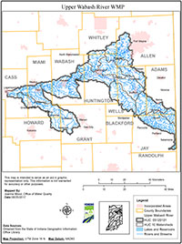
The Upper Wabash River Basin watershed is an 8-digit Hydrologic Unit Code (HUC 05120101) watershed located in northeastern Indiana and western Ohio. The Indiana portion of this watershed encompasses approximately 1,400 square miles in eleven different counties. The watershed drains over 275 square miles in the Rock Creek, Griffin Ditch-Wabash River, and Eight Mile subwatersheds. The project watersheds cover over 58% of Wells County, 10% of Huntington County, almost 3% of Allen County, and less than 0.3 square miles in both Jay and Adams Counties. There are over 330 miles of streams and ditches within the watershed.
The overall primary use of the streams and ditches in the watershed is for drainage. County legal drains are routinely maintained for this purpose. The open streams and drains are regularly sprayed to reduce and control the growth of woody vegetation; clearing, dredging and/or reconstruction are also used as methods to reduce and remove obstructions. These modifications can result in the destruction of aquatic habitats, loss of riparian areas, and increased potential for erosion and sedimentation. The installation, repair, and replacement of subsurface tile are also used extensively throughout the watershed project area to improve drainage. In fact, there is almost as much county regulated tile as there are open streams and legal drains. Subsurface tile speeds up the amount of water that reaches the streams and ditches in a shorter amount of time. This can lead to increased flow within the stream and increased potential for erosion occurring within the stream channel. Tile inlets can also provide a direct conduit for nutrients, sediments and pathogens to travel to the open stream or river, and result in a decrease in water quality; all concerns identified by local stakeholders. Approximately 52.6 miles of streams in the project area (16%) have been assessed by IDEM. Of those, over 43 miles are on the IDEM 303(d) List Revised (12/28/12) for water quality impairments from nutrients, E. coli, and impaired biotic communities (Figure 7). This means that these water bodies do not meet one or more of its designated uses and that the water quality standards or other applicable criteria are not attained.
In 2001, Indiana’s legislature established the Upper Wabash River Basin Commission (UWRBC) under IC 14-30-4 as a separate municipal entity. The UWRBC was formed at the request of local government officials in Adams, Jay, Wells and Huntington Counties, Indiana to provide an organized structure for mutual cooperation in an effort to address water quantity and quality concerns within the Upper Wabash River basin in the four participating counties (Adams, Jay, Wells and Huntington). The mission of the UWRBC is to provide regional leadership and promotion of flood prevention and control, soil and water conservation, and related resource management through a coordinated and comprehensive planning and implementing approach in which projects of the Commission will not adversely affect landowners within the watershed.
The UWRBC completed a watershed management plan for Phase 1 of the Upper Wabash River watershed in 2007, then conducted a three-year implementation project of best management practices (BMP’s) in the Phase 1 area from 2009-2013. This WMP is for Phase 2 of the watershed area and is a continuation of previous efforts to improve water quality in the Upper Wabash River watershed. Upon completion and approval of this plan, the UWRBC will administer a program to install best management practices (BMP’s) in the Phase 2 project area.