
Indiana from NW Ordinance to Statehood
- Indiana’ from 1787 (Passage of Northwest Ordinance) to 1816 (Indiana Statehood)
The Northwest Ordinance of 1787 was enacted on July 13, 1787. It significantly changed the subsequent development of America. It clarified that:
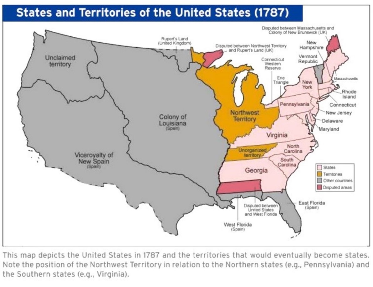
- New states developed from the Northwest Territory would share a ‘Coequal Status’ with the original 13 States
- It established ‘the 3 stage process’ for territories to become states
- Stage 1: Congress appoints a governor, secretary and 3 judges to make laws for a territory
- Stage 2: Once a territory has 5,000 male settlers, then a state legislature could be formed
- Stage 3: Once a territory has 60,000 male settlers, then a territory could apply for statehood
- It was the first and only USA anti-slavery policy before the civil war
- Although the United State Constitution was not adopted and signed until Sept. 17, 1787, the Northwest Ordinance passed 13 July, 1787. For territory citizens, it included freedom of religion, right to a jury trial, due process of the law, safety from cruel or unusual punishment, right to government detention only if legal justification (habeas corpus), compensation for government use of private land for public use (eminent domain), and the right to make private contracts.
- While it established the orderly westward expansion of American States, it did so at the expense of Native Americans
- Established a ‘Township’ System
- ‘Religion, morality, and knowledge, being necessary to good government and the happiness of mankind, schools and the means of education shall ever be encouraged. Early land sales required that schools exist in each township. Land sold to the Ohio Company had two townships for a university. This led to the founding of Ohio University in Athens, Ohio in 1804.
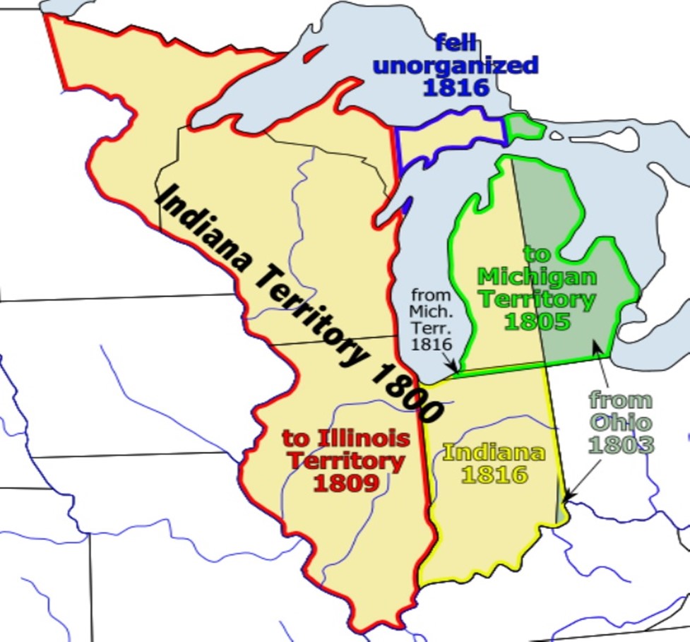
Area in yellow approximates what was the ‘Indiana Territory as of 7 May 1800 when
President John Adams signed the Indiana Organic Act
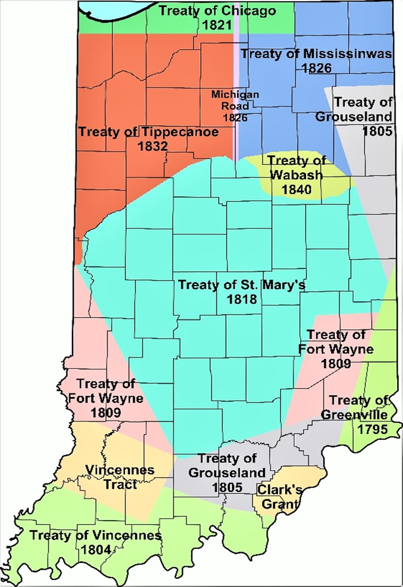
Formation of the State of Indiana was dependent on obtaining Native America lands.
Population of Indiana
1800 2,632
1810 24,520
1816 63,897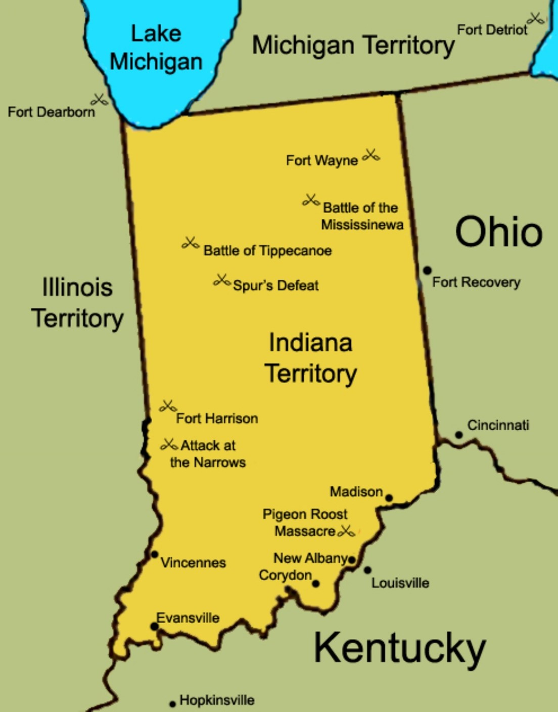
Indiana Territory in 1812 displaying notable places and battles in the War of 1812
Vincennes, IN. was capital of the Indiana Territory 1800-1813
Corydon, IN. was capital of the Indiana Territory 1813-1816
- Indiana achieved Statehood on December 11, 1816
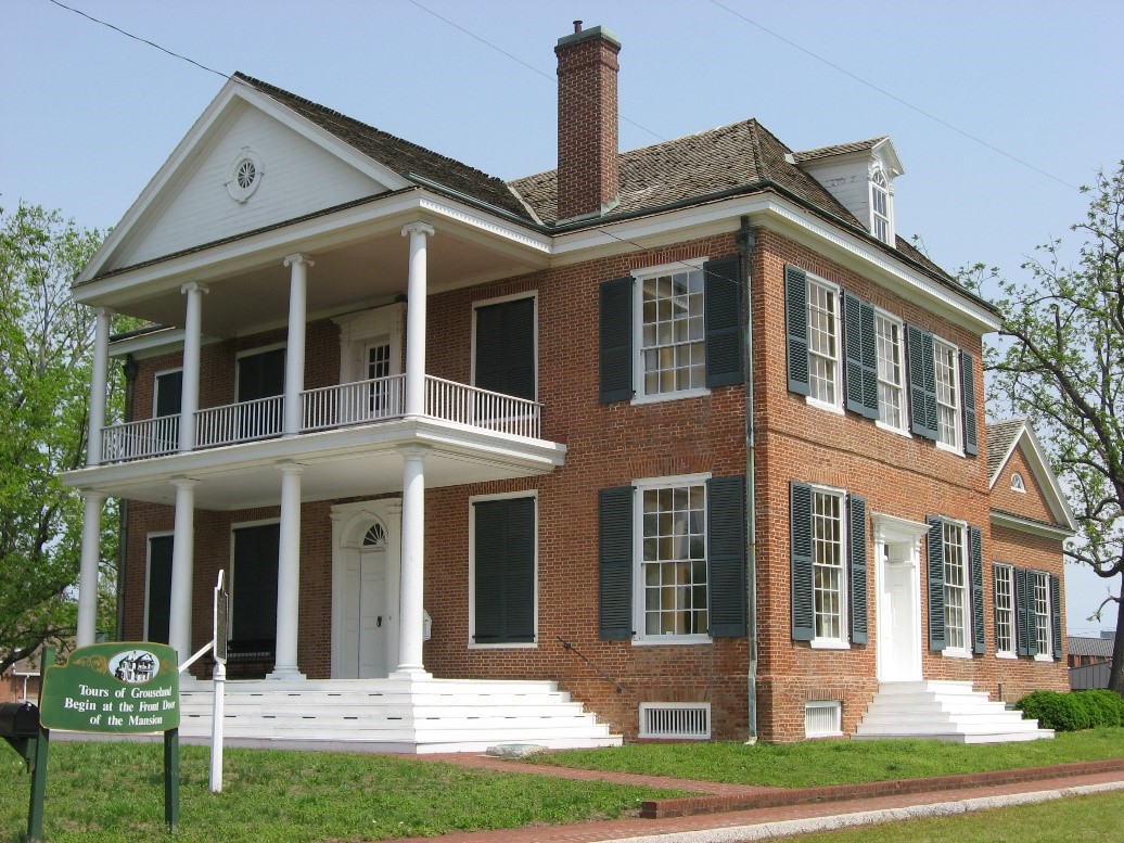
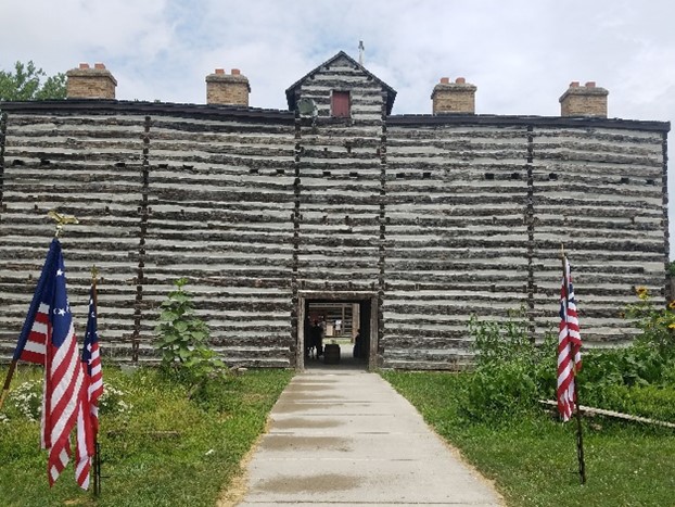
Grouseland
Indiana Territorial Capitol 1800-1813
Vincennes, IN.
Front and southern side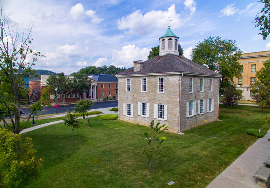
Corydon, IN
Indiana Territorial Capitol 1800-1813
Vincennes, IN.
Front and southern side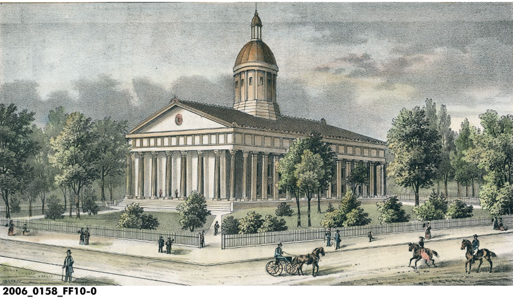
Second Indiana State Capital in Indianapolis 1835-1877
(The First State Capital in Indianapolis was the Marion County Courthouse 1825-1835)
- Historically Significant Locations
Kekionga (Named for the abundance of blackberries in the area)
This area of the Three Rivers was a site of settlement of Native Americans for a period of about 10,000 years.
Largest Village of Native Americans (Miami) in Indiana Mid-1600’s to 1812
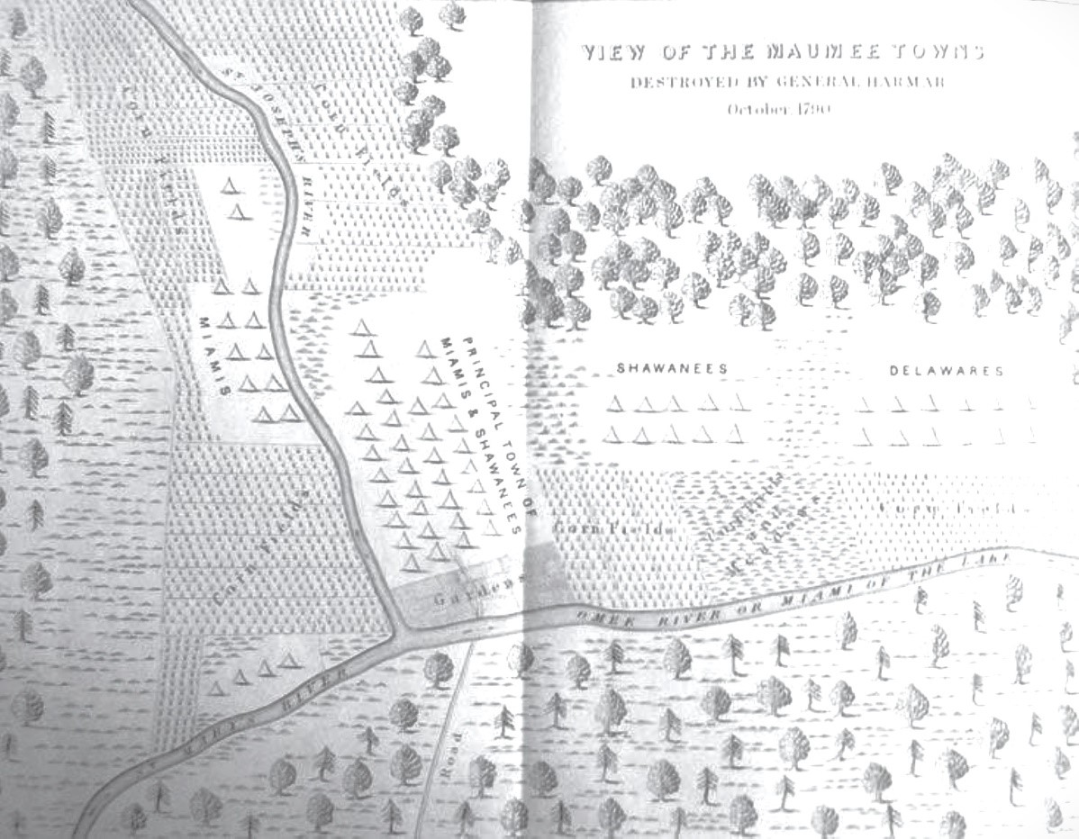
1790 Map from the Military Journal of Ebenezer Denny (Lifetime: 1761-1822)
Situated to be an important trading Post due to its location on the six-mile portage between the Maumee and Little Wabash/Wabash Rivers. This portage allowed for transportation of goods from the Atlantic Ocean/Great Lakes to the Mississippi River/New Orleans/Gulf of Mexico.
Chief Little Turtle, in a speech at the Treaty of Greenville in 1795 called Kekionga ‘that glorious gate . . . through which all the good words of our chiefs had to pass from the north to the south, and from the east to the west.’ Kekionga served as a gathering center for Native Americans who wished to organize their efforts on the frontier.
Seal of the City of Fort Wayne
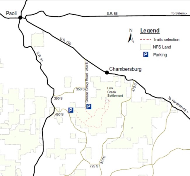
Lick Creek African American Settlement (See https://vimeo.com/852797412)
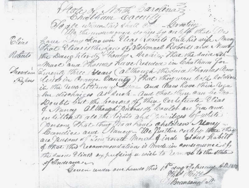
Lick Creek settler Elias Roberts’s freedom papers, also called “free papers.” Roberts once owned 640 acres in three different spots at Lick Creek to help other Black people settle in the area. From Orange County, Indiana, book, February 20, 1833
Quaker allies and free Black families led by Jonathan Lindley moved to the area before Indiana was a state (1811?), and by 1820, census data show 11 Black pioneer families living throughout Orange County. In the 1850s, Black land ownership in Lick Creek peaked at about 2,300 acres.
While the first African American landowners homesteaded in 1817, the Lick Creek settlement, near what is now Chambersburg, began in 1831 with land purchased by 22-year-old Mathew Thomas, who bought eighty acres of U.S. government patent land.
At the time of the first Black settlements, Indiana had none of the racially oppressive laws that had burdened people of color in North Carolina. Yet on October 29, 1833, about a year and a half after his land purchase, Mathew Thomas had witnesses write “free papers” for him, an affidavit witnessed by Quaker men in the area. “These statements are made with a view to save the said Mathew from malestation [sic] of those who might probabley [sic] apprehend him as a slave.” Because Mathew was free born, the affidavit continued, he had a “right to the exercise and enjoyment of all the rights and privileges guaranteed by the constitution and laws of the country to free persons of color.” Mathew carried his free papers with him, but in August 1853, he also recorded them in the then newly built Orange County Courthouse in Paoli, where they remain today. Additional Information from the USDA Forest Service: https://www.fs.usda.gov/Internet/FSE_DOCUMENTS/stelprdb5303625.pdf
Ryan Campbell, associate director of the Center for Archaeological Investigations at Southern Illinois University–Carbondale, has excavated sites in this pioneer community, including a farmhouse owned by Solomon Newby. “It’s pretty special to think about [this community] during that period of time, because it’s right at the beginning of African Americans trying to set up lives outside of slavery in some of these new states and territories,” he says. “It’s really a unique place, because you get to see that develop through time.”
- Historically Significant Locations – ‘Early Indiana’
Harmonie & New Harmony
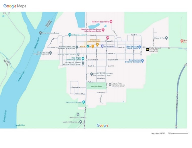
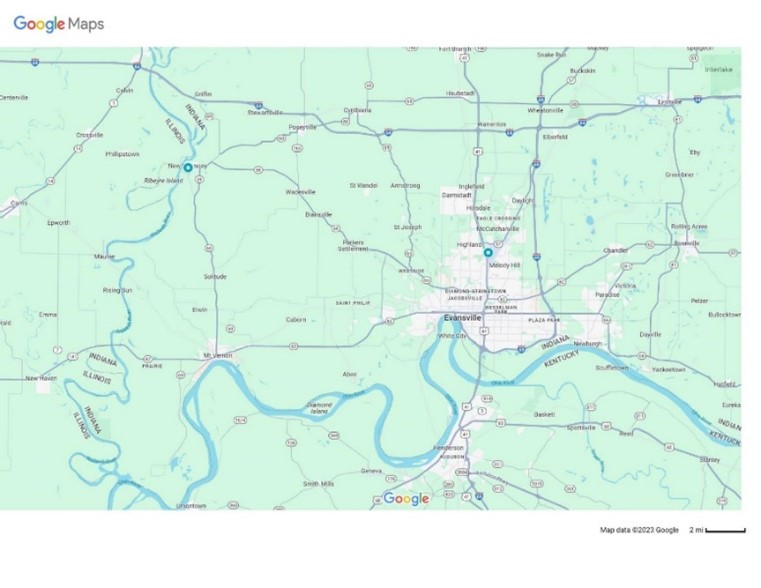
New Harmony is a historic town on the Wabash River in Harmony Township, Posey County, Indiana.[1] It lies 15 miles (24 km) north of Mount Vernon, the county seat, and is part of the Evansville metropolitan area. The town's population was 690 at the 2020 census.
The town was originally known as Harmony (also called Harmonie, or New Harmony) established by the Harmony Society in 1814 under the leadership of George Rapp who led a group of 800 Pietists from Iptingen, a small town in Baden-Württemberg, Karlsruhe Region (Germany). The settlement was the home of Lutheran dissenters who had separated from the official church in the Duchy of Württemberg and immigrated to the United States.[5] The Harmonists built a new town in the wilderness, but in 1824 they decided to sell their property and return to Pennsylvania.
Robert Owen, a Welsh industrialist and social reformer, purchased the town in 1825 with the intention of creating a new utopian community and renamed it New Harmony. The Owenite social experiment failed two years after it began.[7]
New Harmony changed American education and scientific research. Believing that education was the key to a new and better way of life, town residents established the first public library, the first kindergarten, the first infant school, the first trade school, a civic drama club, and a public school system open to men and women offering equal education.
Its prominent citizens included Owen's sons: Robert Dale Owen, an Indiana congressman and social reformer who sponsoredlegislation to create the Smithsonian Institution; David Dale Owen, a noted state and federal geologist; William Owen, a New Harmony businessman; and Richard Owen, Indiana state geologist, Indiana University professor, and first president of Purdue University. The town also served as the second headquarters of the U.S. Geological Survey. Numerous scientists and educators contributed to New Harmony's intellectual community, including William Maclure, Marie Louise Duclos Fretageot, Thomas Say, Charles-Alexandre Lesueur, Joseph Neef, Frances Wright, and others.
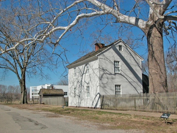 Harmonist Lenz House 1822
Thralls Opera House
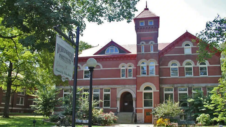
Originally housed in a wing of the Old Harmonist Church Atheneum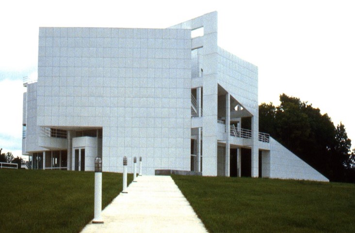
With over 180 years of continuous service the Visitors Center for New Harmony Working Men’s Institute Museum & Library is the oldest library in Indiana
New Harmony Indiana as proposed by Robert Owens - Engraving by F. Bate, London 1838
Key Figures in ‘Early Indiana’
- William Wells
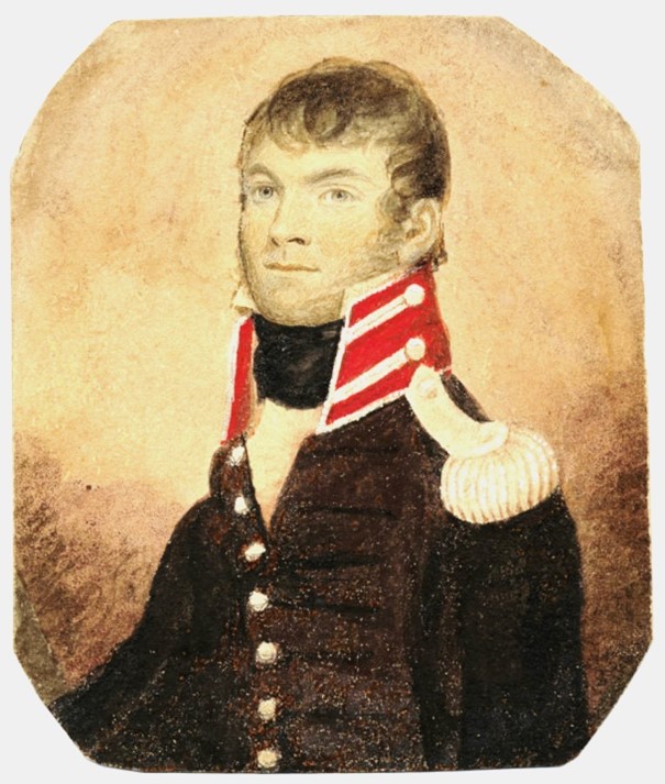
Chicago History Museum - 1810
(c. 1770 – 15 August 1812), also known as Apekonit
("Carrot top"), was the son-in-law of Chief Little Turtle of the Miami. Wells County, IN. named after him.
Wells was born at Jacob's Creek, Pennsylvania, The family moved to Louisville, Kentucky, in 1779 and settled on Beargrass Creek when William was nine and, shortly after, his mother died.
In 1784, he and three other boys were taken captive by an Eel River Miami and Delaware raiding party and taken to Indiana. Wells was 13 years old at the time.
Wells was adopted by a chief named Gaviahate ("Porcupine"), and raised in the village of Kenapakomoko (Snakefish Town) on the Eel River, six miles north from Logansport in northern Indiana.
Wells led a group of Miami sharpshooters at St. Clair's defeat in 1791,[3] the biggest victory the Native Americans ever won against the U. S. Army.
Following the Treaty of Greenville, Chief Little Turtle asked that Wells be appointed as a US Indian Agent to the Miami.
- Francis Slocum
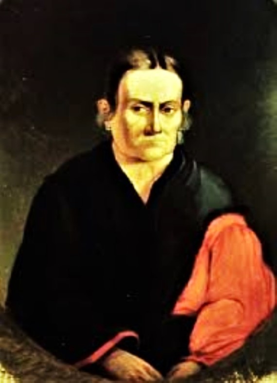
(March 4, 1773 – March 9, 1847) (Ma-con-na-quah, "Young Bear" or "Little Bear") was an adopted member of the Miami people. Slocum was born into a Quaker family that migrated in 1777 to the Wyoming Valley in Luzerne County, Pennsylvania. when Slocum was five years old, she was captured by three Delaware warriors at the Slocum family farm in Wilkes-Barre, Pennsylvania.
Slocum was raised among the Delaware in what is now Ohio and Indiana. With her marriage to Shepoconah (Deaf Man), who later became a Miami chief, Slocum joined the Miami and took the name Maconaquah. She settled with her Miami family at Deaf Man's village along the Mississinewa River near Peru, Indiana.
Buried in Slocum Cemetery, Somerset, Indiana
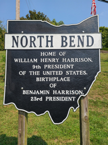
- William Henry Harrison
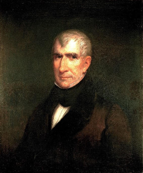
(February 9, 1773 – April 4, 1841) An American military officer and politician who served as the ninth president of the United States at age 68 for 31 days.
He was a son of Benjamin Harrison V, a Founding Father of the United States. His Grandson was the 23rd US President.
He studied medicine at the University of Pennsylvania 1791-93. Harrison's political career began in 1798, with an appointment as secretary of the Northwest Territory. In 1799, he was elected as the territory's non-voting delegate in the United States House of Representatives.
He became governor of the newly established Indiana Territory in 1801 and negotiated multiple treaties with American Indian tribes.
He was the first U.S. president to die in office, causing a brief constitutional crisis since presidential succession was not then fully defined in the United States Constitution.
Harrison died nearly penniless, and Congress voted his wife Anna a presidential widow's pension of $25,000.
- Jonathan Jennings
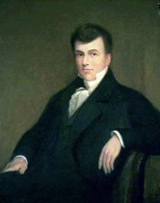
(March 27, 1784 – July 26, 1834) was the first governor of the State of Indiana and a nine-term congressman from Indiana. He studied law before migrating to the Indiana Territory in 1806.
Jennings became involved in a dispute with the territorial governor, William Henry Harrison, that soon led him to enter politics and set the tone for his early political career.
By 1812 he was the leader of the anti-slavery and pro-statehood faction of the territorial government. He was elected president of the Indiana constitutional convention, held in Corydon in June 1816, where he helped draft the state's first constitution.
In August 1816 Jennings was elected to serve as the first governor of Indiana at age 32, and re-elected for an additional term. He pressed for the construction of roads and schools, and negotiated the Treaty of St. Mary's to open up central Indiana to American settlement.
Fort Wayne in Ft. Wayne. IN.
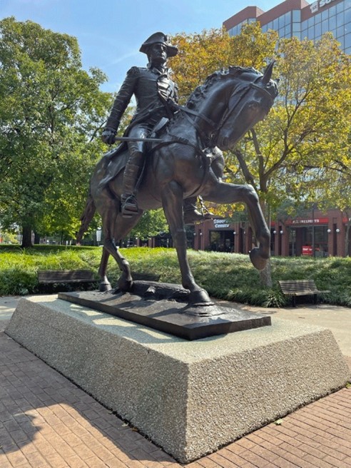
General Anthony Wayne Statue
Chief Richardville Home
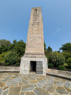
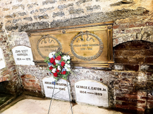
William Henry Harrison Monument with tomb inside
(North Bend is almost in Southeastern Indiana)
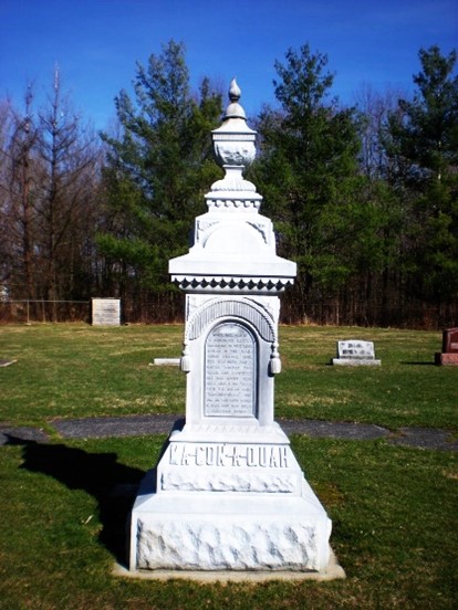 Francis Slocum Gravestone
Slocum Cemetery Somerset, IN
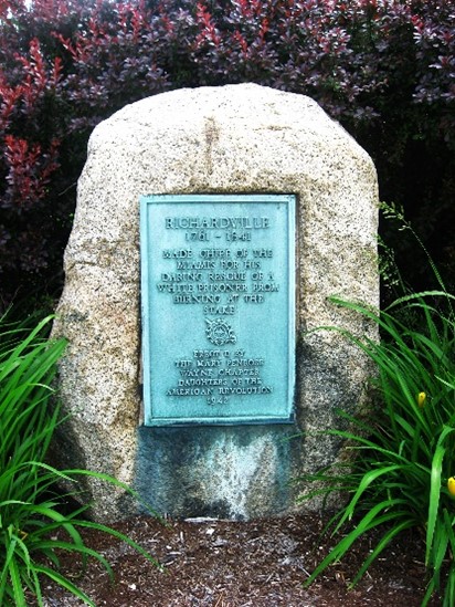
Chief Richardville Marker
Corner of Jefferson and Calhoun Street Ft. Wayne, IN
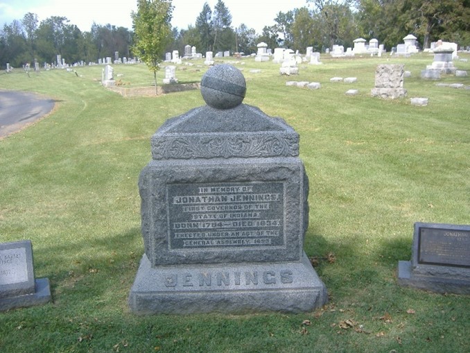
Jonathan Jennings Gravestone
Pleasant Street, Charlestown Clark Co Indiana