AES-02: Facility General Information
The Facility General Information form contains all of the information required under state rules for the entire facility. This form will only need to be completed once and should be the first page of your submittal to the Office of Air Quality. Make sure that you review the information on this form to ensure that it is correct and up to date.
Section 1: Facility Identification
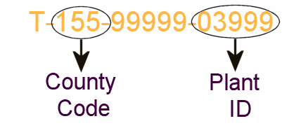
- County Code - The county code is a three-digit number assigned to each county. This number is usually used when assigning a permit number. The county code will generally be the first three numbers of the permit number.
- Plant ID - The plant ID is a five-digit number used in conjunction with the county code to identify the facility. The plant ID will generally be the last five numbers of the permit number. Below is an example of a permit number with the County Code and the Plant ID pointed out.
- Facility Name - Simply the name of the facility. The name should be the same as on the permit, if your facility's name has changed make sure to update it.
- ORIS ID Code - Enter the ORIS ID Code, Office of Regulatory Information Systems Plant Number, for the plant. This is a facility identification number maintained by the Department of Energy's Energy Information Administration and applies to electric power generation utility facilities.
- Year of Inventory - When the reported activities occurred
Section 2: Physical Address
- Source Address - The actual physical street address of the facility. This may be different from the mailing address, make sure that you are using the actual street location. DO NOT USE A POST OFFICE BOX FOR THE SOURCE ADDRESS.
- Source City and Zip Code - Like the source address, this should reflect the actual location of the source.
Section 3: Mailing Address
- Mailing Address - The street address or post office box information required to ensure that any mailings are properly received.
- Mailing City, State, Zip Code - Like the above make sure that this information is properly filled out and updated to ensure receipt of any mailings.
Section 4: Source Coordinates
- UTM Vertical and UTM Horizontal - UTM stands for Universal Transverse Mercator, a mapping system similar to latitude and longitude. The UTMs should be given in Kilometers.
- Latitude and Longitude - The more traditional way of mapping a sources location. The latitude and longitude should be given in degrees, minutes and seconds.
- A note about your Facility's coordinates: This is required information and you must fill it in, but you will only have to give the UTMs or the Latitude and Longitude. You can refer to the following geocoding websites for coordinates if you do have them or if you need to convert them from another format.
- Free Coordinates
- MultiMap - Select looking up a US Address
- Free Coordinate Conversion Sites - These are helpful if you have your coordinates in Decimal Degrees and need to convert them to Degrees, Minutes, Seconds for input into the Satellite.
Section 5: Industrial Classification
- Primary NAICS Code - The North American Industry Classification System (NAICS, pronounced Nakes) is the classification system that has replaced the 1987 Standard Industrial Classification (SIC) system. This is a code of up to six characters to identify establishments by their primary activity. This code can be found at the NAICS Association's website.
- Primary SIC Code - The 1987 Standard Industrial Classification system is the traditional system of identifying a facility's primary operation. This system will continue to be used to aid in the transition to the NAICS Codes. This code can be found at the Occupational Safety & Health Administration's "SIC Search" website.