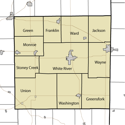
Randolph County is subdivided into the following townships:
- Franklin (24 Square Miles) Population 1,265 in 576 housing units (2010 Census)
- Green (29.57 Square Miles, Population 957 in 404 housing units (2010 Census)
- Greensfork (46.09 Square Miles, Population 1082 in 469 housing units (2010 Census)
- Jackson (30.41 Square Miles, Population 619 in 215 housing units (2010 Census)
- Monroe (29.14 Square Miles, Population 3711 in 1609 housing units (2010 Census) Includes Parker, Indiana.
- Stoney Creek (26.76 Square Miles, Population 990 in 425 housing units (2010 Census)
- Union (71.65 Square Miles, Population 2142 in 960 housing units (2010 Census) Includes Modoc, IN and Losantville IN
- Ward (36.88 Square Miles, Population 1109 in 960 housing units (2010 Census)
- Washington (44.43 Square Miles, Population 2172 in 955 housing units (2010 Census) Includes Lynn, IN
- Wayne (39.74 Square Miles, Population 4611 in 2195 housing units (2010 Census) Includes Union City, Indiana
- White River (74.63 Square Miles, Population 7513 in 3405 housing units (2010 Census) Includes Winchester, Indiana