Summary
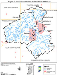
The Wabash River watershed includes all the land that drains into the Wabash River. The river starts in Ohio and drains about 7,300 square miles by the time it passes through the current watershed project area which is highlighted by the southward bend of the Wabash River from its previously westward course (Figure 1). The local watershed of interest includes the area that drains into the Wabash River from just downstream of Wildcat Creek to immediately upstream of Big Pine Creek. This watershed totals 478 square miles. By managing and improving this portion of the Wabash River watershed, it is the intent of the participants to improve water quality in the Wabash River. The history of the region’s present and past projects including funding details, project purposes, and stakeholder involvement are a part of the Region of the Great Bend of the Wabash River Watershed Management Plan.
In the fall of 2007, the Wabash River Enhancement Corporation (WREC) and their partner, Purdue University’s Living Laboratory on the Wabash (LLOW), submitted a Section 319 Non-point Source Program grant application. The grant’s purpose was to produce a watershed management plan (WMP) for the Region of the Great Bend of the Wabash River, provide education and outreach to the watershed community and greater Lafayette area, assess stakeholder opinions and provide educational opportunities, and monitor water quality within the Wabash River and its tributaries with hopes of showing a measurable improvement in water quality during the implementation phase of the project.
Concurrent with grant submission, identification of watershed partners occurred. Many of these initial partners became part of the project steering committee. The grant application was approved in 2008. Development of the WMP was a community driven process and involved a diverse group of local citizens, experts, organizations, and community leaders. Additionally, input from watershed stakeholders and the mechanisms in which this input was generated are also included in the plan. All of these efforts were guided by the following mission and vision developed by public participants and committee members:
- Mission: We are a community partnership to develop and implement a watershed management plan to improve and sustain water quality, natural resources, and economic benefits in the Great Bend Region of the Wabash River.
- Vision: The Wabash River, Indiana’s state river, merits stewardship equal to its importance.
This WMP meets the requirements of the IDEM’s Watershed Management Plan Checklist.