Summary
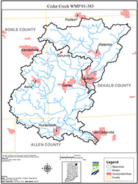
Cedar Creek is a significant area of natural beauty within the St. Joseph River watershed in northeastern Indiana. A mix of farms and agricultural lands, small towns and cities, and significant geological features mark the watershed. Its confluence with the St. Joseph River in northern Allen County lies directly north of Fort Wayne, the second largest city in Indiana. Fort Wayne draws its drinking water from the St. Joseph River downstream of its confluence with the Cedar Creek.
When the St. Joseph River Watershed Plan was approved by the IDEM in 2000, the stated philosophy indicated the St. Joseph River Watershed Initiative (SJRWI) would act as a coordinator and help to develop sub-watershed planning groups in each sub-watershed. The Cedar Creek WMP is the first of this focused series of sub-watershed plans to be developed.
The Cedar Creek has been on the State of Indiana’s 303(d) list of impaired waters for E. coli contamination for several years and was scheduled for a Total Maximum Daily Load (TMDL) in 2004. The Cedar Creek watershed management planning effort began in 2002 with an agreement between IDEM and the SJRWI that the TMDL would be delayed while the SJRWI, funded by a Section 319 planning grant, attempted to work in the community to develop a watershed management plan (WMP) and support implementation of voluntary best management practices in the watershed. As this process progressed over the first year of the project, the Cedar Creek WMP became a pilot effort to develop a WMP in lieu of the TMDL through the mechanism of a voluntary, community-based and community-led watershed management process. Because of this agreement, the Cedar Creek WMP contains some documentation normally found in a TMDL assessment, including load allocation, load reduction, load duration curves, as well as a SWAT (Soil & Water Assessment Tool) model.
This plan also incorporated research findings of the Initiative’s Bacteria Source Tracking project, funded by the same Section 319 grant, as well as research from the Source Water Protection Initiative project located in the Upper Cedar Creek watershed.
A series of public meetings held in DeKalb County from April through July of 2003, coordinated by the SJRWI, focused on gathering input from Cedar Creek stakeholders regarding perceived problems, goals and activities in the watershed. The meetings also served to introduce groups, agencies and individuals currently working within the watershed to various land use and water quality and quantity issues. From attendees at these meetings a core group of interested citizens formed a steering committee which continued to meet to develop this document.
The Cedar Creek Watershed Planning Group sponsored events in the Cedar Creek watershed which enabled people to become more familiar with and enjoy the use of this high quality natural resource, including canoe trips on the Creek, as well as walking/hiking tours of scenic and park areas bordering the Cedar Creek. Other activities included volunteer monitoring of the streams and educational outreach highlighting the biotic communities of the Cedar Creek.
This Cedar Creek WMP is intended to be a living document designed to assist watershed stakeholders in their efforts toward restoration and protection of the Cedar Creek, the largest tributary of the St. Joseph River in the Maumee River Basin. This document describes a sub-watershed of the St. Joseph River and is intended to be a subsection of the St. Joseph River WMP. The plan will be re-evaluated in five years by the SJRWI to determine whether goals are being met and to adjust tasks, cost estimates and load reduction estimates, as necessary.