Building an Accessible GIS Future
Resources, Compliance, and the Work Behind It
Accessibility is no longer a “nice‑to‑have” in modern GIS, it's a requirement and a shared responsibility across our statewide geospatial community. Every website, web map, dashboard, story map, application, and digital document (PDFs) must meet WCAG 2.1 AA standards by April 26, 2027.
To help teams meet this need, the Indiana Geographic Information Office has expanded the Accessibility Resources, which brings together practical tools, examples, and guidance for creating inclusive GIS products.
This year, accessibility work was highlighted at the IGIC Conference through a session led by Haley Hartenstine. Much of the material in that presentation connects directly to the work happening behind the scenes on the IGIO Accessibility Master Doc, developed by Haley Hartenstine and Ben Grubbs. Their efforts compile mapping best practices, WCAG (Web Content Accessibility Guidelines) support links, and recommended testing tools that help GIS teams understand how accessibility standards apply to real‑world map design and application development
Why Accessibility Matters
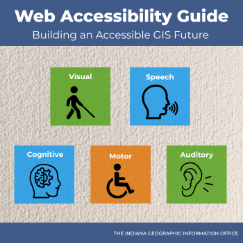
Accessible GIS ensures that all Hoosiers, including those with visual, motor, auditory, or cognitive disabilities, can use and understand digital map content. When our GIS tools follow accessibility guidelines, we improve clarity and navigation, support assistive technologies, offer alternatives for users who cannot interact with visual maps, strengthen public trust, and expand equitable access to information.
WCAG standards affect anyone who creates or shares content, not just developers. Maps, documents, graphics, dashboards, and web pages all fall within compliance expectations.
Who Should Be Using These Resources
The Accessibility Resources supports a wide range of roles, including:
- GIS Technicians, Analysts, Developers, Project Managers, and anyone else who creates visual digital content
- Anyone who makes maps, applications, documents, or presentations for public audiences
- Leaders and Program Owners making decisions about compliance and user experience
- Data Stewards and Cartographers ensuring readable symbology and color‑blind‑friendly design
- Communications Staff reviewing documents, reports, PDFs, and visuals
What You’ll Find in the Hub
The accessibility resource hub offers a curated set of materials that help teams get started quickly.
These include:
- How-to guides for creating accessible web maps, web applications, and PDFs
- Esri’s accessibility resources and training
- Checklists to use when creating accessible digital content
- Strategies for inventorying and prioritizing content that needs accessibility enhancements
- Examples of accessible applications with instructions on how to create your own copy
- Tutorials for accessible cartography
- ADA compliance information
- A master document that details accessibility concepts, tools, and resources available
- WCAG guidance and evaluation methods
- Tools for evaluating accessibility of your content
Together, these materials create a simple starting point for building accessible and compliant GIS products.
The Work Behind the Scenes
Accessibility guidelines can feel complex. The work carried out by Haley and Ben has made it easier for teams to navigate these requirements by documenting standards, validating expectations, and providing clarity around how WCAG 2.1 AA applies to GIS workflows. Their effort reflects a growing culture of accessibility within the statewide GIS community.
Moving Forward Together
Accessibility is an ongoing commitment to serving every Indiana resident fairly. The work shared at the IGIC Conference, combined with the expanded Accessibility Resources and internal best‑practice guides, shows the direction we are moving towards as a community. We encourage teams to explore all the resources, learn the available tools, and begin integrating accessibility into every step of their workflows. Together, we can ensure that every map tells a story all Hoosiers can access.
Explore the Accessibility Resources and improve your digital content today.