
Celebrating Indiana’s 2025 Data Harvest and Our Star Counties
The Indiana Geographic Information Office (IGIO) is proud to celebrate the successful completion of the 2025 Data Harvest, an effort made possible through the dedication and collaboration of counties across the state. This annual initiative plays a vital role in maintaining high‑quality, statewide geospatial data that supports transportation planning, broadband expansion, NG9‑1‑1, environmental management, public health, tax distribution, and countless mapping and analytical needs.
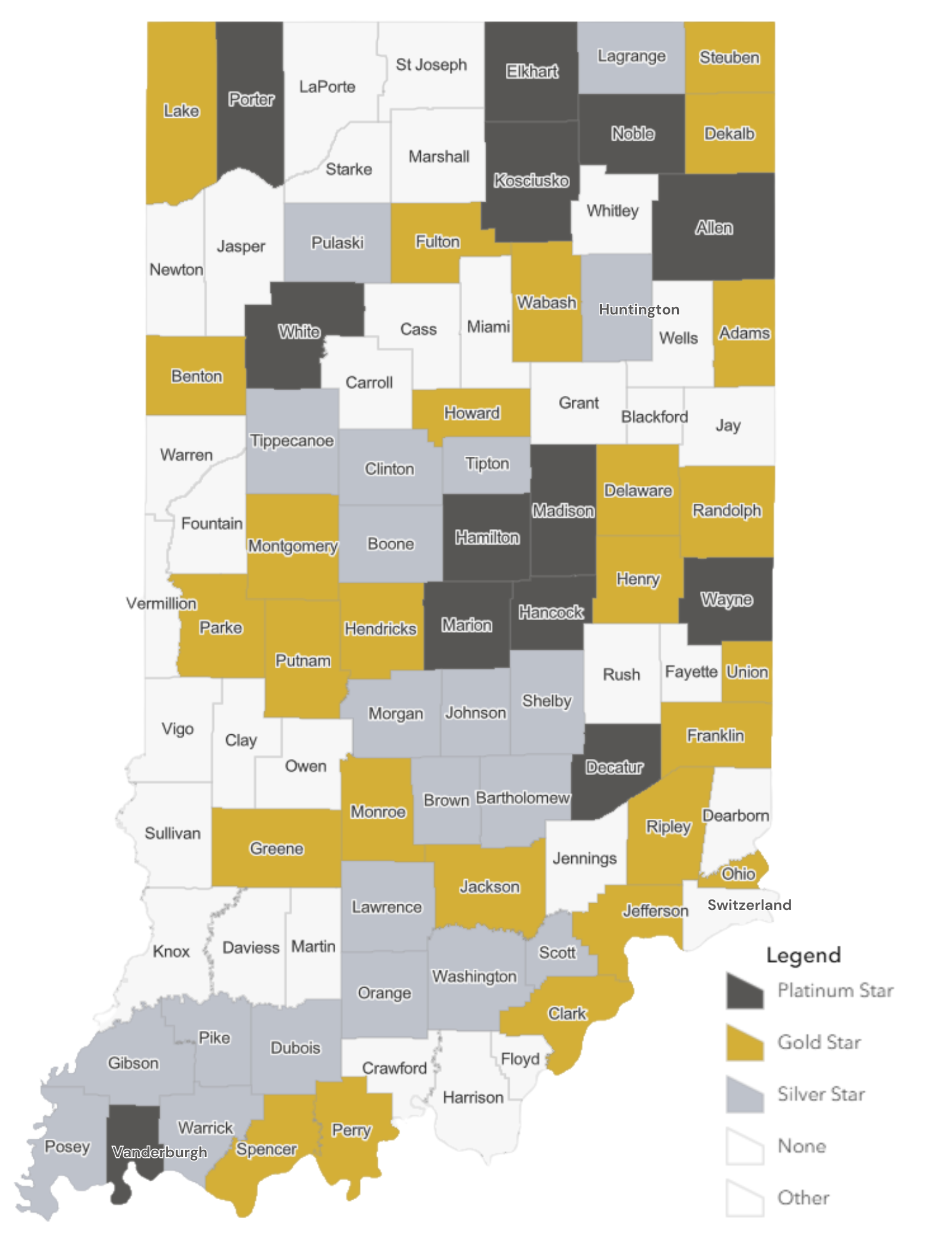
A record 60 counties earned stars for their 2025 Data Harvest! 13 counties earned a platinum star, 26 earned a gold star, and 21 earned a silver star.
For more information about what each recognition level means, please visit our Data Harvest Recognition page (https://dataharvest.gio.in.gov/pages/recognition)
Each of these counties demonstrated exceptional dedication in providing high‑quality data, helping Indiana continue to lead in GIS collaboration and statewide data stewardship.
Thank You to all Participating Counties
Even beyond the Star recognitions, every county that participated in this year’s harvest made a meaningful contribution. The collective work of county GIS staff, assessors, IT teams, 9‑1‑1 offices, surveyors, and local officials ensures that Indiana’s maps, dashboards, applications, and decision‑making tools remain strong and reliable.
Your continued participation is the backbone of the Data Harvest, and we appreciate your partnership each year.
Looking Ahead to the 2026 Cycle
Planning for the 2026 Data Harvest is already underway. Make sure to check out our May newsletter for information about Data harvest webinars.