- Mounds State Park (0)
- None at this time.
- Description
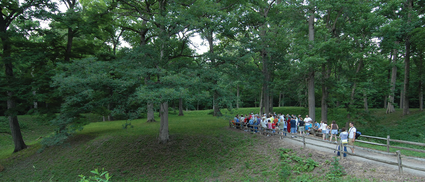
Mounds State Park, located off I-69 east of Anderson, features 10 unique earthworks built by prehistoric Indians known as the Adena-Hopewell people. The largest earthwork, the Great Mound, is believed to have been constructed around 160 B.C. Archaeological surveys indicate the mounds were used as gathering places for religious ceremonies, from where astronomical alignments could be viewed.
Be sure to visit our Nature Center, which includes a wildlife viewing room, animal displays, interactive games, and more. Hours are 9 a.m. to 4 p.m. daily. Naturalist-led hikes and interpretive programs are offered every weekend throughout the year.
- Activities
- Visitor Center and Gift Shop/Interpretive Naturalist Services
- Picnicking/Shelters
(Shelter Reservations) - Hiking Trails
- Fishing (White River)
- Rental - Recreation Building
- Camp Store
Camping - See campground maps under MAPS tab
- Electric / 75 sites
- Youth Tent Areas
- Dumping Station
INFORMATION
- Description of Hiking Trails
Note: For trail locations, view the property map under the MAPS tab.
Mounds State Park offers a motorized wheelchair that can be taken on trails and around facilities.
1. EASY (1 mile)—You will find the 20 most common trees in Indiana marked for your convenience along this trail. The trail also winds around four prehistoric mounds, one of which is the Great Mound, the focal point of the park. A tree guide and mounds history guide can be obtained at the Visitors Center. Parts of this trail are wheelchair accessible.
2. RUGGED (.5 mile)—Begins at the pavilion. Going to the left, it descends to a boardwalk that skirts a spring-fed creek and onto the backside of the Great Mound. When starting from behind the pavilion, it provides a shortcut downstairs to the White River and intersects with Trail 5.
3. MODERATE (.9 mile)—The trail descends into the woods from the first two parking lots on the left side of the road in the picnic area. It winds through the forest, providing views of different species of birds and animals. It intersects with Trail 5 and skirts the backside of the pavilion.
4. RUGGED (.7 mile)—Begins from the back parking lot at the pool. This trail is suited for the avid hiker because of its rugged terrain and steep hills. It can be traveled to and from the campground via a long boardwalk, which descends into a ravine with a creek and then climbs up the bluff. It provides a scenic overlook with all types of wildlife and many of our feathered friends. It intersects Trail 5 three times.
5. MODERATE WITH HILLS (2.5 miles)—Begins at the main gate and skirts the boundary of the park. It provides a scenic view as it follows along the White River and the limestone bluffs. One might catch glimpses of different types of waterfowl and aquatic life. It crosses several creeks and goes on into the woods, where all kinds of songbirds, along with upland game, make their home. This is a great trail for spring wildflower enthusiasts and for fans of the majestic hardwood trees that populate the forest. It is the longest and most popular trail in the park.
6. MODERATE (.4 mile)—Begins at the campground control station and leads to either the campground or the canoe launch area. This trail works great for campers who want to fish or purchase minor items from the camp store. It’s a great trail for a short hike and enjoying the outdoors.
PLEASE STAY ON MARKED TRAILS.
- Maps
Loading events