Summary
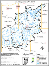
The Upper Iroquois River Watershed is located within the larger Iroquois Watershed and covers portions of Jasper, Newton, Benton, White, Pulaski, and Starke Counties, Indiana. The land use of the watershed is predominately agricultural. The City of Rensselaer along with the small towns of Remington, Brook, and Kentland make up the urban and residential areas of the watersheds. Several stream reaches in the watersheds are listed on the Indiana Department of Environmental Management’s 303(d) List of Impaired Waterbodies, and stakeholders in the Upper Iroquois River watershed value the river for its scenic beauty, fishing, and canoeing opportunities.
The purpose of the Watershed Management Plan (WMP) is to evaluate the current state of each watershed and determine where future improvements and protection should be focused. The Planning Team for the WMP includes the Jasper and Newton County Soil & Water Conservation District (SWCD) Board of Supervisors, the Steering Committee for the grant, and the many Stakeholders who have attended outreach events and provided input.
The Upper Iroquois River WMP addresses several causes of water quality impairments in the watersheds based on scientific data and visual observations by the Steering Committee and SWCD staff. The causes addressed in this plan are excessive sediment and nutrients; high E. coli; and stream corridor degradation.
Each cause of impairment is addressed by a goal that provides direction for specific objectives and action items that are identified in this Plan for the improvement of water quality in the watersheds. The WMP will be implemented utilizing funds from a four-year Section 319 Clean Water grant to install conservation practices and begin fulfilling tasks set forth in the Plan beginning in November 2014. The plan will be reviewed every five years.