GIS Resources
GIS News
NSGIC Announces New Board Members; Indiana’s GIO, Megan Compton Elected to the Board of Directors
National States Geographic Information Council recently made appointments of five new members to its Board of Directors, which includes GIO Megan Compton a Board Member. Compton provides strategic oversight of the state’s GIS technology portfolio, as well as leadership on GIS governance for the State of Indiana. She has been involved with GIS projects and applications since earning her MPA from Indiana University in 2008. Read more here: https://www.nsgic.org/board-of-directors
https://www.directionsmag.com/pressrelease/10164
Outstanding NSGIC 2019 Geospatial Maturity Assessment
It's an exciting time for GIS in Indiana! Indiana was one of only two states in the country to earn an “A+” for statewide GIS coordination by the National States Geographic Information Council, 28-year-old organization founded to advance state-led geospatial coordination across the nation.
While this should come as no surprise to members of the Indiana GIS community, Indiana’s coordination success underscores the important role that we all have as members of the statewide GIS community! (News Release)
Opinion - Changes to the Census Could Make Small Towns Disappear
USGS 3DEP Data Now Available to Academic Users in OpenTopography Pilot
The U.S. Geological Survey’s (USGS) 3D Elevation Program (3DEP) is an ambitious effort to complete acquisition of nationwide lidar (IfSAR in AK) by 2023 to provide the first-ever national baseline of consistent high-resolution elevation data – both bare earth and 3D point clouds – collected in a timeframe of less than a decade. Since 2015, USGS and federal, state, local and non-government partners have collected over 2 million square miles of high resolution topography data, covering nearly 67% of the United States. Thanks to USGS efforts in the last year to migrate these data into the cloud, OpenTopography is happy to announce a pilot project to make these exciting data available to our core US academic user community.
For more information click here - https://opentopography.org/news/USGS-3DEP-in-OpenTopography
History of GIS in Indiana
Polis Center at IUPUI is featuring a blog series to discuss the HISTORY OF GIS IN INDIANA. Featured bloggers include Jim Sparks, Indiana Geographic Information Officer, Phil Worrall, Executive Director of Indiana Geographic Information Council, and John Buechler, Director of Geoinformatics at Polis, as well as interviews with key figures in our state’s GIS history.
We realize that there are many diverse perspectives of Indiana’s GIS history, so we encourage you to share your own by adding your comments to the Polis Center blog or Facebook page. You can read and post your comments to part one and two of our blog series right now!
Polis Center at IUPUI is featuring a blog series to discuss the HISTORY OF GIS IN INDIANA. Featured bloggers include Jim Sparks, Indiana Geographic Information Officer, Phil Worrall, Executive Director of Indiana Geographic Information Council, and John Buechler, Director of Geoinformatics at Polis, as well as interviews with key figures in our state’s GIS history.We realize that there are many diverse perspectives of Indiana’s GIS history, so we encourage you to share your own by adding your comments to the Polis Center blog or Facebook page. You can read and post your comments to part one and two of our blog series right now!
Part I History of GIS in Indiana: One Perspective, by Jim Sparks, Former Indiana GIO
https://polis.iupui.edu/announcements/history-of-gis-in-indiana/
Part II History of GIS in Indiana: The MSE Perspective, by Phil Worrall, ED of IGIC
https://polis.iupui.edu/announcements/history-of-gis-in-indiana/
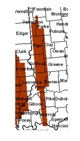 NAIP Imagery Acquired In Indiana
Indiana's data collection for 2012 is complete.
What is NAIP?
The National Agriculture Imagery Program (NAIP) acquires aerial imagery during the agricultural growing seasons in the continental U.S. A primary goal of the NAIP program is to make digital ortho photography available to governmental agencies and the public within a year of acquisition.
King County GIS Delivers Significant Return on Investment
Ever wonder about the financial benefit of GIS to your organization? In King County, Washington, the use of GIS resulted in at least $775 million in net benefits to the county over the eighteen-year period from 1992 to 2010, according to a study performed by Dr. Richard O. Zerbe, Jr., Director of the Center for Benefit-Cost Analysis at the University of Washington. ROI Report
Learning Opportunities
- GIO Virtual Training for Public Sector
- GIS for Public Safety Professionals (Flyer)
- An Intro to GIS from USGS
- ESRI Training
- GIS at Indiana University
- GIS at Purdue
GIS in Indiana
GIS at the National Level
- COVID19 Geospatial Resource
- National States Geographic Information Council
- Federal Geographic Data Committee
- The National Map