Summary
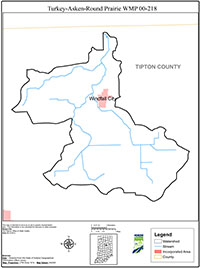
The Turkey Creek/Askren/Round Prairie Watershed (abbreviated “Round Prairie Watershed”) is located in the northeast portion of Tipton County and encompasses the Town of Windfall. The Round Prairie Watershed (Hydrologic Unit Code 05120107010060) drains approximately 15,361 acres and represents approximately 9% of the total land area of Tipton County (166,660 acres). This watershed is a headwater tributary to Wildcat Creek, which is a contributor to the Wabash River.
The Round Prairie Watershed was selected for plan development through a prioritization process. This watershed management plan (Plan) was developed by a stepwise process driven by local interests to reflect the water quality concerns of local stakeholders. A watershed team was assembled from members of the community and residents of the watershed in the early stages of the project. At the first public meeting to introduce the project, a questionnaire survey of the participants was conducted to evaluate local opinions of water quality and its importance.
Results of the survey closely mirrored priority issues and action items developed later in the planning process. Once the team was assembled, the following events occurred in sequential order to develop the Plan. Quarterly watershed team meetings and monthly Steering Committee meetings provided the forum to undertake the process.